
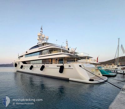
O'EVA
Yacht
Current Trip
| Time Travelled | 10 h, 39 mins |
|---|---|
| Remaining Time | --- |
| Distance Travelled | 73.75 nm |
| Remaining Distance | --- |
| AVG Speed | 12.2 Knots |
| MAX Speed | 15.9 Knots |
| AVG Wind | 7 knots |
| MAX Wind | 11.8 knots |
| MIN Temp | 24.5°C / 76.1°F |
| MAX Temp | 34.9°C / 94.82°F |
| Draught | 3.4 m |
| Position Received | 3 m ago |
Current Position
| Longitude | 22.40647° |
|---|---|
| Latitude | 38.19751° |
| Status | Under way using engine |
| Speed | 10.7 Knots |
| Course | 296.1° |
| Area | Ionian Sea |
| Station | T-AIS |
| Position Received | 3 m ago |
Info
Information
The current position of O'EVA is in Ionian Sea with coordinates 38.19751° / 22.40647° as reported on 2024-06-11 21:08 by AIS to our vessel tracker app. The vessel's current speed is 10.7 Knots and is heading at the port of ITHAKI. The estimated time of arrival as calculated by vessel tracking app is 2024-06-12 04:00 LT
The vessel O'EVA (IMO: 9444572, MMSI: 256139000) is a Yacht that was built in 2009 ( 15 years old ). It's sailing under the flag of [MT] Malta.
In this page you can find informations about the vessels current position, last detected port calls, and current voyage information. If the vessels is not in coverage by AIS you will find the latest position.
The current position of O'EVA is detected by our AIS receivers and we are not responsible for the reliability of the data. The last position was recorded while the vessel was in Coverage by the Ais receivers of our vessel tracking app.
The current draught of O'EVA as reported by AIS is 3.4 meters
Weather
| Temperature | 24.7°C / 76.46°F |
|---|---|
| Wind Speed | 10 knots |
| Direction | 274° W |
| Pressure | 1011.4 hPa |
| Humidity | 58.6 % |
| Cloud Coverage | --- |
Featured Company
Last Port Calls
| Port | Arrival | Departure | Time In Port |
|---|---|---|---|
| 2024-06-10 06:08 | 2024-06-11 10:33 | 1 d | |
| 2024-06-05 08:34 | 2024-06-05 14:29 | 5 h | |
| 2024-06-03 14:58 | 2024-06-03 19:11 | 4 h | |
| 2024-05-26 06:27 | 2024-06-02 03:06 | 6 d | |
| 2024-05-25 17:35 | 2024-05-26 02:43 | 9 h | |
| 2024-05-25 05:49 | 2024-05-25 11:28 | 5 h | |
| 2024-05-24 15:53 | 2024-05-25 01:11 | 9 h | |
| 2024-05-20 07:48 | 2024-05-21 04:13 | 20 h | |
| 2024-05-18 05:09 | 2024-05-20 06:35 | 2 d | |
| 2024-05-17 21:11 |
Last Trips
| Origin | Departure | Destination | Arrival | Distance | |
|---|---|---|---|---|---|
| 2024-06-05 17:29 | 2024-06-10 09:08 | 246.74 nm | |||
| 2024-06-03 22:11 | 2024-06-05 11:34 | 39.65 nm | |||
| 2024-06-02 06:06 | 2024-06-03 17:58 | 162.57 nm | |||
| 2024-05-26 05:43 | 2024-05-26 09:27 | 52.52 nm | |||
| 2024-05-25 14:28 | 2024-05-25 20:35 | 19.49 nm | |||
| 2024-05-25 04:11 | 2024-05-25 08:49 | 64.52 nm | |||
| 2024-05-21 07:13 | 2024-05-24 18:53 | 172.83 nm | |||
| 2024-05-20 09:35 | 2024-05-20 10:48 | 20.46 nm | |||
| 2024-05-18 00:11 | 2024-05-18 08:09 | 92.19 nm |
Events
| Time | Event | Details | Position / Dest | Info |
|---|---|---|---|---|
| 2024-06-11 18:26 | Change Sea Area | Greek part of the Ionian Sea Greek part of the Aegean Sea |
37.95334 / 22.95537
Ionian Sea
ITHAKI
|
Speed: 1.8 kn Course: 241.8° |
| 2024-06-11 17:51 | START Moving | 0.57 nm, South West of AGIOS CHARALAMPOS |
37.91318 / 23.01462
ITHAKI
|
Speed: 3.8 kn Course: 302° |
| 2024-06-11 17:45 | STOP Moving | 0.56 nm, South West of AGIOS CHARALAMPOS |
37.91188 / 23.01638
ITHAKI
|
Speed: 0.3 kn Course: 297° |
| 2024-06-11 16:19 | IN Coverage |
37.68868 / 23.31690
Aegean Sea
AGKISTRI
|
Speed: 14.9 kn Course: 325.8° |
|
| 2024-06-11 12:01 | OUT of Coverage |
37.68482 / 23.31915
Aegean Sea
AGKISTRI
|
Speed: 7.3 kn Course: 167.9° |
|
| 2024-06-11 10:40 | Destination Changed | AGKISTRI MARINA ZEA |
37.91627 / 23.63890
AGKISTRI
|
Speed: 15.7 kn Course: 225° |
| 2024-06-11 10:40 | ETA Changed | 2024/06/11 12:00 2024/06/10 06:00 |
37.91627 / 23.63890
AGKISTRI
|
Speed: 15.7 kn Course: 225° |
| 2024-06-11 10:33 | PORT DEPARTURE |
|
37.93254 / 23.65407
MARINA ZEA
|
Speed: 7.8 kn Course: 101° |
| 2024-06-11 10:33 | Status Changed | Under way using engine Moored |
37.93258 / 23.65137
[GR] ZEA
|
Speed: 8 kn Course: 84° |
| 2024-06-11 10:32 | START Moving |
37.93256 / 23.65094
[GR] ZEA
|
Speed: 8 kn Course: 84° |