
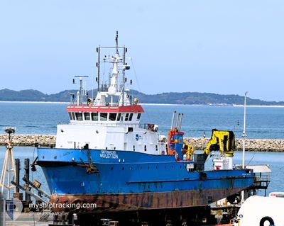
OFFSHORE SOLUTION
Other Type
Current Trip
| Time Travelled | 25 days |
|---|---|
| Remaining Time | --- |
| Distance Travelled | 875.98 nm |
| Remaining Distance | --- |
| AVG Speed | 6.3 Knots |
| MAX Speed | 9.8 Knots |
| AVG Wind | 8.2 knots |
| MAX Wind | 16.7 knots |
| MIN Temp | 24.9°C / 76.82°F |
| MAX Temp | 30.6°C / 87.08°F |
| Draught | 3 m |
| Position Received | 1 d ago |
Current Position
| Longitude | 116.22899° |
|---|---|
| Latitude | -20.35190° |
| Status | Under way using engine |
| Speed | 5.9 Knots |
| Course | 131.2° |
| Area | Indian Ocean |
| Station | T-AIS |
| Position Received | 1 d ago |
Info
Information
The current position of OFFSHORE SOLUTION is in Indian Ocean with coordinates -20.35190° / 116.22899° as reported on 2024-05-27 19:13 by AIS to our vessel tracker app. The vessel's current speed is 5.9 Knots and is heading at the port of ANCHORAGE. The estimated time of arrival as calculated by vessel tracking app is 2024-05-28 04:00 LT
The vessel OFFSHORE SOLUTION (IMO: 9784465, MMSI: 503000136) is a Other Type It's sailing under the flag of [AU] Australia.
In this page you can find informations about the vessels current position, last detected port calls, and current voyage information. If the vessels is not in coverage by AIS you will find the latest position.
The current position of OFFSHORE SOLUTION is detected by our AIS receivers and we are not responsible for the reliability of the data. The last position was recorded while the vessel was in Coverage by the Ais receivers of our vessel tracking app.
The current draught of OFFSHORE SOLUTION as reported by AIS is 3 meters
Weather
| Temperature | 26.2°C / 79.16°F |
|---|---|
| Wind Speed | 2 knots |
| Direction | 31° NNE |
| Pressure | 1013.4 hPa |
| Humidity | 55.3 % |
| Cloud Coverage | 10 % |
Featured Company
Events
| Time | Event | Details | Position / Dest | Info |
|---|---|---|---|---|
| 2024-05-27 19:13 | OUT of Coverage |
-20.35190 / 116.22899
Indian Ocean
WEST LEWIS ANCHORAGE
|
Speed: 5.9 kn Course: 131.2° |
|
| 2024-05-27 17:41 | Destination Changed | WEST LEWIS ANCHORAGE SURVEY OPS |
-20.24758 / 116.10756
WEST LEWIS ANCHORAGE
|
Speed: 6.2 kn Course: 130.5° |
| 2024-05-27 17:41 | ETA Changed | 2024/05/28 04:00 2024/05/27 04:00 |
-20.24758 / 116.10756
WEST LEWIS ANCHORAGE
|
Speed: 6.2 kn Course: 130.5° |
| 2024-05-27 15:31 | IN Coverage |
-20.09999 / 115.93643
Indian Ocean
|
Speed: 6.4 kn Course: 131.4° |
|
| 2024-05-27 13:49 | OUT of Coverage |
-19.97437 / 115.78935
Indian Ocean
|
Speed: 7.7 kn Course: 131.6° |
|
| 2024-05-27 13:49 | IN Coverage |
-19.97437 / 115.78935
Indian Ocean
|
Speed: 7.7 kn Course: 131.6° |
|
| 2024-05-26 21:54 | OUT of Coverage |
-19.77182 / 115.55628
Indian Ocean
SURVEY OPS
|
Speed: 1.3 kn Course: 350.2° |
|
| 2024-05-26 20:55 | IN Coverage |
-19.83611 / 115.63085
Indian Ocean
SURVEY OPS
|
Speed: 5.9 kn Course: 308.6° |
|
| 2024-05-26 17:20 | OUT of Coverage |
-20.08832 / 115.92220
Indian Ocean
SURVEY OPS
|
Speed: 6.4 kn Course: 307.5° |
|
| 2024-05-26 11:04 | Destination Changed | SURVEY OPS WEST LEWIS ANCHORAGE |
-20.51129 / 116.42543
SURVEY OPS
|
Speed: 6.2 kn Course: 308.3° |