
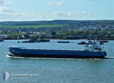
OHIOBORG
General Cargo
Current Trip
| Time Travelled | 2 days |
|---|---|
| Remaining Time | --- |
| Distance Travelled | 479.91 nm |
| Remaining Distance | --- |
| AVG Speed | 10.5 Knots |
| MAX Speed | 12.3 Knots |
| AVG Wind | 10.8 knots |
| MAX Wind | 17 knots |
| MIN Temp | 7.9°C / 46.22°F |
| MAX Temp | 18.7°C / 65.66°F |
| Draught | 5.4 m |
| Position Received | 16 h, 34 m ago |
Current Position
| Longitude | 21.47178° |
|---|---|
| Latitude | 59.00511° |
| Status | Under way using engine |
| Speed | 11 Knots |
| Course | 217° |
| Area | Baltic Sea |
| Station | T-AIS |
| Position Received | 16 h, 34 m ago |
Info
Information
The current position of OHIOBORG is in Baltic Sea with coordinates 59.00511° / 21.47178° as reported on 2024-05-17 12:18 by AIS to our vessel tracker app. The vessel's current speed is 11 Knots and is heading at the port of AMSTERDAM. The estimated time of arrival as calculated by vessel tracking app is 2024-05-20 22:00 LT
The vessel OHIOBORG (IMO: 9423657, MMSI: 245176000) is a General Cargo that was built in 2007 ( 17 years old ). It's sailing under the flag of [NL] Netherlands.
In this page you can find informations about the vessels current position, last detected port calls, and current voyage information. If the vessels is not in coverage by AIS you will find the latest position.
The current position of OHIOBORG is detected by our AIS receivers and we are not responsible for the reliability of the data. The last position was recorded while the vessel was in Coverage by the Ais receivers of our vessel tracking app.
The current draught of OHIOBORG as reported by AIS is 5.4 meters
Weather
| Temperature | 10.2°C / 50.36°F |
|---|---|
| Wind Speed | 10 knots |
| Direction | 77° ENE |
| Pressure | 1018.6 hPa |
| Humidity | 89.3 % |
| Cloud Coverage | 6 % |
Featured Company
Last Port Calls
| Port | Arrival | Departure | Time In Port |
|---|---|---|---|
| 2024-05-13 20:40 | 2024-05-15 10:04 | 1 d | |
| 2024-05-08 21:38 | 2024-05-10 15:20 | 1 d | |
| 2024-05-07 01:26 | 2024-05-08 01:24 | 23 h | |
| 2024-05-01 10:05 | 2024-05-03 11:06 | 2 d | |
| 2024-04-24 12:32 | 2024-04-24 12:34 | 2 m | |
| 2024-04-21 09:50 | 2024-04-22 22:20 | 1 d | |
| 2024-04-17 01:03 | 2024-04-19 00:48 | 1 d | |
| 2024-04-09 15:54 | 2024-04-11 15:47 | 1 d | |
| 2024-04-07 07:36 | 2024-04-09 04:49 | 1 d | |
| 2024-04-03 15:57 | 2024-04-04 13:21 | 21 h |
Most Visited Ports (Last year)
| Port | Arrivals | |
|---|---|---|
| 4 | ||
| 4 | ||
| 4 | ||
| 2 | ||
| 2 | ||
| 2 |
Last Trips
| Origin | Departure | Destination | Arrival | Distance | |
|---|---|---|---|---|---|
| 2024-05-10 17:20 | 2024-05-13 23:40 | 805.51 nm | |||
| 2024-05-08 03:24 | 2024-05-08 23:38 | 260.96 nm | |||
| 2024-05-03 13:06 | 2024-05-07 03:26 | 834.37 nm | |||
| 2024-04-24 14:34 | 2024-05-01 12:05 | 885.49 nm | |||
| 2024-04-23 00:20 | 2024-04-24 14:32 | 360.03 nm | |||
| 2024-04-19 01:48 | 2024-04-21 11:50 | 566.21 nm | |||
| 2024-04-11 17:47 | 2024-04-17 02:03 | 1063.89 nm | |||
| 2024-04-09 06:49 | 2024-04-09 17:54 | 85.76 nm | |||
| 2024-04-04 15:21 | 2024-04-07 09:36 | 663.62 nm | |||
| 2024-03-19 17:07 | 2024-04-03 17:57 | 1991.24 nm |
Events
| Time | Event | Details | Position / Dest | Info |
|---|---|---|---|---|
| 2024-05-17 12:24 | Status Changed | Default Under way using engine |
58.99100 / 21.45078
NLAMS
|
Speed: 11 kn Course: 217° |
| 2024-05-17 12:18 | OUT of Coverage |
59.00511 / 21.47178
Baltic Sea
NLAMS
|
Speed: 11 kn Course: 217° |
|
| 2024-05-17 10:17 | Status Changed | Under way using engine Default |
59.26527 / 21.97782
NLAMS
|
Speed: 11.1 kn Course: 232° |
| 2024-05-17 10:12 | Status Changed | Default Under way using engine |
59.27581 / 22.00454
NLAMS
|
Speed: 11.1 kn Course: 231.4° |
| 2024-05-17 09:50 | Detected in Sea | Estonian part of the Baltic Sea |
59.31686 / 22.10824
Baltic Sea
NLAMS
|
Speed: 11.1 kn Course: 232.4° |
| 2024-05-17 09:48 | Status Changed | Under way using engine Default |
59.31972 / 22.11545
NLAMS
|
Speed: 11.3 kn Course: 232° |
| 2024-05-17 09:48 | IN Coverage |
59.31686 / 22.10824
Baltic Sea
NLAMS
|
Speed: 11.1 kn Course: 232.4° |
|
| 2024-05-17 07:34 | Status Changed | Default Under way using engine |
59.53084 / 22.81822
NLAMS
|
Speed: 11 kn Course: 253° |
| 2024-05-17 07:24 | OUT of Coverage |
59.53976 / 22.87535
Baltic Sea
NLAMS
|
Speed: 11 kn Course: 253° |
|
| 2024-05-17 06:42 | Detected in Sea | Finnish part of the Baltic Sea |
59.57685 / 23.11342
Baltic Sea
NLAMS
|
Speed: 11.1 kn Course: 253.4° |