
OKEANOS EXPLORER
Other Type
Current Trip
| Time Travelled | 14 days |
|---|---|
| Remaining Time | --- |
| Distance Travelled | 2596.23 nm |
| Remaining Distance | --- |
| AVG Speed | 7.4 Knots |
| MAX Speed | 13.8 Knots |
| AVG Wind | 14.5 knots |
| MAX Wind | 25 knots |
| MIN Temp | 23.3°C / 73.94°F |
| MAX Temp | 26.1°C / 78.98°F |
| Draught | 6.5 m |
| Position Received | 6 d ago |
Current Position
| Longitude | -156.31932° |
|---|---|
| Latitude | 19.21309° |
| Status | Under way using engine |
| Speed | 9.9 Knots |
| Course | 210.6° |
| Area | North Pacific Ocean |
| Station | T-AIS |
| Position Received | 6 d ago |
Info
Information
The current position of OKEANOS EXPLORER is in North Pacific Ocean with coordinates 19.21309° / -156.31932° as reported on 2024-05-23 02:07 by AIS to our vessel tracker app. The vessel's current speed is 9.9 Knots
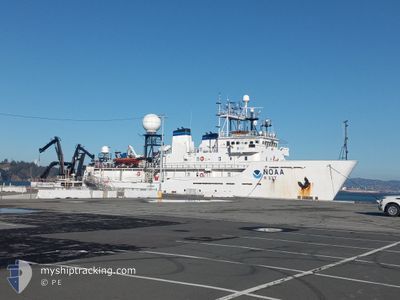
The vessel OKEANOS EXPLORER (IMO: 8835114, MMSI: 369888000) is a Other Type It's sailing under the flag of [US] USA.
In this page you can find informations about the vessels current position, last detected port calls, and current voyage information. If the vessels is not in coverage by AIS you will find the latest position.
The current position of OKEANOS EXPLORER is detected by our AIS receivers and we are not responsible for the reliability of the data. The last position was recorded while the vessel was in Coverage by the Ais receivers of our vessel tracking app.
The current draught of OKEANOS EXPLORER as reported by AIS is 6.5 meters
Weather
| Temperature | 25.2°C / 77.36°F |
|---|---|
| Wind Speed | 20 knots |
| Direction | 80° E |
| Pressure | 1014.6 hPa |
| Humidity | 83.5 % |
| Cloud Coverage | 79 % |
Featured Company
Last Port Calls
| Port | Arrival | Departure | Time In Port |
|---|---|---|---|
| 2024-05-04 19:24 | 2024-05-14 19:36 | 10 d | |
| 2024-04-10 17:19 |
Most Visited Ports (Last year)
| Port | Arrivals | |
|---|---|---|
| 3 | ||
| 1 | ||
| 1 | ||
| 1 | ||
| 1 |
Last Trips
| Origin | Departure | Destination | Arrival | Distance | |
|---|---|---|---|---|---|
| 2024-04-10 10:19 | 2024-05-04 09:24 | 4602.08 nm |
Events
| Time | Event | Details | Position / Dest | Info |
|---|---|---|---|---|
| 2024-05-23 02:13 | Status Changed | Default Under way using engine |
19.19906 / -156.32947
USPEA>USPEA
|
Speed: 9.9 kn Course: 210.6° |
| 2024-05-23 02:07 | OUT of Coverage |
19.21309 / -156.31932
North Pacific Ocean
USPEA>USPEA
|
Speed: 9.9 kn Course: 210.6° |
|
| 2024-05-22 23:04 | START Moving |
19.62660 / -156.01349
USPEA>USPEA
|
Speed: 3.7 kn Course: 220° |
|
| 2024-05-22 22:19 | Status Changed | Under way using engine Default |
19.62156 / -156.00702
USPEA>USPEA
|
Speed: 0.9 kn Course: 511° |
| 2024-05-22 22:19 | Status Changed | Default Under way using engine |
19.62130 / -156.00700
USPEA>USPEA
|
Speed: 0.9 kn Course: 14° |
| 2024-05-22 22:16 | Status Changed | Under way using engine Default |
19.62085 / -156.00695
USPEA>USPEA
|
Speed: 0.8 kn Course: 511° |
| 2024-05-22 22:16 | Status Changed | Default Under way using engine |
19.62059 / -156.00693
USPEA>USPEA
|
Speed: 0.8 kn Course: 10° |
| 2024-05-22 22:13 | Status Changed | Under way using engine Default |
19.62006 / -156.00686
USPEA>USPEA
|
Speed: 0.9 kn Course: 511° |
| 2024-05-22 22:13 | Status Changed | Default Under way using engine |
19.61986 / -156.00679
USPEA>USPEA
|
Speed: 0.8 kn Course: 0° |
| 2024-05-22 21:19 | STOP Moving |
19.60993 / -156.00541
USPEA>USPEA
|
Speed: 0.3 kn Course: 179° |