
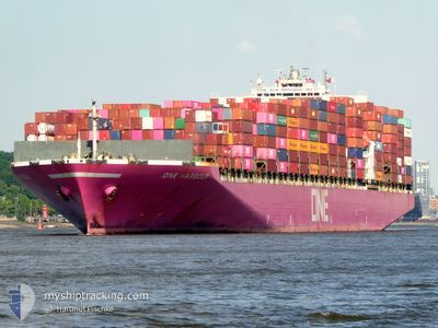
ONE HARBOUR
Container Ship
Current Trip
SG SIN PWBGA
| Time Travelled | 28 days |
|---|---|
| Remaining Time | --- |
| Distance Travelled | 9876.15 nm |
| Remaining Distance | --- |
| AVG Speed | 14.4 Knots |
| MAX Speed | 19.9 Knots |
| AVG Wind | 15.6 knots |
| MAX Wind | 32.3 knots |
| MIN Temp | 12.8°C / 55.04°F |
| MAX Temp | 29.3°C / 84.74°F |
| Draught | 13.1 m |
| Position Received | 9 d ago |
Current Position
| Longitude | 31.48931° |
|---|---|
| Latitude | -30.33316° |
| Status | Under way using engine |
| Speed | 12.3 Knots |
| Course | 67.4° |
| Area | Indian Ocean |
| Station | T-AIS |
| Position Received | 9 d ago |
Info
Information
The current position of ONE HARBOUR is in Indian Ocean with coordinates -30.33316° / 31.48931° as reported on 2024-06-08 04:51 by AIS to our vessel tracker app. The vessel's current speed is 12.3 Knots
The vessel ONE HARBOUR (IMO: 9302152, MMSI: 372367000) is a Container Ship that was built in 2007 ( 17 years old ). It's sailing under the flag of [PA] Panama.
In this page you can find informations about the vessels current position, last detected port calls, and current voyage information. If the vessels is not in coverage by AIS you will find the latest position.
The current position of ONE HARBOUR is detected by our AIS receivers and we are not responsible for the reliability of the data. The last position was recorded while the vessel was in Coverage by the Ais receivers of our vessel tracking app.
The current draught of ONE HARBOUR as reported by AIS is 13.1 meters
Weather
| Temperature | 28.1°C / 82.58°F |
|---|---|
| Wind Speed | 14 knots |
| Direction | 133° SE |
| Pressure | 1011.9 hPa |
| Humidity | 72.7 % |
| Cloud Coverage | 46 % |
Featured Company
Last Port Calls
| Port | Arrival | Departure | Time In Port |
|---|---|---|---|
| 2024-05-19 02:35 | 2024-05-20 06:10 | 1 d | |
| 2024-05-16 01:28 | 2024-05-17 15:17 | 1 d | |
| 2024-05-12 15:23 | 2024-05-15 03:49 | 2 d | |
| 2024-04-07 21:24 | 2024-04-09 10:57 | 1 d |
Last Trips
| Origin | Departure | Destination | Arrival | Distance | |
|---|---|---|---|---|---|
| 2024-05-17 17:17 | 2024-05-19 04:35 | 528.98 nm | |||
| 2024-05-15 05:49 | 2024-05-16 03:28 | 301.44 nm | |||
| 2024-04-09 18:57 | 2024-05-12 17:23 | 11928.89 nm | |||
| 2024-04-01 05:41 | 2024-04-08 05:24 | 2908.78 nm |
Events
| Time | Event | Details | Position / Dest | Info |
|---|---|---|---|---|
| 2024-06-08 04:56 | Status Changed | Default Under way using engine |
-30.32667 / 31.50667
SG SIN PWBGA
|
Speed: 12.3 kn Course: 67.4° |
| 2024-06-08 04:51 | OUT of Coverage |
-30.33316 / 31.48931
Indian Ocean
SG SIN PWBGA
|
Speed: 12.3 kn Course: 67.4° |
|
| 2024-06-08 03:46 | Status Changed | Under way using engine Default |
-30.40787 / 31.24711
SG SIN PWBGA
|
Speed: 13.5 kn Course: 68° |
| 2024-06-08 03:35 | Status Changed | Default Under way using engine |
-30.42167 / 31.20167
SG SIN PWBGA
|
Speed: 13.6 kn Course: 68.2° |
| 2024-06-08 02:36 | Status Changed | Under way using engine Default |
-30.49724 / 30.96693
SG SIN PWBGA
|
Speed: 13.2 kn Course: 66° |
| 2024-06-08 02:30 | Status Changed | Default Under way using engine |
-30.50508 / 30.94280
SG SIN PWBGA
|
Speed: 13.4 kn Course: 68.4° |
| 2024-06-08 02:08 | Change Sea Area | South African part of the Indian Ocean South African part of the South Atlantic Ocean |
-30.53224 / 30.85031
Indian Ocean
SG SIN PWBGA
|
Speed: 14 kn Course: 72.3° |
| 2024-06-08 02:08 | Status Changed | Under way using engine Default |
-30.53224 / 30.85031
SG SIN PWBGA
|
Speed: 14.6 kn Course: 70° |
| 2024-06-08 01:50 | IN Coverage |
-30.53224 / 30.85031
Indian Ocean
SG SIN PWBGA
|
Speed: 14 kn Course: 72.3° |