
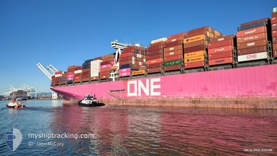
ONE IBIS
Cargo
Current Trip
| Time Travelled | 6 days |
|---|---|
| Remaining Time | 11 days |
| Distance Travelled | 2255.12 nm |
| Remaining Distance | 4940.47 nm |
| AVG Speed | 15.6 Knots |
| MAX Speed | 21.3 Knots |
| AVG Wind | 8.2 knots |
| MAX Wind | 17 knots |
| MIN Temp | 6.9°C / 44.42°F |
| MAX Temp | 23.6°C / 74.48°F |
| Draught | 15 m |
| Position Received | 4 d ago |
Current Position
| Longitude | 141.74257° |
|---|---|
| Latitude | 41.65203° |
| Status | Under way using engine |
| Speed | 17.2 Knots |
| Course | 89.9° |
| Area | North Pacific Ocean |
| Station | T-AIS |
| Position Received | 4 d ago |
Info
Information
The current position of ONE IBIS is in North Pacific Ocean with coordinates 41.65203° / 141.74257° as reported on 2024-06-22 08:57 by AIS to our vessel tracker app. The vessel's current speed is 17.2 Knots and is heading at the port of MANZANILLO. The estimated time of arrival as calculated by vessel tracking app is 2024-07-07 15:21 LT
The vessel ONE IBIS (IMO: 9741384, MMSI: 374815000) is a Cargo It's sailing under the flag of [PA] Panama.
In this page you can find informations about the vessels current position, last detected port calls, and current voyage information. If the vessels is not in coverage by AIS you will find the latest position.
The current position of ONE IBIS is detected by our AIS receivers and we are not responsible for the reliability of the data. The last position was recorded while the vessel was in Coverage by the Ais receivers of our vessel tracking app.
The current draught of ONE IBIS as reported by AIS is 15 meters
Weather
| Temperature | 7.8°C / 46.04°F |
|---|---|
| Wind Speed | 10 knots |
| Direction | 286° WNW |
| Pressure | 1011.9 hPa |
| Humidity | 89.3 % |
| Cloud Coverage | 100 % |
Featured Company
Last Port Calls
| Port | Arrival | Departure | Time In Port |
|---|---|---|---|
| 2024-06-18 02:53 | 2024-06-20 10:00 | 2 d | |
| 2024-06-09 05:26 | 2024-06-09 23:40 | 18 h | |
| 2024-05-03 02:12 | 2024-05-05 11:50 | 2 d | |
| 2024-04-29 00:54 | 2024-04-30 10:11 | 1 d | |
| 2024-04-01 08:28 |
Most Visited Ports (Last year)
| Port | Arrivals | |
|---|---|---|
| 6 | ||
| 4 | ||
| 3 | ||
| 3 | ||
| 2 | ||
| 2 |
Last Trips
| Origin | Departure | Destination | Arrival | Distance | |
|---|---|---|---|---|---|
| 2024-06-10 07:40 | 2024-06-18 11:53 | 1396.03 nm | |||
| 2024-05-05 18:50 | 2024-06-09 13:26 | 3803.32 nm | |||
| 2024-04-30 18:11 | 2024-05-03 09:12 | 848.73 nm | |||
| 2024-04-01 05:28 | 2024-04-29 08:54 | 12175.58 nm |
Events
| Time | Event | Details | Position / Dest | Info |
|---|---|---|---|---|
| 2024-06-24 11:19 | START Moving |
45.63438 / 157.59985
MXZLO
|
Speed: 3.4 kn Course: 77° |
|
| 2024-06-24 11:09 | STOP Moving |
45.63610 / 157.59582
MXZLO
|
Speed: 0.3 kn Course: 154° |
|
| 2024-06-22 09:04 | Status Changed | Default Under way using engine |
41.65206 / 141.78447
MXZLO
|
Speed: 17.2 kn Course: 89.9° |
| 2024-06-22 08:57 | OUT of Coverage |
41.65203 / 141.74257
North Pacific Ocean
MXZLO
|
Speed: 17.2 kn Course: 89.9° |
|
| 2024-06-22 08:39 | Status Changed | Under way using engine Default |
41.65316 / 141.62378
MXZLO
|
Speed: 18.2 kn Course: 90° |
| 2024-06-22 08:10 | Status Changed | Default Under way using engine |
41.64751 / 141.43239
MXZLO
|
Speed: 16.4 kn Course: 83° |
| 2024-06-22 08:04 | Status Changed | Under way using engine Default |
41.64448 / 141.39983
MXZLO
|
Speed: 16.4 kn Course: 82° |
| 2024-06-22 08:01 | Status Changed | Default Under way using engine |
41.64302 / 141.38223
MXZLO
|
Speed: 16.5 kn Course: 84.1° |
| 2024-06-22 07:56 | Status Changed | Under way using engine Default |
41.63962 / 141.34920
MXZLO
|
Speed: 16.4 kn Course: 84° |
| 2024-06-22 07:53 | Status Changed | Default Under way using engine |
41.63834 / 141.33470
MXZLO
|
Speed: 16.2 kn Course: 86.7° |