
ONE TRUTH
Cargo
Current Trip
| Time Travelled | 3 days |
|---|---|
| Remaining Time | 26 days |
| Distance Travelled | 1434.53 nm |
| Remaining Distance | 10475.30 nm |
| AVG Speed | 13.5 Knots |
| MAX Speed | 17.7 Knots |
| AVG Wind | 13.8 knots |
| MAX Wind | 21 knots |
| MIN Temp | 11.3°C / 52.34°F |
| MAX Temp | 18.5°C / 65.3°F |
| Draught | 15.2 m |
| Position Received | 3 h, 59 m ago |
Current Position
| Longitude | -13.43055° |
|---|---|
| Latitude | 34.85687° |
| Status | Under way using engine |
| Speed | 17 Knots |
| Course | 197° |
| Area | North Atlantic Ocean |
| Station | T-AIS |
| Position Received | 3 h, 59 m ago |
Info
Information
The current position of ONE TRUTH is in North Atlantic Ocean with coordinates 34.85687° / -13.43055° as reported on 2024-05-28 19:57 by AIS to our vessel tracker app. The vessel's current speed is 17 Knots and is heading at the port of SINGAPORE. The estimated time of arrival as calculated by vessel tracking app is 2024-06-24 01:10 LT
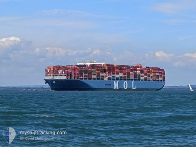
The vessel ONE TRUTH (IMO: 9773210, MMSI: 356984000) is a Cargo It's sailing under the flag of [PA] Panama.
In this page you can find informations about the vessels current position, last detected port calls, and current voyage information. If the vessels is not in coverage by AIS you will find the latest position.
The current position of ONE TRUTH is detected by our AIS receivers and we are not responsible for the reliability of the data. The last position was recorded while the vessel was in Coverage by the Ais receivers of our vessel tracking app.
The current draught of ONE TRUTH as reported by AIS is 15.2 meters
Weather
| Temperature | 18.6°C / 65.48°F |
|---|---|
| Wind Speed | 21 knots |
| Direction | 21° NNE |
| Pressure | 1020 hPa |
| Humidity | 81.9 % |
| Cloud Coverage | 8 % |
Featured Company
Last Port Calls
| Port | Arrival | Departure | Time In Port |
|---|---|---|---|
| 2024-05-20 11:22 | 2024-05-25 01:39 | 4 d | |
| 2024-05-16 09:40 | 2024-05-17 10:49 | 1 d | |
| 2024-05-13 19:21 | 2024-05-15 02:52 | 1 d | |
| 2024-05-12 14:46 | 2024-05-12 15:17 | 30 m | |
| 2024-05-09 00:13 | 2024-05-12 13:28 | 3 d | |
| 2024-04-03 07:53 | 2024-04-04 12:25 | 1 d | |
| 2024-03-28 04:20 | 2024-03-29 07:04 | 1 d | |
| 2024-03-26 17:25 | 2024-03-27 14:32 | 21 h | |
| 2024-03-15 13:15 | 2024-03-17 11:25 | 1 d | |
| 2024-03-05 03:18 | 2024-03-06 22:02 | 1 d |
Most Visited Ports (Last year)
| Port | Arrivals | |
|---|---|---|
| 7 | ||
| 5 | ||
| 4 | ||
| 4 | ||
| 4 | ||
| 4 |
Last Trips
| Origin | Departure | Destination | Arrival | Distance | |
|---|---|---|---|---|---|
| 2024-05-17 12:49 | 2024-05-20 13:22 | 289.65 nm | |||
| 2024-05-15 04:52 | 2024-05-16 11:40 | 466.58 nm | |||
| 2024-05-12 16:17 | 2024-05-13 21:21 | 113.36 nm | |||
| 2024-05-12 14:28 | 2024-05-12 15:46 | 15.30 nm | |||
| 2024-04-04 20:25 | 2024-05-09 01:13 | 11995.04 nm | |||
| 2024-03-29 15:04 | 2024-04-03 15:53 | 1489.22 nm | |||
| 2024-03-27 22:32 | 2024-03-28 12:20 | 135.78 nm | |||
| 2024-03-17 20:25 | 2024-03-27 01:25 | 1544.34 nm | |||
| 2024-03-07 06:02 | 2024-03-15 22:15 | 2538.80 nm | |||
| 2024-01-29 21:46 | 2024-03-05 11:18 | 11222.62 nm |
Events
| Time | Event | Details | Position / Dest | Info |
|---|---|---|---|---|
| 2024-05-28 20:03 | Status Changed | Default Under way using engine |
34.82960 / -13.44022
SGSIN
|
Speed: 17 kn Course: 197° |
| 2024-05-28 19:57 | OUT of Coverage |
34.85687 / -13.43055
North Atlantic Ocean
SGSIN
|
Speed: 17 kn Course: 197° |
|
| 2024-05-28 19:48 | Status Changed | Under way using engine Default |
34.89687 / -13.41624
SGSIN
|
Speed: 17 kn Course: 196° |
| 2024-05-28 19:43 | Status Changed | Default Under way using engine |
34.91994 / -13.40804
SGSIN
|
Speed: 17 kn Course: 195.9° |
| 2024-05-28 19:35 | Status Changed | Under way using engine Default |
34.95779 / -13.39439
SGSIN
|
Speed: 16.9 kn Course: 198° |
| 2024-05-28 19:32 | IN Coverage |
34.95779 / -13.39439
North Atlantic Ocean
SGSIN
|
Speed: 16.9 kn Course: 197° |
|
| 2024-05-28 18:31 | Status Changed | Default Under way using engine |
35.24480 / -13.28340
SGSIN
|
Speed: 16.9 kn Course: 199.2° |
| 2024-05-28 18:26 | Change Sea Area | Portuguese (Madeira) part of the North Atlantic Ocean High seas of the North Atlantic Ocean |
35.26860 / -13.27374
North Atlantic Ocean
SGSIN
|
Speed: 16.9 kn Course: 199.2° |
| 2024-05-28 18:26 | Status Changed | Under way using engine Default |
35.26860 / -13.27374
SGSIN
|
Speed: 16.9 kn Course: 199° |
| 2024-05-28 18:26 | OUT of Coverage |
35.26860 / -13.27374
North Atlantic Ocean
SGSIN
|
Speed: 16.9 kn Course: 199.2° |