
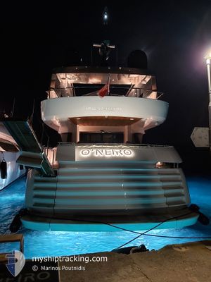
O'NEIRO
Pleasure Craft
Current Trip
| Time Travelled | 1 day |
|---|---|
| Remaining Time | --- |
| Distance Travelled | 63.01 nm |
| Remaining Distance | --- |
| AVG Speed | 16 Knots |
| MAX Speed | 17.5 Knots |
| AVG Wind | 8 knots |
| MAX Wind | 12 knots |
| MIN Temp | 24.6°C / 76.28°F |
| MAX Temp | 26.3°C / 79.34°F |
| Draught | 3.4 m |
| Position Received | 2 h, 32 m ago |
Current Position
| Longitude | 23.35512° |
|---|---|
| Latitude | 37.68698° |
| Status | At anchor |
| Speed | |
| Course | 155° |
| Area | Aegean Sea |
| Station | T-AIS |
| Position Received | 2 h, 32 m ago |
Info
Information
The current position of O'NEIRO is in Aegean Sea with coordinates 37.68698° / 23.35512° as reported on 2024-06-18 10:44 by AIS to our vessel tracker app. The vessel's current speed is 0 Knots
The vessel O'NEIRO (IMO: 9948906, MMSI: 256315000) is a Pleasure Craft It's sailing under the flag of [MT] Malta.
In this page you can find informations about the vessels current position, last detected port calls, and current voyage information. If the vessels is not in coverage by AIS you will find the latest position.
The current position of O'NEIRO is detected by our AIS receivers and we are not responsible for the reliability of the data. The last position was recorded while the vessel was in Coverage by the Ais receivers of our vessel tracking app.
The current draught of O'NEIRO as reported by AIS is 3.4 meters
Weather
| Temperature | 28.4°C / 83.12°F |
|---|---|
| Wind Speed | 4 knots |
| Direction | 303° WNW |
| Pressure | 1014.6 hPa |
| Humidity | 54 % |
| Cloud Coverage | --- |
Featured Company
Last Port Calls
| Port | Arrival | Departure | Time In Port |
|---|---|---|---|
| 2024-06-16 11:17 | 2024-06-17 03:27 | 16 h | |
| 2024-05-26 12:39 | 2024-06-16 09:11 | 20 d | |
| 2024-05-25 14:36 | 2024-05-25 17:48 | 3 h | |
| 2024-05-02 11:29 | 2024-05-25 08:29 | 22 d | |
| 2024-04-25 17:07 | 2024-05-02 07:02 | 6 d | |
| 2024-04-10 07:06 | 2024-04-25 07:42 | 15 d | |
| 2024-04-06 20:08 | 2024-04-07 07:20 | 11 h | |
| 2024-04-05 18:48 | 2024-04-06 07:09 | 12 h | |
| 2024-04-04 11:02 | 2024-04-05 16:02 | 1 d | |
| 2024-04-04 10:14 |
Most Visited Ports (Last year)
| Port | Arrivals | |
|---|---|---|
| 10 | ||
| 6 | ||
| 5 | ||
| 4 | ||
| 4 | ||
| 3 |
Last Trips
| Origin | Departure | Destination | Arrival | Distance | |
|---|---|---|---|---|---|
| 2024-06-16 12:11 | 2024-06-16 14:17 | 31.56 nm | |||
| 2024-05-25 20:48 | 2024-05-26 15:39 | 26.89 nm | |||
| 2024-05-25 11:29 | 2024-05-25 17:36 | 25.07 nm | |||
| 2024-05-02 10:02 | 2024-05-02 14:29 | 69.65 nm | |||
| 2024-04-25 10:42 | 2024-04-25 20:07 | 74.55 nm | |||
| 2024-04-07 10:20 | 2024-04-10 10:06 | 36.09 nm | |||
| 2024-04-06 10:09 | 2024-04-06 23:08 | 3.60 nm | |||
| 2024-04-05 19:02 | 2024-04-05 21:48 | 47.12 nm | |||
| 2024-04-04 13:14 | 2024-04-04 14:02 | 7.52 nm |
Events
| Time | Event | Details | Position / Dest | Info |
|---|---|---|---|---|
| 2024-06-18 10:44 | OUT of Coverage |
37.68698 / 23.35512
Aegean Sea
AGISTRI
|
Speed: Course: 44° |
|
| 2024-06-18 10:44 | Status Changed | At anchor Under way using engine |
37.68698 / 23.35512
AGISTRI
|
Speed: Course: 157° |
| 2024-06-18 05:49 | STOP Moving | 1.48 nm, South West of SKALA AGKISTRI |
37.68606 / 23.35568
AGISTRI
|
Speed: 0.3 kn Course: 276° |
| 2024-06-18 04:45 | Destination Changed | AGISTRI KEA |
37.60675 / 23.64241
AGISTRI
|
Speed: 16.4 kn Course: 287° |
| 2024-06-18 04:45 | ETA Changed | 2024/06/18 15:00 2024/06/16 15:00 |
37.60675 / 23.64241
AGISTRI
|
Speed: 16.4 kn Course: 287° |
| 2024-06-18 02:48 | IN Coverage |
37.43505 / 24.29608
Aegean Sea
|
Speed: 17.5 kn Course: 289.2° |
|
| 2024-06-17 03:58 | OUT of Coverage |
37.54223 / 24.25394
Aegean Sea
|
Speed: 17.4 kn Course: 170.2° |
|
| 2024-06-17 03:27 | PORT DEPARTURE |
|
37.66500 / 24.30984
KEA
|
Speed: 5.5 kn Course: 264° |
| 2024-06-17 03:20 | IN Coverage |
37.66574 / 24.31581
Aegean Sea
[GR] KEA
|
Speed: 3.9 kn Course: 243.4° |
|
| 2024-06-17 01:33 | OUT of Coverage |
37.66819 / 24.32240
Aegean Sea
[GR] KEA
|
Speed: Course: 152.1° |