
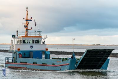
ONKEL OTTO
Cargo
Current Trip
| Time Travelled | 31 mins |
|---|---|
| Remaining Time | -7 mins |
| Distance Travelled | 1.82 nm |
| Remaining Distance | 1.97 nm |
| AVG Speed | 8.8 Knots |
| MAX Speed | 8.8 Knots |
| AVG Wind | 15.3 knots |
| MAX Wind | 15.5 knots |
| MIN Temp | 17.8°C / 64.04°F |
| MAX Temp | 17.8°C / 64.04°F |
| Draught | 1.2 m |
| Position Received | 20 m ago |
Current Position
| Longitude | 7.53098° |
|---|---|
| Latitude | 53.70205° |
| Status | Under way using engine |
| Speed | 9.5 Knots |
| Course | 117° |
| Area | North Sea |
| Station | T-AIS |
| Position Received | 20 m ago |
Info
Information
The current position of ONKEL OTTO is in North Sea with coordinates 53.70205° / 7.53098° as reported on 2024-05-16 12:32 by AIS to our vessel tracker app. The vessel's current speed is 9.5 Knots and is heading at the port of BENSERSIEL. The estimated time of arrival as calculated by vessel tracking app is 2024-05-16 12:45 LT
The vessel ONKEL OTTO (IMO: 886295900, MMSI: 211270860) is a Cargo It's sailing under the flag of [DE] Germany.
In this page you can find informations about the vessels current position, last detected port calls, and current voyage information. If the vessels is not in coverage by AIS you will find the latest position.
The current position of ONKEL OTTO is detected by our AIS receivers and we are not responsible for the reliability of the data. The last position was recorded while the vessel was in Coverage by the Ais receivers of our vessel tracking app.
The current draught of ONKEL OTTO as reported by AIS is 1.2 meters
Weather
| Temperature | 17.8°C / 64.04°F |
|---|---|
| Wind Speed | 16 knots |
| Direction | 93° E |
| Pressure | 1006.4 hPa |
| Humidity | 73.1 % |
| Cloud Coverage | 2 % |
Featured Company
Last Port Calls
| Port | Arrival | Departure | Time In Port |
|---|---|---|---|
| 2024-05-16 10:11 | 2024-05-16 12:21 | 2 h | |
| 2024-05-16 08:15 | 2024-05-16 09:41 | 1 h | |
| 2024-05-16 05:29 | 2024-05-16 07:38 | 2 h | |
| 2024-05-15 12:50 | 2024-05-16 05:02 | 16 h | |
| 2024-05-15 11:31 | 2024-05-15 12:19 | 47 m | |
| 2024-05-15 10:26 | 2024-05-15 11:05 | 38 m | |
| 2024-05-15 08:06 | 2024-05-15 09:39 | 1 h | |
| 2024-05-15 06:35 | 2024-05-15 07:44 | 1 h | |
| 2024-05-15 04:59 | 2024-05-15 05:49 | 49 m | |
| 2024-05-14 15:24 | 2024-05-15 04:35 | 13 h |
Most Visited Ports (Last year)
| Port | Arrivals | |
|---|---|---|
| 1035 | ||
| 984 | ||
| 1 |
Last Trips
| Origin | Departure | Destination | Arrival | Distance | |
|---|---|---|---|---|---|
| 2024-05-16 11:41 | 2024-05-16 12:11 | 3.44 nm | |||
| 2024-05-16 09:38 | 2024-05-16 10:15 | 3.75 nm | |||
| 2024-05-16 07:02 | 2024-05-16 07:29 | 3.58 nm | |||
| 2024-05-15 14:19 | 2024-05-15 14:50 | 3.73 nm | |||
| 2024-05-15 13:05 | 2024-05-15 13:31 | 3.09 nm | |||
| 2024-05-15 11:39 | 2024-05-15 12:26 | 3.66 nm | |||
| 2024-05-15 09:44 | 2024-05-15 10:06 | 3.01 nm | |||
| 2024-05-15 07:49 | 2024-05-15 08:35 | 3.65 nm | |||
| 2024-05-15 06:35 | 2024-05-15 06:59 | 3.45 nm | |||
| 2024-05-14 16:57 | 2024-05-14 17:24 | 3.53 nm |
Events
| Time | Event | Details | Position / Dest | Info |
|---|---|---|---|---|
| 2024-05-16 12:35 | Status Changed | Default Under way using engine |
53.69826 / 7.54560
LANGEOOG BENSERSIEL
|
Speed: 9.5 kn Course: 117° |
| 2024-05-16 12:21 | PORT DEPARTURE |
|
53.72198 / 7.50345
LANGEOOG BENSERSIEL
|
Speed: 7.6 kn Course: 152° |
| 2024-05-16 12:19 | START Moving |
53.72451 / 7.49838
[DE] LANGEOOG
|
Speed: 4.8 kn Course: 119° |
|
| 2024-05-16 10:16 | STOP Moving |
53.72525 / 7.49543
[DE] LANGEOOG
|
Speed: 0.2 kn Course: 299° |
|
| 2024-05-16 10:11 | PORT ARRIVAL |
|
53.72333 / 7.50184
[DE] LANGEOOG
|
Speed: 7 kn Course: 328.5° |
| 2024-05-16 09:48 | Status Changed | Under way using engine Default |
53.68951 / 7.55628
LANGEOOG BENSERSIEL
|
Speed: 3 kn Course: -1° |
| 2024-05-16 09:48 | START Moving | 0.86 nm, North West of BENSERSIEL |
53.68951 / 7.55628
LANGEOOG BENSERSIEL
|
Speed: 4.1 kn Course: 317° |
| 2024-05-16 09:41 | PORT DEPARTURE |
|
53.68333 / 7.56333
LANGEOOG BENSERSIEL
|
Speed: 0.4 kn Course: 341° |
| 2024-05-16 09:32 | IN Coverage |
53.68951 / 7.55628
North Sea
|
Speed: 4.1 kn Course: 318° |
|
| 2024-05-16 07:54 | OUT of Coverage |
53.69946 / 7.54002
North Sea
[DE] BENSERSIEL
|
Speed: 7.6 kn Course: 114.8° |