
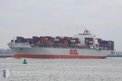
OOCL LONDON
Cargo
Current Trip
| Time Travelled | 4 days |
|---|---|
| Remaining Time | --- |
| Distance Travelled | 1373.16 nm |
| Remaining Distance | --- |
| AVG Speed | 15.9 Knots |
| MAX Speed | 19.9 Knots |
| AVG Wind | 9.4 knots |
| MAX Wind | 22.8 knots |
| MIN Temp | 25°C / 77°F |
| MAX Temp | 32.2°C / 89.96°F |
| Draught | 9 m |
| Position Received | 2 d ago |
Current Position
| Longitude | -79.90180° |
|---|---|
| Latitude | 9.45030° |
| Status | Under way using engine |
| Speed | 4 Knots |
| Course | 235° |
| Area | Caribbean Sea |
| Station | T-AIS |
| Position Received | 2 d ago |
Info
Information
The current position of OOCL LONDON is in Caribbean Sea with coordinates 9.45030° / -79.90180° as reported on 2024-05-29 07:17 by AIS to our vessel tracker app. The vessel's current speed is 4 Knots
The vessel OOCL LONDON (MMSI: 477738500) is a Cargo It's sailing under the flag of [HK] Hong Kong.
In this page you can find informations about the vessels current position, last detected port calls, and current voyage information. If the vessels is not in coverage by AIS you will find the latest position.
The current position of OOCL LONDON is detected by our AIS receivers and we are not responsible for the reliability of the data. The last position was recorded while the vessel was in Coverage by the Ais receivers of our vessel tracking app.
The current draught of OOCL LONDON as reported by AIS is 9 meters
Weather
| Temperature | 29.3°C / 84.74°F |
|---|---|
| Wind Speed | 14 knots |
| Direction | 122° ESE |
| Pressure | 1008.2 hPa |
| Humidity | 75.3 % |
| Cloud Coverage | 98 % |
Featured Company
Last Port Calls
| Port | Arrival | Departure | Time In Port |
|---|---|---|---|
| 2024-05-27 05:03 | 2024-05-27 18:23 | 13 h | |
| 2024-05-23 08:34 | 2024-05-24 04:27 | 19 h | |
| 2024-05-21 09:02 | 2024-05-22 06:26 | 21 h | |
| 2024-05-16 12:07 | 2024-05-19 01:09 | 2 d | |
| 2024-04-11 03:58 | 2024-04-12 18:45 | 1 d | |
| 2024-03-15 02:20 | 2024-03-16 11:59 | 1 d | |
| 2024-03-12 20:55 | 2024-03-13 23:10 | 1 d | |
| 2024-03-08 17:36 | 2024-03-11 13:11 | 2 d |
Last Trips
| Origin | Departure | Destination | Arrival | Distance | |
|---|---|---|---|---|---|
| 2024-05-24 00:27 | 2024-05-27 00:03 | 997.39 nm | |||
| 2024-05-22 01:26 | 2024-05-23 04:34 | 384.38 nm | |||
| 2024-05-18 20:09 | 2024-05-21 04:02 | 552.58 nm | |||
| 2024-04-13 02:45 | 2024-05-16 07:07 | 11996.10 nm | |||
| 2024-03-16 07:59 | 2024-04-11 11:58 | 10110.19 nm | |||
| 2024-03-13 18:10 | 2024-03-14 22:20 | 382.27 nm | |||
| 2024-03-11 08:11 | 2024-03-12 15:55 | 546.27 nm | |||
| 2024-02-06 20:10 | 2024-03-08 11:36 | 10739.26 nm |
Events
| Time | Event | Details | Position / Dest | Info |
|---|---|---|---|---|
| 2024-05-30 01:48 | START Moving | 5.05 nm, North East of TABOGUILLA |
8.87650 / -79.47063
USTPA > JMKIN
|
Speed: 4.4 kn Course: 192° |
| 2024-05-30 00:24 | STOP Moving | 5.27 nm, North East of TABOGUILLA |
8.88115 / -79.47079
USTPA > JMKIN
|
Speed: 0.2 kn Course: 144° |
| 2024-05-29 22:48 | START Moving | 0.93 nm, North West of RODMAN |
8.96995 / -79.57967
USTPA > JMKIN
|
Speed: 4.3 kn Course: 141° |
| 2024-05-29 21:02 | STOP Moving | 2.05 nm, North West of RODMAN |
8.98477 / -79.59165
USTPA > JMKIN
|
Speed: Course: 141° |
| 2024-05-29 16:32 | START Moving | 5.74 nm, South of CRISTOBAL |
9.25098 / -79.92188
USTPA > JMKIN
|
Speed: 6.5 kn Course: 217° |
| 2024-05-29 11:12 | STOP Moving | 5.43 nm, South of CRISTOBAL |
9.25558 / -79.91512
USTPA > JMKIN
|
Speed: 0.1 kn Course: 266° |
| 2024-05-29 11:00 | START Moving | 5.12 nm, South of CRISTOBAL |
9.26067 / -79.91057
USTPA > JMKIN
|
Speed: 3.6 kn Course: 184° |
| 2024-05-29 09:28 | STOP Moving | 4.19 nm, South of CRISTOBAL |
9.27622 / -79.91315
USTPA > JMKIN
|
Speed: 0.1 kn Course: 171° |
| 2024-05-29 07:24 | Status Changed | Default Under way using engine |
9.44618 / -79.90700
USTPA > JMKIN
|
Speed: 4 kn Course: 235° |
| 2024-05-29 07:17 | OUT of Coverage |
9.45030 / -79.90180
Caribbean Sea
|
Speed: 4 kn Course: 232° |