
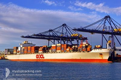
OOCL WASHINGTON
Container Ship
Current Trip
| Time Travelled | --- |
|---|---|
| Remaining Time | 6 days |
| Distance Travelled | 16407.18 nm |
| Remaining Distance | 3699.00 nm |
| AVG Speed | 13 Knots |
| MAX Speed | 21.7 Knots |
| AVG Wind | 12.5 knots |
| MAX Wind | 28.8 knots |
| MIN Temp | 5.7°C / 42.26°F |
| MAX Temp | 32.4°C / 90.32°F |
| Draught | 12.9 m |
| Position Received | 3 d ago |
Current Position
| Longitude | 142.11523° |
|---|---|
| Latitude | 41.68522° |
| Status | Under way using engine |
| Speed | 19 Knots |
| Course | 82° |
| Area | North Pacific Ocean |
| Station | T-AIS |
| Position Received | 3 d ago |
Info
Information
The current position of OOCL WASHINGTON is in North Pacific Ocean with coordinates 41.68522° / 142.11523° as reported on 2024-05-25 00:11 by AIS to our vessel tracker app. The vessel's current speed is 19 Knots and is heading at the port of LOS ANGELES. The estimated time of arrival as calculated by vessel tracking app is 2024-06-04 15:07 LT
The vessel OOCL WASHINGTON (IMO: 9417256, MMSI: 477617600) is a Container Ship that was built in 2010 ( 14 years old ). It's sailing under the flag of [HK] Hong Kong.
In this page you can find informations about the vessels current position, last detected port calls, and current voyage information. If the vessels is not in coverage by AIS you will find the latest position.
The current position of OOCL WASHINGTON is detected by our AIS receivers and we are not responsible for the reliability of the data. The last position was recorded while the vessel was in Coverage by the Ais receivers of our vessel tracking app.
The current draught of OOCL WASHINGTON as reported by AIS is 12.9 meters
Weather
| Temperature | 8.2°C / 46.76°F |
|---|---|
| Wind Speed | 17 knots |
| Direction | 268° W |
| Pressure | 1013.9 hPa |
| Humidity | 96.6 % |
| Cloud Coverage | 100 % |
Featured Company
Events
| Time | Event | Details | Position / Dest | Info |
|---|---|---|---|---|
| 2024-05-25 00:12 | Status Changed | Default Under way using engine |
41.68603 / 142.12354
CNNGB>USLGB
|
Speed: 19 kn Course: 82° |
| 2024-05-25 00:11 | OUT of Coverage |
41.68522 / 142.11523
North Pacific Ocean
CNNGB>USLGB
|
Speed: 19 kn Course: 82° |
|
| 2024-05-24 22:46 | ETA Changed | 2024/06/05 12:00 2024/06/05 19:00 |
41.64867 / 141.50537
CNNGB>USLGB
|
Speed: 21 kn Course: 87° |
| 2024-05-24 22:38 | ETA Changed | 2024/06/05 19:00 2024/06/05 11:00 |
41.64652 / 141.44608
CNNGB>USLGB
|
Speed: 20.4 kn Course: 88° |
| 2024-05-24 22:16 | Change Sea Area | Japanese part of the North Pacific Ocean Japanese part of the Japan Sea |
41.63480 / 141.29113
North Pacific Ocean
CNNGB>USLGB
|
Speed: 18.4 kn Course: 80° |
| 2024-05-24 21:29 | Status Changed | Under way using engine Default |
41.60558 / 140.95197
CNNGB>USLGB
|
Speed: 20.2 kn Course: 76° |
| 2024-05-24 21:24 | Status Changed | Default Under way using engine |
41.60260 / 140.91849
CNNGB>USLGB
|
Speed: 20.2 kn Course: 65° |
| 2024-05-24 19:59 | Status Changed | Under way using engine Default |
41.35625 / 140.37213
CNNGB>USLGB
|
Speed: 20.4 kn Course: 49° |
| 2024-05-24 19:53 | Status Changed | Default Under way using engine |
41.33675 / 140.33452
CNNGB>USLGB
|
Speed: 19.7 kn Course: 41° |
| 2024-05-24 19:42 | Status Changed | Under way using engine Default |
41.29390 / 140.28243
CNNGB>USLGB
|
Speed: 19.3 kn Course: 47° |