
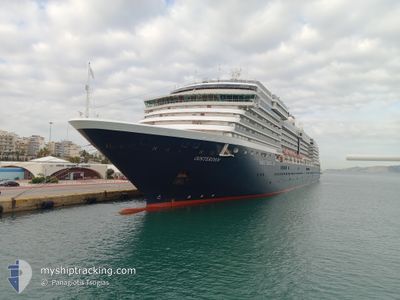
OOSTERDAM
Passengers Ship
Current Trip
| Time Travelled | 1 day |
|---|---|
| Remaining Time | --- |
| Distance Travelled | 570.81 nm |
| Remaining Distance | --- |
| AVG Speed | 14.8 Knots |
| MAX Speed | 19.1 Knots |
| AVG Wind | 5.3 knots |
| MAX Wind | 9 knots |
| MIN Temp | 16.5°C / 61.7°F |
| MAX Temp | 23.9°C / 75.02°F |
| Draught | 7.9 m |
| Position Received | 4 m ago |
Current Position
| Longitude | 22.78673° |
|---|---|
| Latitude | 37.55551° |
| Status | At anchor |
| Speed | 0.5 Knots |
| Course | 137° |
| Area | Aegean Sea |
| Station | T-AIS |
| Position Received | 4 m ago |
Info
Information
The current position of OOSTERDAM is in Aegean Sea with coordinates 37.55551° / 22.78673° as reported on 2024-05-31 12:17 by AIS to our vessel tracker app. The vessel's current speed is 0.5 Knots
The vessel OOSTERDAM (IMO: 9221281, MMSI: 245417000) is a Passengers Ship that was built in 2003 ( 21 years old ). It's sailing under the flag of [NL] Netherlands.
In this page you can find informations about the vessels current position, last detected port calls, and current voyage information. If the vessels is not in coverage by AIS you will find the latest position.
The current position of OOSTERDAM is detected by our AIS receivers and we are not responsible for the reliability of the data. The last position was recorded while the vessel was in Coverage by the Ais receivers of our vessel tracking app.
The current draught of OOSTERDAM as reported by AIS is 7.9 meters
Weather
| Temperature | 23.9°C / 75.02°F |
|---|---|
| Wind Speed | 9 knots |
| Direction | 131° SE |
| Pressure | 1013.5 hPa |
| Humidity | 53.6 % |
| Cloud Coverage | 10 % |
Featured Company
Last Port Calls
| Port | Arrival | Departure | Time In Port |
|---|---|---|---|
| 2024-05-29 04:30 | 2024-05-29 15:20 | 10 h | |
| 2024-05-27 07:22 | 2024-05-27 16:58 | 9 h | |
| 2024-05-26 03:20 | 2024-05-26 21:50 | 18 h | |
| 2024-05-25 07:10 | 2024-05-25 15:55 | 8 h | |
| 2024-05-24 05:11 | 2024-05-24 15:05 | 9 h | |
| 2024-05-23 04:03 | 2024-05-23 13:59 | 9 h | |
| 2024-05-22 06:15 | 2024-05-22 15:03 | 8 h | |
| 2024-05-21 01:11 | 2024-05-21 13:28 | 12 h | |
| 2024-05-20 03:11 | 2024-05-20 14:11 | 11 h | |
| 2024-05-19 04:21 | 2024-05-19 17:46 | 13 h |
Last Trips
| Origin | Departure | Destination | Arrival | Distance | |
|---|---|---|---|---|---|
| 2024-05-27 18:58 | 2024-05-29 06:30 | 342.20 nm | |||
| 2024-05-26 23:50 | 2024-05-27 09:22 | 157.20 nm | |||
| 2024-05-25 17:55 | 2024-05-26 05:20 | 158.45 nm | |||
| 2024-05-24 17:05 | 2024-05-25 09:10 | 225.90 nm | |||
| 2024-05-23 16:59 | 2024-05-24 07:11 | 210.65 nm | |||
| 2024-05-22 18:03 | 2024-05-23 07:03 | 127.38 nm | |||
| 2024-05-21 16:28 | 2024-05-22 09:15 | 310.61 nm | |||
| 2024-05-20 17:11 | 2024-05-21 04:11 | 95.31 nm | |||
| 2024-05-19 20:46 | 2024-05-20 06:11 | 95.54 nm | |||
| 2024-05-17 18:28 | 2024-05-19 07:21 | 416.69 nm |
Events
| Time | Event | Details | Position / Dest | Info |
|---|---|---|---|---|
| 2024-05-31 11:39 | Destination Changed | GR PIR GR NAF |
37.55523 / 22.78666
GR PIR
|
Speed: Course: 155° |
| 2024-05-31 11:39 | ETA Changed | 2024/06/01 04:00 2024/05/31 05:00 |
37.55523 / 22.78666
GR PIR
|
Speed: Course: 155° |
| 2024-05-31 04:23 | Status Changed | At anchor Under way using engine |
37.55459 / 22.78728
GR NAF
|
Speed: 0.2 kn Course: 341° |
| 2024-05-31 04:22 | STOP Moving | 1.03 nm, South of NAFPLIO |
37.55463 / 22.78730
GR NAF
|
Speed: 0.2 kn Course: 343° |
| 2024-05-30 22:47 | Change Sea Area | Greek part of the Aegean Sea Greek part of the Mediterranean Sea - Eastern Basin |
36.39239 / 23.01924
Aegean Sea
GR NAF
|
Speed: 15.3 kn Course: 104.3° |
| 2024-05-30 22:35 | Status Changed | Under way using engine Default |
36.40364 / 22.95744
GR NAF
|
Speed: 15.1 kn Course: 76° |
| 2024-05-30 22:19 | Status Changed | Default Under way using engine |
36.39500 / 22.87167
GR NAF
|
Speed: 15.1 kn Course: 65° |
| 2024-05-30 21:47 | IN Coverage |
36.33991 / 22.72216
Mediterranean Sea - Eastern Basin
GR NAF
|
Speed: 15.2 kn Course: 63.9° |
|
| 2024-05-30 21:46 | Status Changed | Under way using engine Default |
36.33847 / 22.71844
GR NAF
|
Speed: 15.3 kn Course: 72° |
| 2024-05-30 19:33 | OUT of Coverage |
36.37073 / 22.04299
Mediterranean Sea - Eastern Basin
GR NAF
|
Speed: 14.7 kn Course: 100° |