
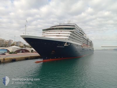
OOSTERDAM
Passengers Ship
Current Trip
IT PTF
| Time Travelled | 1 day |
|---|---|
| Remaining Time | --- |
| Distance Travelled | 339.13 nm |
| Remaining Distance | --- |
| AVG Speed | 14.3 Knots |
| MAX Speed | 19.3 Knots |
| AVG Wind | 11.6 knots |
| MAX Wind | 26.4 knots |
| MIN Temp | 14.8°C / 58.64°F |
| MAX Temp | 20.8°C / 69.44°F |
| Draught | 7.9 m |
| Position Received | 1 m ago |
Current Position
| Longitude | 8.25628° |
|---|---|
| Latitude | 43.57770° |
| Status | Under way using engine |
| Speed | 10.1 Knots |
| Course | 80.9° |
| Area | Ligurian Sea |
| Station | T-AIS |
| Position Received | 1 m ago |
Info
Information
The current position of OOSTERDAM is in Ligurian Sea with coordinates 43.57770° / 8.25628° as reported on 2024-06-13 22:15 by AIS to our vessel tracker app. The vessel's current speed is 10.1 Knots
The vessel OOSTERDAM (IMO: 9221281, MMSI: 245417000) is a Passengers Ship that was built in 2003 ( 21 years old ). It's sailing under the flag of [NL] Netherlands.
In this page you can find informations about the vessels current position, last detected port calls, and current voyage information. If the vessels is not in coverage by AIS you will find the latest position.
The current position of OOSTERDAM is detected by our AIS receivers and we are not responsible for the reliability of the data. The last position was recorded while the vessel was in Coverage by the Ais receivers of our vessel tracking app.
The current draught of OOSTERDAM as reported by AIS is 7.9 meters
Weather
| Temperature | 19.4°C / 66.92°F |
|---|---|
| Wind Speed | 23 knots |
| Direction | 235° SW |
| Pressure | 1017 hPa |
| Humidity | 78.2 % |
| Cloud Coverage | 29 % |
Featured Company
Last Port Calls
| Port | Arrival | Departure | Time In Port |
|---|---|---|---|
| 2024-06-12 03:13 | 2024-06-12 14:46 | 11 h | |
| 2024-06-09 07:10 | 2024-06-09 15:52 | 8 h | |
| 2024-06-08 04:07 | 2024-06-08 20:13 | 16 h | |
| 2024-06-07 04:13 | 2024-06-07 15:26 | 11 h | |
| 2024-06-06 06:05 | 2024-06-06 15:01 | 8 h | |
| 2024-06-05 05:21 | 2024-06-05 21:07 | 15 h | |
| 2024-06-03 05:42 | 2024-06-03 16:21 | 10 h | |
| 2024-06-02 04:28 | 2024-06-02 13:37 | 9 h | |
| 2024-06-01 00:26 | 2024-06-01 14:02 | 13 h | |
| 2024-05-29 04:30 | 2024-05-29 15:20 | 10 h |
Last Trips
| Origin | Departure | Destination | Arrival | Distance | |
|---|---|---|---|---|---|
| 2024-06-09 17:52 | 2024-06-12 05:13 | 488.64 nm | |||
| 2024-06-08 22:13 | 2024-06-09 09:10 | 184.04 nm | |||
| 2024-06-07 17:26 | 2024-06-08 06:07 | 173.92 nm | |||
| 2024-06-06 17:01 | 2024-06-07 06:13 | 187.23 nm | |||
| 2024-06-05 23:07 | 2024-06-06 08:05 | 158.26 nm | |||
| 2024-06-03 18:21 | 2024-06-05 07:21 | 380.17 nm | |||
| 2024-06-02 16:37 | 2024-06-03 07:42 | 180.01 nm | |||
| 2024-06-01 17:02 | 2024-06-02 07:28 | 256.34 nm | |||
| 2024-05-29 17:20 | 2024-06-01 03:26 | 669.16 nm | |||
| 2024-05-27 18:58 | 2024-05-29 06:30 | 342.20 nm |
Events
| Time | Event | Details | Position / Dest | Info |
|---|---|---|---|---|
| 2024-06-13 21:32 | Change Sea Area | Italian part of the Ligurian Sea Italian part of the Mediterranean Sea - Western Basin |
43.55516 / 8.09140
Ligurian Sea
IT PTF
|
Speed: 10.2 kn Course: 75.5° |
| 2024-06-13 19:56 | ETA Changed | 2024/06/14 04:45 2024/06/14 05:00 |
43.49655 / 7.72842
IT PTF
|
Speed: 10.1 kn Course: 78.5° |
| 2024-06-13 19:38 | Detected in Sea | Italian part of the Mediterranean Sea - Western Basin |
43.48629 / 7.66118
Mediterranean Sea - Western Basin
IT PTF
|
Speed: 9.4 kn Course: 77.2° |
| 2024-06-13 19:11 | Detected in Sea | French part of the Mediterranean Sea - Western Basin |
43.47171 / 7.56519
Mediterranean Sea - Western Basin
IT PTF
|
Speed: 9.4 kn Course: 79.3° |
| 2024-06-13 18:59 | Change Sea Area | Mon�gasque part of the Mediterranean Sea - Western Basin French part of the Mediterranean Sea - Western Basin |
43.46541 / 7.52330
Mediterranean Sea - Western Basin
IT PTF
|
Speed: 9.3 kn Course: 79.9° |
| 2024-06-13 16:58 | START Moving | 0.94 nm, West of SAINTJEAN CAP FERRAT |
43.68807 / 7.31386
IT PTF
|
Speed: 3.5 kn Course: 189° |
| 2024-06-13 16:44 | Status Changed | Under way using engine At anchor |
43.69071 / 7.31400
IT PTF
|
Speed: 0.2 kn Course: 92° |
| 2024-06-13 15:07 | Draught Changed | 7.9 7 |
43.69171 / 7.31505
IT PTF
|
Speed: 0.3 kn Course: 144° |
| 2024-06-13 15:07 | ETA Changed | 2024/06/14 05:00 |
43.69171 / 7.31505
IT PTF
|
Speed: 0.3 kn Course: 144° |
| 2024-06-13 14:55 | Draught Changed | 7 7.9 |
43.69151 / 7.31512
IT PTF
|
Speed: 0.4 kn Course: 136° |