
ORALORA
Oil/Chemical Tanker
Current Trip
| Time Travelled | 11 h, 5 mins |
|---|---|
| Remaining Time | 1 day |
| Distance Travelled | 123.08 nm |
| Remaining Distance | 448.66 nm |
| AVG Speed | 11.1 Knots |
| MAX Speed | 12.9 Knots |
| AVG Wind | 11 knots |
| MAX Wind | 19 knots |
| MIN Temp | 13.7°C / 56.66°F |
| MAX Temp | 16.8°C / 62.24°F |
| Draught | 6.2 m |
| Position Received | 22 m ago |
Current Position
| Longitude | 4.86662° |
|---|---|
| Latitude | 53.65283° |
| Status | Under way using engine |
| Speed | 10.5 Knots |
| Course | 20.9° |
| Area | North Sea |
| Station | T-AIS |
| Position Received | 22 m ago |
Info
Information
The current position of ORALORA is in North Sea with coordinates 53.65283° / 4.86662° as reported on 2024-06-07 22:15 by AIS to our vessel tracker app. The vessel's current speed is 10.5 Knots and is heading at the port of KARLSHAMN. The estimated time of arrival as calculated by vessel tracking app is 2024-06-09 16:38 LT
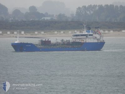
The vessel ORALORA (IMO: 9534066, MMSI: 219200000) is a Oil/Chemical Tanker that was built in 2009 ( 15 years old ). It's sailing under the flag of [DK] Denmark.
In this page you can find informations about the vessels current position, last detected port calls, and current voyage information. If the vessels is not in coverage by AIS you will find the latest position.
The current position of ORALORA is detected by our AIS receivers and we are not responsible for the reliability of the data. The last position was recorded while the vessel was in Coverage by the Ais receivers of our vessel tracking app.
The current draught of ORALORA as reported by AIS is 6.2 meters
Weather
| Temperature | 13.7°C / 56.66°F |
|---|---|
| Wind Speed | 19 knots |
| Direction | 218° SW |
| Pressure | 1013.4 hPa |
| Humidity | 81.5 % |
| Cloud Coverage | 100 % |
Featured Company
Last Port Calls
| Port | Arrival | Departure | Time In Port |
|---|---|---|---|
| 2024-06-06 11:16 | 2024-06-07 11:33 | 1 d | |
| 2024-06-01 11:58 | 2024-06-06 10:54 | 4 d | |
| 2024-05-28 05:55 | 2024-05-29 06:24 | 1 d | |
| 2024-05-24 03:47 | 2024-05-25 13:13 | 1 d | |
| 2024-05-22 03:26 | 2024-05-22 19:33 | 16 h | |
| 2024-05-17 05:08 | 2024-05-22 03:18 | 4 d | |
| 2024-05-16 06:30 | 2024-05-17 04:37 | 22 h | |
| 2024-05-12 14:55 | 2024-05-13 05:10 | 14 h | |
| 2024-05-07 20:17 | 2024-05-09 07:38 | 1 d | |
| 2024-05-05 16:34 | 2024-05-06 19:37 | 1 d |
Most Visited Ports (Last year)
| Port | Arrivals | |
|---|---|---|
| 7 | ||
| 5 | ||
| 5 | ||
| 5 | ||
| 4 | ||
| 4 |
Last Trips
| Origin | Departure | Destination | Arrival | Distance | |
|---|---|---|---|---|---|
| 2024-06-06 12:54 | 2024-06-06 13:16 | 1.04 nm | |||
| 2024-05-29 08:24 | 2024-06-01 13:58 | 672.52 nm | |||
| 2024-05-25 15:13 | 2024-05-28 07:55 | 666.77 nm | |||
| 2024-05-22 21:33 | 2024-05-24 05:47 | 335.89 nm | |||
| 2024-05-22 05:18 | 2024-05-22 05:26 | 0.32 nm | |||
| 2024-05-17 06:37 | 2024-05-17 07:08 | 2.49 nm | |||
| 2024-05-13 07:10 | 2024-05-16 08:30 | 778.76 nm | |||
| 2024-05-09 09:38 | 2024-05-12 16:55 | 419.18 nm | |||
| 2024-05-06 21:37 | 2024-05-07 22:17 | 262.27 nm | |||
| 2024-05-03 03:37 | 2024-05-05 18:34 | 341.28 nm |
Events
| Time | Event | Details | Position / Dest | Info |
|---|---|---|---|---|
| 2024-06-07 21:41 | Status Changed | Under way using engine Default |
53.56223 / 4.80083
SE KAN
|
Speed: 10 kn Course: 22° |
| 2024-06-07 21:29 | Status Changed | Default Under way using engine |
53.52833 / 4.77667
SE KAN
|
Speed: 10.7 kn Course: 22.1° |
| 2024-06-07 20:20 | Status Changed | Under way using engine Default |
53.33923 / 4.64288
SE KAN
|
Speed: 10.9 kn Course: 24° |
| 2024-06-07 20:15 | IN Coverage |
53.34524 / 4.64736
North Sea
SE KAN
|
Speed: 10.7 kn Course: 24.3° |
|
| 2024-06-07 19:03 | Status Changed | Default Under way using engine |
53.12345 / 4.46841
SE KAN
|
Speed: 11.3 kn Course: 27.6° |
| 2024-06-07 18:48 | Status Changed | Under way using engine Default |
53.08209 / 4.43152
SE KAN
|
Speed: 11 kn Course: 27° |
| 2024-06-07 18:48 | OUT of Coverage |
53.08209 / 4.43152
North Sea
SE KAN
|
Speed: 11.3 kn Course: 27.6° |
|
| 2024-06-07 18:38 | Status Changed | Default Under way using engine |
53.05333 / 4.40500
SE KAN
|
Speed: 11.8 kn Course: 28.3° |
| 2024-06-07 18:08 | Status Changed | Under way using engine Default |
52.96554 / 4.33141
SE KAN
|
Speed: 11.8 kn Course: 25° |
| 2024-06-07 18:08 | IN Coverage |
52.97373 / 4.33832
North Sea
SE KAN
|
Speed: 11.7 kn Course: 27.4° |