
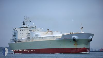
ORANGE STAR
Fruit Juice Tanker
Current Trip
| Time Travelled | 7 days |
|---|---|
| Remaining Time | --- |
| Distance Travelled | 2547.06 nm |
| Remaining Distance | --- |
| AVG Speed | 13.4 Knots |
| MAX Speed | 15.3 Knots |
| AVG Wind | 14.7 knots |
| MAX Wind | 21.8 knots |
| MIN Temp | 12.2°C / 53.96°F |
| MAX Temp | 22.4°C / 72.32°F |
| Draught | 7.4 m |
| Position Received | 1 d ago |
Current Position
| Longitude | -16.92923° |
|---|---|
| Latitude | 27.14827° |
| Status | Under way using engine |
| Speed | 14.6 Knots |
| Course | 208.9° |
| Area | North Atlantic Ocean |
| Station | T-AIS |
| Position Received | 1 d ago |
Info
Information
The current position of ORANGE STAR is in North Atlantic Ocean with coordinates 27.14827° / -16.92923° as reported on 2024-06-01 09:06 by AIS to our vessel tracker app. The vessel's current speed is 14.6 Knots and is heading at the port of SANTOS. The estimated time of arrival as calculated by vessel tracking app is 2024-06-12 09:00 LT
The vessel ORANGE STAR (IMO: 9564384, MMSI: 636014800) is a Fruit Juice Tanker that was built in 2011 ( 13 years old ). It's sailing under the flag of [LR] Liberia.
In this page you can find informations about the vessels current position, last detected port calls, and current voyage information. If the vessels is not in coverage by AIS you will find the latest position.
The current position of ORANGE STAR is detected by our AIS receivers and we are not responsible for the reliability of the data. The last position was recorded while the vessel was in Coverage by the Ais receivers of our vessel tracking app.
The current draught of ORANGE STAR as reported by AIS is 7.4 meters
Weather
| Temperature | 22.3°C / 72.14°F |
|---|---|
| Wind Speed | 11 knots |
| Direction | 30° NNE |
| Pressure | 1017.9 hPa |
| Humidity | 80.5 % |
| Cloud Coverage | 73 % |
Featured Company
Last Port Calls
| Port | Arrival | Departure | Time In Port |
|---|---|---|---|
| 2024-05-22 23:57 | 2024-05-26 14:45 | 3 d | |
| 2024-05-01 22:39 | 2024-05-05 02:21 | 3 d | |
| 2024-04-08 18:59 | 2024-04-15 16:04 | 6 d |
Most Visited Ports (Last year)
| Port | Arrivals | |
|---|---|---|
| 7 | ||
| 4 | ||
| 4 | ||
| 1 |
Events
| Time | Event | Details | Position / Dest | Info |
|---|---|---|---|---|
| 2024-06-01 09:15 | Status Changed | Default Under way using engine |
27.11538 / -16.94968
BR SSZ
|
Speed: 14.6 kn Course: 208.9° |
| 2024-06-01 09:06 | Status Changed | Under way using engine Default |
27.14827 / -16.92923
BR SSZ
|
Speed: 14.8 kn Course: 209° |
| 2024-06-01 09:06 | OUT of Coverage |
27.14827 / -16.92923
North Atlantic Ocean
BR SSZ
|
Speed: 14.6 kn Course: 208.9° |
|
| 2024-06-01 08:15 | Status Changed | Default Under way using engine |
27.33622 / -16.81450
BR SSZ
|
Speed: 15.2 kn Course: 209.1° |
| 2024-06-01 08:10 | Status Changed | Under way using engine Default |
27.35383 / -16.80370
BR SSZ
|
Speed: 15.1 kn Course: 209° |
| 2024-06-01 08:03 | Status Changed | Default Under way using engine |
27.37882 / -16.78825
BR SSZ
|
Speed: 14.9 kn Course: 209.6° |
| 2024-05-31 22:49 | Change Sea Area | Spanish (Canary Islands) part of the North Atlantic Ocean Portuguese (Madeira) part of the North Atlantic Ocean |
29.26482 / -15.53782
North Atlantic Ocean
BR SSZ
|
Speed: 14.4 kn Course: 197.4° |
| 2024-05-31 20:39 | Status Changed | Under way using engine Default |
29.76148 / -15.34808
BR SSZ
|
Speed: 14.2 kn Course: 199° |
| 2024-05-31 20:34 | Status Changed | Default Under way using engine |
29.77938 / -15.34128
BR SSZ
|
Speed: 14.3 kn Course: 198.5° |
| 2024-05-31 20:28 | Status Changed | Under way using engine Default |
29.80485 / -15.33155
BR SSZ
|
Speed: 14.4 kn Course: 198° |