
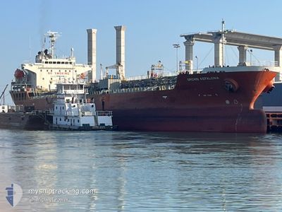
ORCHID KEFALONIA
Oil/Chemical Tanker
Current Trip
| Time Travelled | 51 days |
|---|---|
| Remaining Time | --- |
| Distance Travelled | 13440.03 nm |
| Remaining Distance | --- |
| AVG Speed | 11.4 Knots |
| MAX Speed | 15.4 Knots |
| AVG Wind | 13.3 knots |
| MAX Wind | 29 knots |
| MIN Temp | 15.9°C / 60.62°F |
| MAX Temp | 31°C / 87.8°F |
| Draught | 8.5 m |
| Position Received | Now |
Current Position
| Longitude | 14.22478° |
|---|---|
| Latitude | 37.03632° |
| Status | At anchor |
| Speed | |
| Course | 169° |
| Area | Mediterranean Sea - Eastern Basin |
| Station | T-AIS |
| Position Received | Now |
Info
Information
The current position of ORCHID KEFALONIA is in Mediterranean Sea - Eastern Basin with coordinates 37.03632° / 14.22478° as reported on 2024-06-25 07:10 by AIS to our vessel tracker app. The vessel's current speed is 0 Knots
The vessel ORCHID KEFALONIA (IMO: 9363821, MMSI: 538009509) is a Oil/Chemical Tanker that was built in 2008 ( 16 years old ). It's sailing under the flag of [MH] Marshall Is.
In this page you can find informations about the vessels current position, last detected port calls, and current voyage information. If the vessels is not in coverage by AIS you will find the latest position.
The current position of ORCHID KEFALONIA is detected by our AIS receivers and we are not responsible for the reliability of the data. The last position was recorded while the vessel was in Coverage by the Ais receivers of our vessel tracking app.
The current draught of ORCHID KEFALONIA as reported by AIS is 8.5 meters
Weather
| Temperature | 24.9°C / 76.82°F |
|---|---|
| Wind Speed | 3 knots |
| Direction | 96° E |
| Pressure | 1011.1 hPa |
| Humidity | 61.4 % |
| Cloud Coverage | 97 % |
Featured Company
Last Port Calls
| Port | Arrival | Departure | Time In Port |
|---|---|---|---|
| 2024-05-02 23:16 | 2024-05-04 19:49 | 1 d | |
| 2024-04-24 02:55 | 2024-04-25 08:00 | 1 d |
Most Visited Ports (Last year)
| Port | Arrivals | |
|---|---|---|
| 4 | ||
| 3 | ||
| 2 | ||
| 1 | ||
| 1 | ||
| 1 |
Last Trips
| Origin | Departure | Destination | Arrival | Distance | |
|---|---|---|---|---|---|
| 2024-04-25 16:00 | 2024-05-03 07:16 | 2278.17 nm | |||
| 2024-03-20 10:39 | 2024-04-24 10:55 | 6792.91 nm |
Events
| Time | Event | Details | Position / Dest | Info |
|---|---|---|---|---|
| 2024-06-24 12:28 | Status Changed | At anchor Under way using engine |
37.03512 / 14.22793
IT GEA
|
Speed: 0.2 kn Course: 296° |
| 2024-06-24 12:12 | STOP Moving | 0.99 nm, West of GELA |
37.03447 / 14.22758
IT GEA
|
Speed: 0.3 kn Course: 310° |
| 2024-06-24 10:23 | ETA Changed | 2024/06/24 11:30 2024/06/25 10:00 |
36.82142 / 14.29568
IT GEA
|
Speed: 11.5 kn Course: 351° |
| 2024-06-24 08:02 | Draught Changed | 8.5 9.9 |
36.50568 / 14.53400
IT GEA
|
Speed: 11.1 kn Course: 281° |
| 2024-06-24 07:33 | Status Changed | Under way using engine Default |
36.48683 / 14.64105
IT GEA
|
Speed: 11.2 kn Course: 284° |
| 2024-06-24 07:15 | Status Changed | Default Under way using engine |
36.47188 / 14.71165
IT GEA
|
Speed: 11.1 kn Course: 280° |
| 2024-06-24 07:07 | Status Changed | Under way using engine Default |
36.46662 / 14.74170
IT GEA
|
Speed: 11 kn Course: 274° |
| 2024-06-24 07:04 | Status Changed | Default Under way using engine |
36.46545 / 14.75047
IT GEA
|
Speed: 10.9 kn Course: 264° |
| 2024-06-24 06:54 | Status Changed | Under way using engine Default |
36.46692 / 14.78895
IT GEA
|
Speed: 10.9 kn Course: 265° |
| 2024-06-24 06:45 | IN Coverage |
36.46672 / 14.78518
Mediterranean Sea - Eastern Basin
IT GEA
|
Speed: 11 kn Course: 265° |