
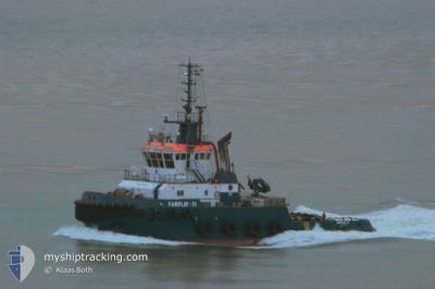
ORIOLE
Oil/Chemical Tanker
Current Trip
| Trip Time | 4 days |
|---|---|
| Trip Distance | 711.58 nm |
| AVG Speed | 11.4 Knots |
| MAX Speed | 11.4 Knots |
| Draught | 5.8 m |
| AVG Wind | 5.5 knots |
| MAX Wind | 11.4 knots |
| MIN Temp | 16.4°C / 61.52°F |
| MAX Temp | 24°C / 75.2°F |
| Position Received | 1 h, 31 m ago |
Current Position
| Longitude | 28.67590° |
|---|---|
| Latitude | 44.33317° |
| Status | Moored |
| Speed | 57.8 Knots |
| Course | 357° |
| Area | Black Sea |
| Station | T-AIS |
| Position Received | 1 h, 31 m ago |
Info
Information
The current position of ORIOLE is in Black Sea with coordinates 44.33317° / 28.67590° as reported on 2024-06-06 18:39 by AIS to our vessel tracker app. The vessel's current speed is 57.8 Knots and is currently inside the port of MIDIA.
The vessel ORIOLE (IMO: 9547570, MMSI: 305940000) is a Oil/Chemical Tanker that was built in 2010 ( 14 years old ). It's sailing under the flag of [AG] Antigua Barbuda.
In this page you can find informations about the vessels current position, last detected port calls, and current voyage information. If the vessels is not in coverage by AIS you will find the latest position.
The current position of ORIOLE is detected by our AIS receivers and we are not responsible for the reliability of the data. The last position was recorded while the vessel was in Coverage by the Ais receivers of our vessel tracking app.
The current draught of ORIOLE as reported by AIS is 5.8 meters
Weather
| Temperature | 20.5°C / 68.9°F |
|---|---|
| Wind Speed | 4 knots |
| Direction | 153° SSE |
| Pressure | 1017.1 hPa |
| Humidity | 80.6 % |
| Cloud Coverage | 1 % |
Featured Company
Last Port Calls
| Port | Arrival | Departure | Time In Port |
|---|---|---|---|
| 2024-06-06 18:38 | |||
| 2024-05-31 18:35 | 2024-06-02 11:34 | 1 d | |
| 2024-05-28 14:05 | 2024-05-29 15:26 | 1 d | |
| 2024-04-30 14:39 | 2024-05-13 12:31 | 12 d | |
| 2024-04-21 07:51 | 2024-04-21 12:09 | 4 h | |
| 2024-04-12 14:06 | 2024-04-12 19:40 | 5 h | |
| 2024-04-11 07:10 | 2024-04-12 06:04 | 22 h | |
| 2024-04-01 08:41 |
Last Trips
| Origin | Departure | Destination | Arrival | Distance | |
|---|---|---|---|---|---|
| 2024-06-02 15:34 | 2024-06-06 21:38 | 711.58 nm | |||
| 2024-05-29 18:26 | 2024-05-31 22:35 | 598.39 nm | |||
| 2024-05-13 15:31 | 2024-05-28 17:05 | 456.74 nm | |||
| 2024-04-21 14:09 | 2024-04-30 17:39 | 1832.49 nm | |||
| 2024-04-12 21:40 | 2024-04-21 09:51 | 1094.37 nm | |||
| 2024-04-12 08:04 | 2024-04-12 16:06 | 14.10 nm | |||
| 2024-04-01 11:41 | 2024-04-11 09:10 | 2247.69 nm |
Events
| Time | Event | Details | Position / Dest | Info |
|---|---|---|---|---|
| 2024-06-06 18:40 | ETA Changed | 2025/05/06 08:00 2025/05/05 18:00 |
44.33317 / 28.67590
[RO] MIDIA
|
Speed: 57.8 kn Course: 357° |
| 2024-06-06 18:39 | START Moving |
44.33317 / 28.67590
[RO] MIDIA
|
Speed: 57.8 kn Course: 357° |
|
| 2024-06-06 18:39 | OUT of Coverage |
44.33317 / 28.67590
Black Sea
[RO] MIDIA
|
Speed: 57.8 kn Course: 72.8° |
|
| 2024-06-06 18:39 | IN Coverage |
44.33317 / 28.67590
Black Sea
[RO] MIDIA
|
Speed: 57.8 kn Course: 72.8° |
|
| 2024-06-06 18:38 | PORT ARRIVAL |
|
44.33400 / 28.67976
[RO] MIDIA
|
Speed: 0.9 kn Course: 99° |
| 2024-06-06 09:14 | OUT of Coverage |
44.15999 / 28.81455
Black Sea
|
Speed: 0.9 kn Course: 130.5° |
|
| 2024-06-06 09:14 | Status Changed | Under way using engine At anchor |
44.15999 / 28.81455
ROMID
|
Speed: 15.9 kn Course: 5.4° |
| 2024-06-06 09:08 | START Moving | 6.64 nm, East of CONSTANTA |
44.15850 / 28.81697
ROMID
|
Speed: 15.9 kn Course: 5.4° |
| 2024-06-06 08:27 | IN Coverage |
44.15967 / 28.81449
Black Sea
|
Speed: 0.5 kn Course: 89.3° |
|
| 2024-06-06 05:10 | OUT of Coverage |
44.15956 / 28.81612
Black Sea
|
Speed: 0.8 kn Course: 288.3° |