
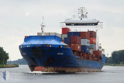
ORION
Container Ship
Current Trip
| Time Travelled | 18 days |
|---|---|
| Remaining Time | 15 h, 54 mins |
| Distance Travelled | 923.89 nm |
| Remaining Distance | 293.29 nm |
| AVG Speed | 10.8 Knots |
| MAX Speed | 15.4 Knots |
| AVG Wind | 10.5 knots |
| MAX Wind | 21.8 knots |
| MIN Temp | 16.6°C / 61.88°F |
| MAX Temp | 24.5°C / 76.1°F |
| Draught | 5.4 m |
| Position Received | 7 m ago |
Current Position
| Longitude | -7.08908° |
|---|---|
| Latitude | 36.16991° |
| Status | Under way using engine |
| Speed | 14.9 Knots |
| Course | 295.2° |
| Area | North Atlantic Ocean |
| Station | T-AIS |
| Position Received | 7 m ago |
Info
Information
The current position of ORION is in North Atlantic Ocean with coordinates 36.16991° / -7.08908° as reported on 2024-06-13 15:56 by AIS to our vessel tracker app. The vessel's current speed is 14.9 Knots and is heading at the port of LISBOA. The estimated time of arrival as calculated by vessel tracking app is 2024-06-14 07:57 LT
The vessel ORION (IMO: 9428217, MMSI: 305484000) is a Container Ship that was built in 2008 ( 16 years old ). It's sailing under the flag of [AG] Antigua Barbuda.
In this page you can find informations about the vessels current position, last detected port calls, and current voyage information. If the vessels is not in coverage by AIS you will find the latest position.
The current position of ORION is detected by our AIS receivers and we are not responsible for the reliability of the data. The last position was recorded while the vessel was in Coverage by the Ais receivers of our vessel tracking app.
The current draught of ORION as reported by AIS is 5.4 meters
Weather
| Temperature | 21°C / 69.8°F |
|---|---|
| Wind Speed | 10 knots |
| Direction | 316° NW |
| Pressure | 1017.9 hPa |
| Humidity | 63.9 % |
| Cloud Coverage | --- |
Featured Company
Last Port Calls
| Port | Arrival | Departure | Time In Port |
|---|---|---|---|
| 2024-05-26 04:56 | 2024-05-26 12:29 | 7 h | |
| 2024-05-22 11:14 | 2024-05-23 04:21 | 17 h | |
| 2024-05-17 12:12 | 2024-05-18 00:26 | 12 h | |
| 2024-05-14 21:30 | 2024-05-16 02:37 | 1 d | |
| 2024-05-06 15:17 | 2024-05-07 18:32 | 1 d | |
| 2024-05-01 13:35 | 2024-05-03 04:58 | 1 d | |
| 2024-04-26 23:13 | 2024-04-27 22:25 | 23 h | |
| 2024-04-20 03:15 | 2024-04-20 20:01 | 16 h | |
| 2024-04-18 14:22 | 2024-04-19 01:22 | 11 h | |
| 2024-04-14 18:08 | 2024-04-15 21:41 | 1 d |
Last Trips
| Origin | Departure | Destination | Arrival | Distance | |
|---|---|---|---|---|---|
| 2024-05-23 05:21 | 2024-05-26 06:56 | 741.19 nm | |||
| 2024-05-18 01:26 | 2024-05-22 12:14 | 577.28 nm | |||
| 2024-05-16 03:37 | 2024-05-17 13:12 | 490.03 nm | |||
| 2024-05-07 20:32 | 2024-05-14 22:30 | 599.94 nm | |||
| 2024-05-03 05:58 | 2024-05-06 17:17 | 594.61 nm | |||
| 2024-04-27 23:25 | 2024-05-01 14:35 | 391.17 nm | |||
| 2024-04-20 22:01 | 2024-04-27 00:13 | 653.46 nm | |||
| 2024-04-19 03:22 | 2024-04-20 05:15 | 6.30 nm | |||
| 2024-04-15 22:41 | 2024-04-18 16:22 | 596.00 nm | |||
| 2024-04-09 08:38 | 2024-04-14 19:08 | 594.04 nm |
Events
| Time | Event | Details | Position / Dest | Info |
|---|---|---|---|---|
| 2024-06-13 15:43 | Change Sea Area | Spanish part of the North Atlantic Ocean Spanish part of the Strait of Gibraltar |
36.14745 / -7.03168
North Atlantic Ocean
PTLIS
|
Speed: 14.9 kn Course: 298.7° |
| 2024-06-13 15:41 | Status Changed | Under way using engine Default |
36.14198 / -7.01939
PTLIS
|
Speed: 15.1 kn Course: 298° |
| 2024-06-13 15:33 | IN Coverage |
36.14745 / -7.03168
North Atlantic Ocean
PTLIS
|
Speed: 14.9 kn Course: 298.7° |
|
| 2024-06-13 11:04 | Status Changed | Default Under way using engine |
35.96555 / -5.63862
PTLIS
|
Speed: 14.7 kn Course: 271° |
| 2024-06-13 11:02 | OUT of Coverage |
35.96552 / -5.63761
Strait of Gibraltar
PTLIS
|
Speed: 14.7 kn Course: 271° |
|
| 2024-06-13 10:41 | ETA Changed | 2024/06/14 08:00 2024/06/14 07:00 |
35.97486 / -5.53530
PTLIS
|
Speed: 14.4 kn Course: 257.9° |
| 2024-06-13 09:55 | Change Sea Area | Spanish part of the Strait of Gibraltar Gibraltarian part of the Strait of Gibraltar |
36.08333 / -5.38716
Strait of Gibraltar
PTLIS
|
Speed: 15 kn Course: 180.6° |
| 2024-06-13 09:38 | Status Changed | Under way using engine At anchor |
36.13940 / -5.37932
PTLIS
|
Speed: 9.2 kn Course: 222.9° |
| 2024-06-13 09:35 | START Moving | 0.58 nm, West of GIBRALTAR |
36.14439 / -5.37401
PTLIS
|
Speed: 3.1 kn Course: 209.7° |
| 2024-06-13 08:31 | ETA Changed | 2024/06/14 07:00 2025/05/31 16:00 |
36.14575 / -5.37347
PTLIS
|
Speed: Course: 511° |