
OSLO TS
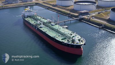
Tanker
Current Trip
| Time Travelled | 18 days |
|---|---|
| Remaining Time | 12 h, 28 mins |
| Distance Travelled | 5435.13 nm |
| Remaining Distance | 461.88 nm |
| AVG Speed | 12.8 Knots |
| MAX Speed | 16.4 Knots |
| AVG Wind | 16 knots |
| MAX Wind | 37.1 knots |
| MIN Temp | 7.2°C / 44.96°F |
| MAX Temp | 27.9°C / 82.22°F |
| Draught | 13.1 m |
| Position Received | 3 h, 21 m ago |
Current Position
| Longitude | 7.47861° |
|---|---|
| Latitude | 54.06409° |
| Status | At anchor |
| Speed | |
| Course | 96° |
| Area | North Sea |
| Station | T-AIS |
| Position Received | 3 h, 21 m ago |
Info
Information
The current position of OSLO TS is in North Sea with coordinates 54.06409° / 7.47861° as reported on 2024-05-28 16:48 by AIS to our vessel tracker app. The vessel's current speed is 0 Knots and is heading at the port of FREDERICIA. The estimated time of arrival as calculated by vessel tracking app is 2024-05-29 08:37 LT
The vessel OSLO TS (IMO: 9737383, MMSI: 248006000) is a Tanker It's sailing under the flag of [MT] Malta.
In this page you can find informations about the vessels current position, last detected port calls, and current voyage information. If the vessels is not in coverage by AIS you will find the latest position.
The current position of OSLO TS is detected by our AIS receivers and we are not responsible for the reliability of the data. The last position was recorded while the vessel was in Coverage by the Ais receivers of our vessel tracking app.
The current draught of OSLO TS as reported by AIS is 13.1 meters
Weather
| Temperature | 14.6°C / 58.28°F |
|---|---|
| Wind Speed | 10 knots |
| Direction | 142° SE |
| Pressure | 1013 hPa |
| Humidity | 79.2 % |
| Cloud Coverage | 100 % |
Featured Company
Last Port Calls
| Port | Arrival | Departure | Time In Port |
|---|---|---|---|
| 2024-05-08 14:05 | 2024-05-10 13:42 | 1 d | |
| 2024-05-02 18:56 | 2024-05-06 12:34 | 3 d | |
| 2024-04-02 09:31 | 2024-04-03 19:23 | 1 d | |
| 2024-03-27 20:23 | 2024-03-29 02:01 | 1 d | |
| 2024-03-22 08:54 | 2024-03-23 18:20 | 1 d | |
| 2024-03-16 11:03 | 2024-03-17 16:28 | 1 d | |
| 2024-03-05 08:14 | 2024-03-08 19:24 | 3 d | |
| 2024-03-01 21:45 |
Last Trips
| Origin | Departure | Destination | Arrival | Distance | |
|---|---|---|---|---|---|
| 2024-05-06 07:34 | 2024-05-08 09:05 | 533.25 nm | |||
| 2024-04-03 22:23 | 2024-05-02 13:56 | 6032.77 nm | |||
| 2024-03-29 03:01 | 2024-04-02 12:31 | 1258.38 nm | |||
| 2024-03-23 19:20 | 2024-03-27 21:23 | 815.04 nm | |||
| 2024-03-17 18:28 | 2024-03-22 09:54 | 1287.93 nm | |||
| 2024-03-08 20:24 | 2024-03-16 13:03 | 1139.81 nm | |||
| 2024-03-01 22:45 | 2024-03-05 09:14 | 445.84 nm |
Events
| Time | Event | Details | Position / Dest | Info |
|---|---|---|---|---|
| 2024-05-28 16:54 | Status Changed | Default At anchor |
54.06405 / 7.47856
USHOU>DKFRC
|
Speed: Course: 96° |
| 2024-05-28 16:48 | Status Changed | At anchor Default |
54.06409 / 7.47861
USHOU>DKFRC
|
Speed: Course: 101° |
| 2024-05-28 16:48 | IN Coverage |
54.06409 / 7.47861
North Sea
|
Speed: Course: 6.3° |
|
| 2024-05-28 16:48 | OUT of Coverage |
54.06409 / 7.47861
North Sea
|
Speed: Course: 6.3° |
|
| 2024-05-28 02:47 | Status Changed | Default At anchor |
54.06313 / 7.48581
USHOU>DKFRC
|
Speed: 0.2 kn Course: 288° |
| 2024-05-28 02:42 | Status Changed | At anchor Default |
54.06316 / 7.48597
USHOU>DKFRC
|
Speed: Course: 289° |
| 2024-05-28 02:42 | OUT of Coverage |
54.06316 / 7.48597
North Sea
USHOU>DKFRC
|
Speed: 0.2 kn Course: 17.3° |
|
| 2024-05-28 02:17 | STOP Moving | 15.94 nm, South West of HELGOLAND |
54.06313 / 7.48592
USHOU>DKFRC
|
Speed: 0.1 kn Course: 296° |
| 2024-05-28 02:02 | Status Changed | Default Under way using engine |
54.06449 / 7.48324
USHOU>DKFRC
|
Speed: 2.7 kn Course: 226° |
| 2024-05-28 01:56 | Status Changed | Under way using engine Default |
54.06741 / 7.48486
USHOU>DKFRC
|
Speed: 4.3 kn Course: 199° |