
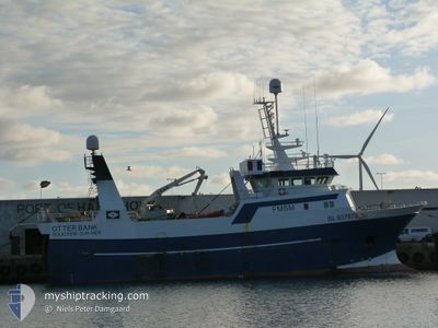
OTTER BANK F/V
Trawler
Current Trip
HANSTHOLM
| Time Travelled | 7 days |
|---|---|
| Remaining Time | --- |
| Distance Travelled | 621.30 nm |
| Remaining Distance | --- |
| AVG Speed | 11.5 Knots |
| MAX Speed | 13.3 Knots |
| AVG Wind | 10.4 knots |
| MAX Wind | 15 knots |
| MIN Temp | 10.5°C / 50.9°F |
| MAX Temp | 14.2°C / 57.56°F |
| Draught | 7 m |
| Position Received | 4 h, 55 m ago |
Current Position
| Longitude | 3.16718° |
|---|---|
| Latitude | 60.54698° |
| Status | Under way using engine |
| Speed | 3.7 Knots |
| Course | 13° |
| Area | North Sea |
| Station | T-AIS |
| Position Received | 4 h, 55 m ago |
Info
Information
The current position of OTTER BANK F/V is in North Sea with coordinates 60.54698° / 3.16718° as reported on 2024-06-02 11:48 by AIS to our vessel tracker app. The vessel's current speed is 3.7 Knots
The vessel OTTER BANK F/V (IMO: 9219721, MMSI: 228425700) is a Trawler that was built in 2000 ( 24 years old ). It's sailing under the flag of [FR] France.
In this page you can find informations about the vessels current position, last detected port calls, and current voyage information. If the vessels is not in coverage by AIS you will find the latest position.
The current position of OTTER BANK F/V is detected by our AIS receivers and we are not responsible for the reliability of the data. The last position was recorded while the vessel was in Coverage by the Ais receivers of our vessel tracking app.
The current draught of OTTER BANK F/V as reported by AIS is 7 meters
Weather
| Temperature | 12.2°C / 53.96°F |
|---|---|
| Wind Speed | 10 knots |
| Direction | 274° W |
| Pressure | 1020.4 hPa |
| Humidity | 79.2 % |
| Cloud Coverage | 54 % |
Featured Company
Most Visited Ports (Last year)
| Port | Arrivals | |
|---|---|---|
| 20 |
Events
| Time | Event | Details | Position / Dest | Info |
|---|---|---|---|---|
| 2024-06-02 11:48 | OUT of Coverage |
60.54698 / 3.16718
North Sea
|
Speed: 3.7 kn Course: 12.8° |
|
| 2024-06-02 11:48 | IN Coverage |
60.54698 / 3.16718
North Sea
|
Speed: 3.7 kn Course: 12.8° |
|
| 2024-06-01 08:24 | OUT of Coverage |
60.54326 / 3.11614
North Sea
|
Speed: 3.5 kn Course: 348.7° |
|
| 2024-06-01 08:24 | IN Coverage |
60.54326 / 3.11614
North Sea
|
Speed: 3.5 kn Course: 348.7° |
|
| 2024-05-31 00:08 | OUT of Coverage |
60.59474 / 2.53119
North Sea
|
Speed: 10.6 kn Course: 103.4° |
|
| 2024-05-30 23:06 | Detected in Sea | Norwegian part of the North Sea |
60.62685 / 2.15563
North Sea
|
Speed: 10.7 kn Course: 99.8° |
| 2024-05-30 23:06 | IN Coverage |
60.62685 / 2.15563
North Sea
|
Speed: 10.7 kn Course: 99.8° |
|
| 2024-05-29 22:53 | OUT of Coverage |
60.73246 / -2.74017
North Atlantic Ocean
|
Speed: 4 kn Course: 221.4° |
|
| 2024-05-29 20:22 | Detected in Sea | United Kingdom part of the North Atlantic Ocean |
60.96836 / -2.05487
North Atlantic Ocean
|
Speed: 10.9 kn Course: 216° |
| 2024-05-29 20:22 | IN Coverage |
60.96836 / -2.05487
North Atlantic Ocean
|
Speed: 10.9 kn Course: 216° |