
OTTOMAN COURTESY
Tanker
Current Trip
| Time Travelled | 5 days |
|---|---|
| Remaining Time | 1 day |
| Distance Travelled | 1682.62 nm |
| Remaining Distance | 361.21 nm |
| AVG Speed | 12.2 Knots |
| MAX Speed | 15.9 Knots |
| AVG Wind | 13.1 knots |
| MAX Wind | 22.1 knots |
| MIN Temp | 11.4°C / 52.52°F |
| MAX Temp | 18°C / 64.4°F |
| Draught | 9.3 m |
| Position Received | 3 d ago |
Current Position
| Longitude | -5.29380° |
|---|---|
| Latitude | 49.07796° |
| Status | Under way using engine |
| Speed | 10 Knots |
| Course | 238.8° |
| Area | Celtic Sea |
| Station | T-AIS |
| Position Received | 3 d ago |
Info
Information
The current position of OTTOMAN COURTESY is in Celtic Sea with coordinates 49.07796° / -5.29380° as reported on 2024-05-15 06:47 by AIS to our vessel tracker app. The vessel's current speed is 10 Knots and is heading at the port of TENERIFE. The estimated time of arrival as calculated by vessel tracking app is 2024-05-20 02:13 LT
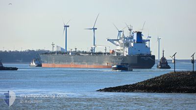
The vessel OTTOMAN COURTESY (IMO: 9788708, MMSI: 271044691) is a Tanker It's sailing under the flag of [TR] Turkey.
In this page you can find informations about the vessels current position, last detected port calls, and current voyage information. If the vessels is not in coverage by AIS you will find the latest position.
The current position of OTTOMAN COURTESY is detected by our AIS receivers and we are not responsible for the reliability of the data. The last position was recorded while the vessel was in Coverage by the Ais receivers of our vessel tracking app.
The current draught of OTTOMAN COURTESY as reported by AIS is 9.3 meters
Weather
| Temperature | 17.9°C / 64.22°F |
|---|---|
| Wind Speed | 11 knots |
| Direction | 8° N |
| Pressure | 1018.6 hPa |
| Humidity | 70 % |
| Cloud Coverage | 100 % |
Featured Company
Last Port Calls
| Port | Arrival | Departure | Time In Port |
|---|---|---|---|
| 2024-05-11 13:30 | 2024-05-13 03:52 | 1 d |
Most Visited Ports (Last year)
| Port | Arrivals | |
|---|---|---|
| 7 | ||
| 2 | ||
| 1 | ||
| 1 | ||
| 1 | ||
| 1 |
Last Trips
| Origin | Departure | Destination | Arrival | Distance |
|---|
Events
| Time | Event | Details | Position / Dest | Info |
|---|---|---|---|---|
| 2024-05-15 06:51 | Status Changed | Default Under way using engine |
49.07246 / -5.30819
DEWVN>ESSCT
|
Speed: 10 kn Course: 238.8° |
| 2024-05-15 06:47 | OUT of Coverage |
49.07796 / -5.29380
Celtic Sea
DEWVN>ESSCT
|
Speed: 10 kn Course: 238.8° |
|
| 2024-05-15 06:47 | Status Changed | Under way using engine Default |
49.07845 / -5.29260
DEWVN>ESSCT
|
Speed: 10.3 kn Course: 237° |
| 2024-05-15 06:44 | Status Changed | Default Under way using engine |
49.08340 / -5.28139
DEWVN>ESSCT
|
Speed: 10.2 kn Course: 237.1° |
| 2024-05-15 06:15 | Status Changed | Under way using engine Default |
49.12698 / -5.17539
DEWVN>ESSCT
|
Speed: 10.3 kn Course: 238° |
| 2024-05-15 05:48 | Status Changed | Default Under way using engine |
49.16794 / -5.06939
DEWVN>ESSCT
|
Speed: 10.2 kn Course: 239.6° |
| 2024-05-15 05:40 | Detected in Sea | French part of the Celtic Sea |
49.17966 / -5.03957
Celtic Sea
DEWVN>ESSCT
|
Speed: 10.6 kn Course: 238.8° |
| 2024-05-15 05:19 | Status Changed | Under way using engine Default |
49.21225 / -4.95775
DEWVN>ESSCT
|
Speed: 10.4 kn Course: 242° |
| 2024-05-15 05:09 | Status Changed | Default Under way using engine |
49.22700 / -4.91970
DEWVN>ESSCT
|
Speed: 10.9 kn Course: 241.5° |
| 2024-05-15 05:08 | Status Changed | Under way using engine Default |
49.22793 / -4.91701
DEWVN>ESSCT
|
Speed: 10.3 kn Course: 238° |