
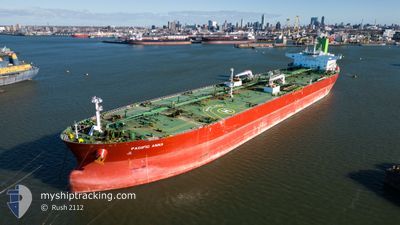
PACIFIC ANNA
Tanker
Current Trip
CAPE FOR ORDER
| Time Travelled | 23 days |
|---|---|
| Remaining Time | --- |
| Distance Travelled | 6207.50 nm |
| Remaining Distance | --- |
| AVG Speed | 11.1 Knots |
| MAX Speed | 15 Knots |
| AVG Wind | 13.1 knots |
| MAX Wind | 36 knots |
| MIN Temp | 16°C / 60.8°F |
| MAX Temp | 33.8°C / 92.84°F |
| Draught | 13.9 m |
| Position Received | 2 d ago |
Current Position
| Longitude | 17.84290° |
|---|---|
| Latitude | -34.51373° |
| Status | Under way using engine |
| Speed | 12.6 Knots |
| Course | 305.3° |
| Area | South Atlantic Ocean |
| Station | T-AIS |
| Position Received | 2 d ago |
Info
Information
The current position of PACIFIC ANNA is in South Atlantic Ocean with coordinates -34.51373° / 17.84290° as reported on 2024-06-13 17:32 by AIS to our vessel tracker app. The vessel's current speed is 12.6 Knots
The vessel PACIFIC ANNA (IMO: 9772010, MMSI: 538006923) is a Tanker It's sailing under the flag of [MH] Marshall Is.
In this page you can find informations about the vessels current position, last detected port calls, and current voyage information. If the vessels is not in coverage by AIS you will find the latest position.
The current position of PACIFIC ANNA is detected by our AIS receivers and we are not responsible for the reliability of the data. The last position was recorded while the vessel was in Coverage by the Ais receivers of our vessel tracking app.
The current draught of PACIFIC ANNA as reported by AIS is 13.9 meters
Weather
| Temperature | 17°C / 62.6°F |
|---|---|
| Wind Speed | 7 knots |
| Direction | 228° SW |
| Pressure | 1012.9 hPa |
| Humidity | 89.8 % |
| Cloud Coverage | 4 % |
Featured Company
Last Port Calls
| Port | Arrival | Departure | Time In Port |
|---|---|---|---|
| 2024-05-22 01:20 | 2024-05-23 06:43 | 1 d | |
| 2024-05-19 20:07 | 2024-05-20 19:45 | 23 h | |
| 2024-04-15 03:54 | 2024-04-17 05:55 | 2 d |
Most Visited Ports (Last year)
| Port | Arrivals | |
|---|---|---|
| 5 | ||
| 2 | ||
| 2 | ||
| 1 | ||
| 1 | ||
| 1 |
Last Trips
| Origin | Departure | Destination | Arrival | Distance | |
|---|---|---|---|---|---|
| 2024-05-20 22:45 | 2024-05-22 05:20 | 265.88 nm | |||
| 2024-04-17 09:55 | 2024-05-19 23:07 | 7078.39 nm | |||
| 2024-03-15 10:00 | 2024-04-15 07:54 | 6102.85 nm |
Events
| Time | Event | Details | Position / Dest | Info |
|---|---|---|---|---|
| 2024-06-13 17:38 | Status Changed | Default Under way using engine |
-34.50005 / 17.82189
CAPE FOR ORDER
|
Speed: 12.6 kn Course: 305.3° |
| 2024-06-13 17:32 | Status Changed | Under way using engine Default |
-34.51373 / 17.84290
CAPE FOR ORDER
|
Speed: 12.6 kn Course: 306° |
| 2024-06-13 17:32 | OUT of Coverage |
-34.51373 / 17.84290
South Atlantic Ocean
CAPE FOR ORDER
|
Speed: 12.6 kn Course: 305.3° |
|
| 2024-06-13 17:10 | Status Changed | Default Under way using engine |
-34.55702 / 17.91717
CAPE FOR ORDER
|
Speed: 12.2 kn Course: 307.4° |
| 2024-06-13 15:26 | Destination Changed | CAPE FOR ORDER ROTTERDAM |
-34.80986 / 18.22294
CAPE FOR ORDER
|
Speed: 13.1 kn Course: 320.3° |
| 2024-06-13 15:26 | ETA Changed | 2024/06/13 18:00 2024/06/19 12:00 |
-34.80986 / 18.22294
CAPE FOR ORDER
|
Speed: 13.1 kn Course: 320.3° |
| 2024-06-13 14:38 | Status Changed | Under way using engine Default |
-34.92829 / 18.37351
ROTTERDAM
|
Speed: 13.2 kn Course: 306° |
| 2024-06-13 14:31 | IN Coverage |
-34.92356 / 18.36653
South Atlantic Ocean
ROTTERDAM
|
Speed: 13.2 kn Course: 310.6° |
|
| 2024-06-13 13:03 | Status Changed | Default Under way using engine |
-35.16699 / 18.66950
ROTTERDAM
|
Speed: 12.9 kn Course: 315° |
| 2024-06-13 12:58 | OUT of Coverage |
-35.17993 / 18.68557
South Atlantic Ocean
ROTTERDAM
|
Speed: 12.9 kn Course: 315° |