
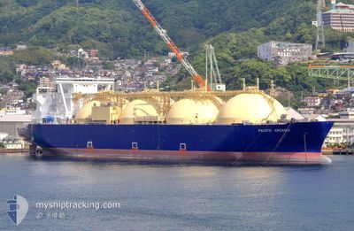
PACIFIC ARCADIA
Tanker
Current Trip
| Time Travelled | 17 days |
|---|---|
| Remaining Time | --- |
| Distance Travelled | 2508.54 nm |
| Remaining Distance | --- |
| AVG Speed | 10.6 Knots |
| MAX Speed | 15.7 Knots |
| AVG Wind | 11.4 knots |
| MAX Wind | 33.1 knots |
| MIN Temp | 5.4°C / 41.72°F |
| MAX Temp | 23.9°C / 75.02°F |
| Draught | 9.4 m |
| Position Received | 1 d ago |
Current Position
| Longitude | 136.17167° |
|---|---|
| Latitude | 32.48373° |
| Status | Under way using engine |
| Speed | 9 Knots |
| Course | 29.8° |
| Area | Philippine Sea |
| Station | T-AIS |
| Position Received | 1 d ago |
Info
Information
The current position of PACIFIC ARCADIA is in Philippine Sea with coordinates 32.48373° / 136.17167° as reported on 2024-06-14 06:41 by AIS to our vessel tracker app. The vessel's current speed is 9 Knots and is heading at the port of YURA. The estimated time of arrival as calculated by vessel tracking app is 2024-06-29 00:00 LT
The vessel PACIFIC ARCADIA (IMO: 9621077, MMSI: 311072200) is a Tanker It's sailing under the flag of [BS] Bahamas.
In this page you can find informations about the vessels current position, last detected port calls, and current voyage information. If the vessels is not in coverage by AIS you will find the latest position.
The current position of PACIFIC ARCADIA is detected by our AIS receivers and we are not responsible for the reliability of the data. The last position was recorded while the vessel was in Coverage by the Ais receivers of our vessel tracking app.
The current draught of PACIFIC ARCADIA as reported by AIS is 9.4 meters
Weather
| Temperature | 23.3°C / 73.94°F |
|---|---|
| Wind Speed | 3 knots |
| Direction | 96° E |
| Pressure | 1005 hPa |
| Humidity | 92.8 % |
| Cloud Coverage | 100 % |
Featured Company
Last Port Calls
| Port | Arrival | Departure | Time In Port |
|---|---|---|---|
| 2024-05-28 00:40 | 2024-05-29 01:58 | 1 d | |
| 2024-05-22 02:23 | 2024-05-23 02:37 | 1 d | |
| 2024-05-03 07:57 | 2024-05-04 09:25 | 1 d | |
| 2024-04-22 08:09 | 2024-04-23 09:00 | 1 d | |
| 2024-04-04 22:00 | 2024-04-06 07:24 | 1 d |
Last Trips
| Origin | Departure | Destination | Arrival | Distance | |
|---|---|---|---|---|---|
| 2024-05-23 11:37 | 2024-05-28 11:40 | 1346.59 nm | |||
| 2024-05-04 20:25 | 2024-05-22 11:23 | 3691.81 nm | |||
| 2024-04-23 20:00 | 2024-05-03 18:57 | 2335.68 nm | |||
| 2024-04-06 16:54 | 2024-04-22 19:09 | 4390.03 nm | |||
| 2024-03-13 12:18 | 2024-04-05 07:30 | 6098.91 nm |
Events
| Time | Event | Details | Position / Dest | Info |
|---|---|---|---|---|
| 2024-06-14 13:49 | STOP Moving |
33.27678 / 136.68741
JP YUR
|
Speed: 0.3 kn Course: 151° |
|
| 2024-06-14 06:43 | Status Changed | Default Under way using engine |
32.48964 / 136.17551
JP YUR
|
Speed: 9 kn Course: 29.8° |
| 2024-06-14 06:41 | Status Changed | Under way using engine Default |
32.48373 / 136.17167
JP YUR
|
Speed: 9 kn Course: 30° |
| 2024-06-14 06:41 | OUT of Coverage |
32.48373 / 136.17167
Philippine Sea
JP YUR
|
Speed: 9 kn Course: 29.8° |
|
| 2024-06-14 06:21 | IN Coverage |
32.48373 / 136.17167
Philippine Sea
JP YUR
|
Speed: 9 kn Course: 29.8° |
|
| 2024-06-13 12:16 | START Moving |
32.19558 / 135.25934
JP YUR
|
Speed: 3.1 kn Course: 165° |
|
| 2024-06-12 14:09 | STOP Moving |
32.68667 / 135.62500
JP YUR
|
Speed: Course: -1° |
|
| 2024-06-12 04:41 | START Moving |
32.43040 / 135.49109
JP YUR
|
Speed: 4.9 kn Course: 98° |
|
| 2024-06-10 05:35 | STOP Moving |
32.75167 / 136.28667
JP YUR
|
Speed: Course: -1° |
|
| 2024-06-09 20:12 | START Moving |
32.09610 / 135.90663
JP YUR
|
Speed: 3.5 kn Course: 249° |