
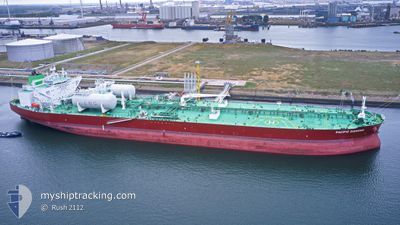
PACIFIC DIAMOND
Tanker
Current Trip
| Time Travelled | 4 days |
|---|---|
| Remaining Time | 2 days |
| Distance Travelled | 1095.33 nm |
| Remaining Distance | 779.41 nm |
| AVG Speed | 12.7 Knots |
| MAX Speed | 14.4 Knots |
| AVG Wind | 7.9 knots |
| MAX Wind | 24 knots |
| MIN Temp | 18.5°C / 65.3°F |
| MAX Temp | 24.8°C / 76.64°F |
| Draught | 12.8 m |
| Position Received | Now |
Current Position
| Longitude | 10.53177° |
|---|---|
| Latitude | 37.66936° |
| Status | Under way using engine |
| Speed | 12.9 Knots |
| Course | 291.9° |
| Area | Mediterranean Sea - Western Basin |
| Station | T-AIS |
| Position Received | Now |
Info
Information
The current position of PACIFIC DIAMOND is in Mediterranean Sea - Western Basin with coordinates 37.66936° / 10.53177° as reported on 2024-06-17 11:56 by AIS to our vessel tracker app. The vessel's current speed is 12.9 Knots and is heading at the port of GIBRALTAR. The estimated time of arrival as calculated by vessel tracking app is 2024-06-19 20:51 LT
The vessel PACIFIC DIAMOND (IMO: 9893046, MMSI: 538009199) is a Tanker It's sailing under the flag of [MH] Marshall Is.
In this page you can find informations about the vessels current position, last detected port calls, and current voyage information. If the vessels is not in coverage by AIS you will find the latest position.
The current position of PACIFIC DIAMOND is detected by our AIS receivers and we are not responsible for the reliability of the data. The last position was recorded while the vessel was in Coverage by the Ais receivers of our vessel tracking app.
The current draught of PACIFIC DIAMOND as reported by AIS is 12.8 meters
Weather
| Temperature | 23.2°C / 73.76°F |
|---|---|
| Wind Speed | 11 knots |
| Direction | 107° ESE |
| Pressure | 1015.9 hPa |
| Humidity | 75.9 % |
| Cloud Coverage | --- |
Featured Company
Most Visited Ports (Last year)
| Port | Arrivals | |
|---|---|---|
| 2 | ||
| 2 | ||
| 2 | ||
| 2 | ||
| 1 | ||
| 1 |
Events
| Time | Event | Details | Position / Dest | Info |
|---|---|---|---|---|
| 2024-06-17 09:23 | Status Changed | Under way using engine Default |
37.43459 / 11.19891
GIGIB
|
Speed: 13.8 kn Course: 298° |
| 2024-06-17 08:49 | Status Changed | Default Under way using engine |
37.37322 / 11.34199
GIGIB
|
Speed: 13.5 kn Course: 298.8° |
| 2024-06-17 08:19 | Change Sea Area | Tunisian part of the Mediterranean Sea - Western Basin Tunisian part of the Mediterranean Sea - Eastern Basin |
37.31469 / 11.46202
Mediterranean Sea - Western Basin
GIGIB
|
Speed: 13.3 kn Course: 303.8° |
| 2024-06-17 06:04 | Change Sea Area | Tunisian part of the Mediterranean Sea - Eastern Basin Italian part of the Mediterranean Sea - Eastern Basin |
36.87996 / 11.67708
Mediterranean Sea - Eastern Basin
GIGIB
|
Speed: 12.4 kn Course: 349.8° |
| 2024-06-17 05:22 | Draught Changed | 12.8 8.5 |
36.73699 / 11.71966
GIGIB
|
Speed: 12.5 kn Course: 343.1° |
| 2024-06-17 05:22 | Destination Changed | GIGIB LYMTH |
36.73699 / 11.71966
GIGIB
|
Speed: 12.5 kn Course: 343.1° |
| 2024-06-17 05:22 | ETA Changed | 2024/06/20 05:00 2024/06/15 04:00 |
36.73699 / 11.71966
GIGIB
|
Speed: 12.5 kn Course: 343.1° |
| 2024-06-17 05:13 | Change Sea Area | Italian part of the Mediterranean Sea - Eastern Basin Tunisian part of the Mediterranean Sea - Eastern Basin |
36.70775 / 11.73040
Mediterranean Sea - Eastern Basin
|
Speed: 12.2 kn Course: 348.3° |
| 2024-06-17 05:11 | Status Changed | Under way using engine Default |
36.70056 / 11.73198
LYMTH
|
Speed: 11.5 kn Course: 18° |
| 2024-06-17 05:01 | Status Changed | Default Under way using engine |
36.66765 / 11.72683
LYMTH
|
Speed: 11.3 kn Course: 14.3° |