
PACIFIC DISPATCH
Anchor Handling Vessel
Current Trip
| Trip Time | 2 days |
|---|---|
| Trip Distance | 59.91 nm |
| AVG Speed | 9.8 Knots |
| MAX Speed | 9.8 Knots |
| Draught | 6.5 m |
| AVG Wind | 9 knots |
| MAX Wind | 13 knots |
| MIN Temp | 12.3°C / 54.14°F |
| MAX Temp | 18.8°C / 65.84°F |
| Position Received | 1 m ago |
Current Position
| Longitude | 10.53577° |
|---|---|
| Latitude | 55.47050° |
| Status | Moored |
| Speed | |
| Course | 128° |
| Area | Kattegat |
| Station | T-AIS |
| Position Received | 1 m ago |
Info
Information
The current position of PACIFIC DISPATCH is in Kattegat with coordinates 55.47050° / 10.53577° as reported on 2024-06-26 00:39 by AIS to our vessel tracker app. The vessel's current speed is 0 Knots and is currently inside the port of LINDOE.
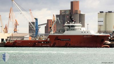
The vessel PACIFIC DISPATCH (IMO: 9456214, MMSI: 564652000) is a Anchor Handling Vessel that was built in 2014 ( 10 years old ). It's sailing under the flag of [SG] Singapore.
In this page you can find informations about the vessels current position, last detected port calls, and current voyage information. If the vessels is not in coverage by AIS you will find the latest position.
The current position of PACIFIC DISPATCH is detected by our AIS receivers and we are not responsible for the reliability of the data. The last position was recorded while the vessel was in Coverage by the Ais receivers of our vessel tracking app.
The current draught of PACIFIC DISPATCH as reported by AIS is 6.5 meters
Weather
| Temperature | 15.3°C / 59.54°F |
|---|---|
| Wind Speed | 6 knots |
| Direction | 133° SE |
| Pressure | 1017.8 hPa |
| Humidity | 86.5 % |
| Cloud Coverage | --- |
Featured Company
Last Trips
| Origin | Departure | Destination | Arrival | Distance | |
|---|---|---|---|---|---|
| 2024-06-23 11:18 | 2024-06-25 15:05 | 59.91 nm | |||
| 2024-05-31 08:23 | 2024-06-03 15:58 | 607.17 nm | |||
| 2024-05-03 10:19 | 2024-05-22 15:21 | 819.52 nm | |||
| 2024-04-07 10:40 | 2024-04-27 13:30 | 577.77 nm | |||
| 2024-03-26 20:30 | 2024-04-06 09:40 | 2088.02 nm |
Events
| Time | Event | Details | Position / Dest | Info |
|---|---|---|---|---|
| 2024-06-25 13:36 | Status Changed | Moored Under way using engine |
55.47052 / 10.53584
[DK] LINDOE
|
Speed: Course: 127° |
| 2024-06-25 13:12 | STOP Moving |
55.47066 / 10.53555
[DK] LINDOE
|
Speed: 0.3 kn Course: 129° |
|
| 2024-06-25 13:05 | PORT ARRIVAL |
|
55.47199 / 10.53449
[DK] LINDOE
|
Speed: 0.7 kn Course: 181° |
| 2024-06-25 12:38 | Draught Changed | 6.5 6.4 |
55.50412 / 10.54701
ODENSE
|
Speed: 8.3 kn Course: 229° |
| 2024-06-25 12:38 | ETA Changed | 2024/06/25 12:00 2024/06/25 14:00 |
55.50412 / 10.54701
ODENSE
|
Speed: 8.3 kn Course: 229° |
| 2024-06-25 12:32 | ETA Changed | 2024/06/25 14:00 2024/06/23 14:00 |
55.51506 / 10.56338
ODENSE
|
Speed: 8.3 kn Course: 187.2° |
| 2024-06-25 12:10 | START Moving | 5.47 nm, North of LINDOE |
55.56209 / 10.56309
ODENSE
|
Speed: 4 kn Course: 188° |
| 2024-06-25 04:55 | Status Changed | Under way using engine At anchor |
55.57737 / 10.56907
ODENSE
|
Speed: 0.7 kn Course: 110° |
| 2024-06-24 17:14 | Status Changed | At anchor Under way using engine |
55.57738 / 10.56904
ODENSE
|
Speed: 0.5 kn Course: 56° |
| 2024-06-24 05:02 | STOP Moving | 6.73 nm, North of LINDOE |
55.58287 / 10.56788
ODENSE
|
Speed: 0.3 kn Course: 42° |