
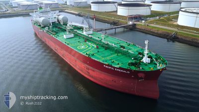
PACIFIC EMERALD
Tanker
Current Trip
| Time Travelled | 5 days |
|---|---|
| Remaining Time | --- |
| Distance Travelled | 1529.33 nm |
| Remaining Distance | --- |
| AVG Speed | 11.7 Knots |
| MAX Speed | 14.9 Knots |
| AVG Wind | 14.3 knots |
| MAX Wind | 26.9 knots |
| MIN Temp | 9.9°C / 49.82°F |
| MAX Temp | 14.5°C / 58.1°F |
| Draught | 8.2 m |
| Position Received | 4 d ago |
Current Position
| Longitude | -7.20791° |
|---|---|
| Latitude | 55.71515° |
| Status | Under way using engine |
| Speed | 12 Knots |
| Course | 268.6° |
| Area | Inner Seas off the West Coast of Scotland |
| Station | T-AIS |
| Position Received | 4 d ago |
Info
Information
The current position of PACIFIC EMERALD is in Inner Seas off the West Coast of Scotland with coordinates 55.71515° / -7.20791° as reported on 2024-05-29 16:43 by AIS to our vessel tracker app. The vessel's current speed is 12 Knots and is heading at the port of STURE. The estimated time of arrival as calculated by vessel tracking app is 2024-05-31 12:00 LT
The vessel PACIFIC EMERALD (IMO: 9893022, MMSI: 538009197) is a Tanker It's sailing under the flag of [MH] Marshall Is.
In this page you can find informations about the vessels current position, last detected port calls, and current voyage information. If the vessels is not in coverage by AIS you will find the latest position.
The current position of PACIFIC EMERALD is detected by our AIS receivers and we are not responsible for the reliability of the data. The last position was recorded while the vessel was in Coverage by the Ais receivers of our vessel tracking app.
The current draught of PACIFIC EMERALD as reported by AIS is 8.2 meters
Weather
| Temperature | 14.2°C / 57.56°F |
|---|---|
| Wind Speed | 13 knots |
| Direction | 94° E |
| Pressure | 1026.3 hPa |
| Humidity | 88.9 % |
| Cloud Coverage | 78 % |
Featured Company
Most Visited Ports (Last year)
| Port | Arrivals | |
|---|---|---|
| 4 | ||
| 3 | ||
| 3 | ||
| 2 | ||
| 1 | ||
| 1 |
Last Trips
Events
| Time | Event | Details | Position / Dest | Info |
|---|---|---|---|---|
| 2024-05-29 16:48 | Status Changed | Default Under way using engine |
55.71484 / -7.23820
NO STU
|
Speed: 12 kn Course: 268.6° |
| 2024-05-29 16:43 | OUT of Coverage |
55.71515 / -7.20791
Inner Seas off the West Coast of Scotland
NO STU
|
Speed: 12 kn Course: 268.6° |
|
| 2024-05-29 16:41 | Status Changed | Under way using engine Default |
55.71521 / -7.19904
NO STU
|
Speed: 11.7 kn Course: 273° |
| 2024-05-29 16:40 | Status Changed | Default Under way using engine |
55.71515 / -7.19116
NO STU
|
Speed: 12.2 kn Course: 300.7° |
| 2024-05-29 16:32 | Status Changed | Under way using engine Default |
55.70450 / -7.14830
NO STU
|
Speed: 12.2 kn Course: 301° |
| 2024-05-29 16:24 | Status Changed | Default Under way using engine |
55.69047 / -7.10726
NO STU
|
Speed: 12.3 kn Course: 300.3° |
| 2024-05-29 15:58 | Change Sea Area | Irish part of the Inner Seas off the West Coast of Scotland United Kingdom part of the Inner Seas off the West Coast of Scotland |
55.64472 / -6.97020
Inner Seas off the West Coast of Scotland
NO STU
|
Speed: 12.7 kn Course: 300.3° |
| 2024-05-29 10:59 | Status Changed | Under way using engine Default |
55.00764 / -5.59819
NO STU
|
Speed: 12.7 kn Course: 328° |
| 2024-05-29 10:52 | Status Changed | Default Under way using engine |
54.98465 / -5.57317
NO STU
|
Speed: 12.6 kn Course: 327.1° |
| 2024-05-29 10:44 | Status Changed | Under way using engine Default |
54.96002 / -5.54600
NO STU
|
Speed: 12.7 kn Course: 327° |