
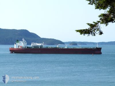
PACIFIC OPAL
Tanker
Aktuelle Reise
CAVAN
| Bisherige Reisezeit | 3 h, 23 Minuten |
|---|---|
| Verbleibende Reisezeit | --- |
| Zurückgelegte Distanz | 3.36 nm |
| Verbleibende Distanz | --- |
| Durchschnittliche Geschwindigkeit | 4.5 Knoten |
| Maximale Geschwindigkeit | 6.2 Knoten |
| Durchschnittliche Windgeschwindigkeit | 6.5 Knoten |
| Maximale Windgeschwindigkeit | 7.9 Knoten |
| Minimale Temperatur | 4.2°C / 39.56°F |
| Maximale Temperatur | 6.4°C / 43.52°F |
| Tiefgang | 8.6 m |
| Position erhalten | 1 m alt |
Aktuelle Position
| Länge | --- |
|---|---|
| Breite | --- |
| Zustand | At anchor |
| Geschwindigkeit | 0.2 Knoten |
| Kurs | 242° |
| Gebiet | The Coastal Waters of Southeast Alaska and British Columbia |
| Station | T-AIS |
| Position erhalten | 1 m alt |
Schiffsdetails
Information
Die PACIFIC OPAL befindet sich derzeit in The Coastal Waters of Southeast Alaska and British Columbia mit den Koordinaten 49.30824° / -122.93542°, Diese Position wurde am 2024-11-04 19:48 von unserer Schiffsverfolgungs-App über AIS erfasst. Das Schiff fährt momentan mit einer Geschwindigkeit von 0.2 Knoten
Das Schiff PACIFIC OPAL (IMO: 9893096, MMSI: 538009204) ist Tanker und fährt unter der Flagge von [MH] Marshall Is.
Auf dieser Seite erhalten Sie Informationen zur aktuellen Position des Schiffes, zu den letzten bekannten Hafenanläufen und zu den aktuellen Reiseinformationen. Sollte das Schiff nicht durch AIS abgedeckt sein, wird die zuletzt erfasste Position angezeigt.
Die PACIFIC OPAL wird durch unsere AIS-Empfänger ermittelt. Wir übernehmen keine Gewähr für die Richtigkeit der Daten. Die letzte Position wurde von unseren AIS-Empfängern aufgezeichnet, während das Schiff in Reichweite war.
Der aktuelle Entwurf von PACIFIC OPAL, wie von AIS gemeldet, betragt 8.6 meter
Wetter
| Temperatur | 6.4°C / 43.52°F |
|---|---|
| Windgeschwindigkeit | 8 Knoten |
| Windrichtung | 87° E |
| Luftdruck | 1006.3 hPa |
| Luftfeuchtigkeit | 94.6 % |
| Wolken | 100 % |
Featured Company
Meistbesuchte Häfen (Letztes Jahr)
| Hafen | Ankünfte | |
|---|---|---|
| 2 | ||
| 2 | ||
| 2 | ||
| 2 | ||
| 1 | ||
| 1 |
Events
| Zeit | Ereignis | Details | Position / Ziel | Information |
|---|---|---|---|---|
| 2024-11-04 18:27 | geänderter Status | At anchor Under way using engine |
49.30365 / -122.93860
CAVAN
|
Geschwindigkeit: 0.2 kn Kurs: 18° |
| 2024-11-04 18:27 | geänderter Tiefgang | 8.6 8.5 |
49.30365 / -122.93861
CAVAN
|
Geschwindigkeit: 0.2 kn Kurs: 18° |
| 2024-11-04 16:58 | STOP Bewegung | 6.14 nm, East of VANCOUVER |
49.30503 / -122.93975
CAVAN
|
Geschwindigkeit: 0.3 kn Kurs: 47° |
| 2024-11-04 16:26 | ABFAHRTSHAFEN |
|
49.29558 / -123.00064
CAVAN
|
Geschwindigkeit: 7.9 kn Kurs: 79° |
| 2024-11-04 15:25 | ZIELHAFEN |
|
49.31708 / -123.14649
[CA] VANCOUVER
|
Geschwindigkeit: 5.6 kn Kurs: 105° |
| 2024-11-04 12:23 | Ändere Seegebiet | Canadian part of the The Coastal Waters of Southeast Alaska and British Columbia United States part of the The Coastal Waters of Southeast Alaska and British Columbia |
49.00055 / -123.23517
The Coastal Waters of Southeast Alaska and British Columbia
|
Geschwindigkeit: 14.2 kn Kurs: 310.4° |
| 2024-11-04 11:12 | Ändere Seegebiet | United States part of the The Coastal Waters of Southeast Alaska and British Columbia Canadian part of the The Coastal Waters of Southeast Alaska and British Columbia |
48.79487 / -123.00116
The Coastal Waters of Southeast Alaska and British Columbia
|
Geschwindigkeit: 13.6 kn Kurs: 35.2° |
| 2024-11-04 10:17 | Ändere Seegebiet | Canadian part of the The Coastal Waters of Southeast Alaska and British Columbia United States part of the The Coastal Waters of Southeast Alaska and British Columbia |
48.70229 / -123.24397
The Coastal Waters of Southeast Alaska and British Columbia
|
Geschwindigkeit: 10.1 kn Kurs: 67.9° |
| 2024-11-04 08:56 | Ändere Seegebiet | United States part of the The Coastal Waters of Southeast Alaska and British Columbia Canadian part of the The Coastal Waters of Southeast Alaska and British Columbia |
48.45882 / -123.16382
The Coastal Waters of Southeast Alaska and British Columbia
|
Geschwindigkeit: 10 kn Kurs: 346.4° |
| 2024-11-04 07:08 | Ändere Seegebiet | Canadian part of the The Coastal Waters of Southeast Alaska and British Columbia United States part of the The Coastal Waters of Southeast Alaska and British Columbia |
48.24197 / -123.45634
The Coastal Waters of Southeast Alaska and British Columbia
|
Geschwindigkeit: 9.7 kn Kurs: 17.1° |