
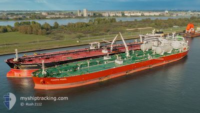
PACIFIC PEARL
Tanker
Current Trip
| Time Travelled | 14 days |
|---|---|
| Remaining Time | --- |
| Distance Travelled | 4464.40 nm |
| Remaining Distance | --- |
| AVG Speed | 12.3 Knots |
| MAX Speed | 16.5 Knots |
| AVG Wind | 12.8 knots |
| MAX Wind | 30.5 knots |
| MIN Temp | 16.9°C / 62.42°F |
| MAX Temp | 29.6°C / 85.28°F |
| Draught | 13.4 m |
| Position Received | 2 d ago |
Current Position
| Longitude | -27.86215° |
|---|---|
| Latitude | 39.80789° |
| Status | Under way using engine |
| Speed | 13.7 Knots |
| Course | 102° |
| Area | North Atlantic Ocean |
| Station | T-AIS |
| Position Received | 2 d ago |
Info
Information
The current position of PACIFIC PEARL is in North Atlantic Ocean with coordinates 39.80789° / -27.86215° as reported on 2024-06-08 09:27 by AIS to our vessel tracker app. The vessel's current speed is 13.7 Knots and is heading at the port of FOS. The estimated time of arrival as calculated by vessel tracking app is 2024-06-14 14:00 LT
The vessel PACIFIC PEARL (IMO: 9893072, MMSI: 538009202) is a Tanker It's sailing under the flag of [MH] Marshall Is.
In this page you can find informations about the vessels current position, last detected port calls, and current voyage information. If the vessels is not in coverage by AIS you will find the latest position.
The current position of PACIFIC PEARL is detected by our AIS receivers and we are not responsible for the reliability of the data. The last position was recorded while the vessel was in Coverage by the Ais receivers of our vessel tracking app.
The current draught of PACIFIC PEARL as reported by AIS is 13.4 meters
Weather
| Temperature | 16.9°C / 62.42°F |
|---|---|
| Wind Speed | 16 knots |
| Direction | 11° N |
| Pressure | 1019.5 hPa |
| Humidity | 74.9 % |
| Cloud Coverage | 100 % |
Featured Company
Last Port Calls
Last Trips
| Origin | Departure | Destination | Arrival | Distance | |
|---|---|---|---|---|---|
| 2024-05-01 10:07 | 2024-05-24 02:55 | 5527.74 nm | |||
| 2024-04-27 07:13 | 2024-04-30 01:22 | 788.00 nm | |||
| 2024-04-22 19:58 | 2024-04-22 20:16 | 2.09 nm | |||
| 2024-04-20 08:20 | 2024-04-20 08:37 | 1.54 nm | |||
| 2024-03-29 11:50 | 2024-04-17 18:42 | 5185.75 nm |
Events
| Time | Event | Details | Position / Dest | Info |
|---|---|---|---|---|
| 2024-06-08 09:31 | Status Changed | Default Under way using engine |
39.80471 / -27.84290
FOS,FRANCE
|
Speed: 13.7 kn Course: 102° |
| 2024-06-08 09:27 | OUT of Coverage |
39.80789 / -27.86215
North Atlantic Ocean
FOS,FRANCE
|
Speed: 13.7 kn Course: 102° |
|
| 2024-06-08 09:23 | Status Changed | Under way using engine Default |
39.81137 / -27.88311
FOS,FRANCE
|
Speed: 13.5 kn Course: 102° |
| 2024-06-08 08:54 | Status Changed | Default Under way using engine |
39.83411 / -28.01801
FOS,FRANCE
|
Speed: 13.4 kn Course: 104° |
| 2024-06-08 08:07 | Status Changed | Under way using engine Default |
39.87315 / -28.23797
FOS,FRANCE
|
Speed: 13.2 kn Course: 106° |
| 2024-06-08 07:22 | Status Changed | Default Under way using engine |
39.91486 / -28.44076
FOS,FRANCE
|
Speed: 12.9 kn Course: 105.2° |
| 2024-06-08 05:28 | Status Changed | Under way using engine Default |
40.00621 / -28.97161
FOS,FRANCE
|
Speed: 13.2 kn Course: 101° |
| 2024-06-08 05:21 | Status Changed | Default Under way using engine |
40.01187 / -29.00413
FOS,FRANCE
|
Speed: 13 kn Course: 102.8° |
| 2024-06-08 05:12 | Draught Changed | 13.4 13.6 |
40.01820 / -29.04291
FOS,FRANCE
|
Speed: 13 kn Course: 102.8° |
| 2024-06-08 05:12 | Destination Changed | FOS,FRANCE BAHAMA |
40.01820 / -29.04291
FOS,FRANCE
|
Speed: 13 kn Course: 102.8° |