
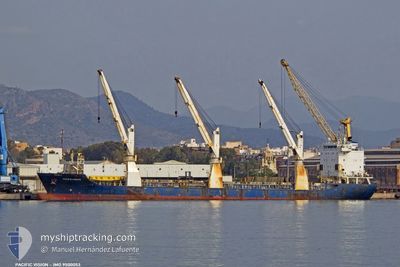
PACIFIC VISION
General Cargo
Current Trip
| Trip Time | 19 days |
|---|---|
| Trip Distance | 5089.11 nm |
| AVG Speed | 12.1 Knots |
| MAX Speed | 18.5 Knots |
| Draught | 5.4 m |
| AVG Wind | 12.4 knots |
| MAX Wind | 26.1 knots |
| MIN Temp | 17.4°C / 63.32°F |
| MAX Temp | 30.9°C / 87.62°F |
| Position Received | Now |
Current Position
| Longitude | 29.46441° |
|---|---|
| Latitude | 40.71370° |
| Status | Under way using engine |
| Speed | |
| Course | 308° |
| Area | Sea of Marmara |
| Station | T-AIS |
| Position Received | Now |
Info
Information
The current position of PACIFIC VISION is in Sea of Marmara with coordinates 40.71370° / 29.46441° as reported on 2024-06-21 05:03 by AIS to our vessel tracker app. The vessel's current speed is 0 Knots and is currently inside the port of YALOVA.
The vessel PACIFIC VISION (IMO: 9500053, MMSI: 305380000) is a General Cargo that was built in 2009 ( 15 years old ). It's sailing under the flag of [AG] Antigua Barbuda.
In this page you can find informations about the vessels current position, last detected port calls, and current voyage information. If the vessels is not in coverage by AIS you will find the latest position.
The current position of PACIFIC VISION is detected by our AIS receivers and we are not responsible for the reliability of the data. The last position was recorded while the vessel was in Coverage by the Ais receivers of our vessel tracking app.
The current draught of PACIFIC VISION as reported by AIS is 5.4 meters
Weather
| Temperature | 23.4°C / 74.12°F |
|---|---|
| Wind Speed | 10 knots |
| Direction | 88° E |
| Pressure | 1016.2 hPa |
| Humidity | 67 % |
| Cloud Coverage | --- |
Featured Company
Most Visited Ports (Last year)
| Port | Arrivals | |
|---|---|---|
| 4 | ||
| 2 | ||
| 2 | ||
| 2 | ||
| 2 | ||
| 2 |
Last Trips
| Origin | Departure | Destination | Arrival | Distance | |
|---|---|---|---|---|---|
| 2024-05-31 16:26 | 2024-06-20 09:43 | 5089.11 nm | |||
| 2024-05-25 13:56 | 2024-05-29 11:34 | 1165.10 nm | |||
| 2024-05-16 10:36 | 2024-05-19 11:36 | 32.39 nm | |||
| 2024-04-05 17:34 | 2024-05-12 09:38 | 5738.85 nm | |||
| 2024-03-26 16:57 | 2024-04-04 05:21 | 17.07 nm |
Events
| Time | Event | Details | Position / Dest | Info |
|---|---|---|---|---|
| 2024-06-20 06:45 | STOP Moving |
40.71538 / 29.46249
[TR] YALOVA
|
Speed: 0.2 kn Course: 345° |
|
| 2024-06-20 06:43 | PORT ARRIVAL |
|
40.71530 / 29.46198
[TR] YALOVA
|
Speed: 1.7 kn Course: 22° |
| 2024-06-20 06:05 | START Moving | 2.38 nm, South West of GEBZE |
40.72273 / 29.34651
YALOVA
|
Speed: 4.4 kn Course: 80° |
| 2024-06-20 06:00 | STOP Moving | 2.43 nm, South West of GEBZE |
40.72326 / 29.34410
YALOVA
|
Speed: 0.3 kn Course: 99° |
| 2024-06-20 04:35 | START Moving | 4.89 nm, North West of YALOVA |
40.73161 / 29.21864
YALOVA
|
Speed: 3.2 kn Course: 95° |
| 2024-06-20 04:17 | STOP Moving | 4.89 nm, North West of YALOVA |
40.73032 / 29.21599
YALOVA
|
Speed: 0.3 kn Course: 85° |
| 2024-06-20 02:46 | ETA Changed | 2024/06/20 09:00 2024/06/20 00:01 |
40.77627 / 29.08697
YALOVA
|
Speed: 6.3 kn Course: 123.9° |
| 2024-06-19 11:49 | Status Changed | Under way using engine Default |
40.69848 / 27.60738
YALOVA
|
Speed: 10.6 kn Course: 64° |
| 2024-06-19 11:43 | Status Changed | Default Under way using engine |
40.69066 / 27.58513
YALOVA
|
Speed: 10.6 kn Course: 65.7° |
| 2024-06-19 10:25 | Status Changed | Under way using engine Default |
40.59475 / 27.29314
YALOVA
|
Speed: 10.7 kn Course: 68° |