
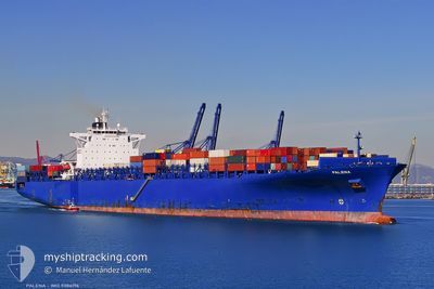
PALENA
Container Ship
Current Trip
| Time Travelled | 4 days |
|---|---|
| Remaining Time | 53 mins |
| Distance Travelled | 1463.65 nm |
| Remaining Distance | 13.38 nm |
| AVG Speed | 14.6 Knots |
| MAX Speed | 18.8 Knots |
| AVG Wind | 10.3 knots |
| MAX Wind | 26 knots |
| MIN Temp | 23.7°C / 74.66°F |
| MAX Temp | 29.8°C / 85.64°F |
| Draught | 12.2 m |
| Position Received | Now |
Current Position
| Longitude | -75.67366° |
|---|---|
| Latitude | 10.32639° |
| Status | Under way using engine |
| Speed | 11 Knots |
| Course | 112.9° |
| Area | Caribbean Sea |
| Station | T-AIS |
| Position Received | Now |
Info
Information
The current position of PALENA is in Caribbean Sea with coordinates 10.32639° / -75.67366° as reported on 2024-06-03 20:45 by AIS to our vessel tracker app. The vessel's current speed is 11 Knots and is heading at the port of CARTAGENA. The estimated time of arrival as calculated by vessel tracking app is 2024-06-03 21:39 LT
The vessel PALENA (IMO: 9306196, MMSI: 636092681) is a Container Ship that was built in 2006 ( 18 years old ). It's sailing under the flag of [LR] Liberia.
In this page you can find informations about the vessels current position, last detected port calls, and current voyage information. If the vessels is not in coverage by AIS you will find the latest position.
The current position of PALENA is detected by our AIS receivers and we are not responsible for the reliability of the data. The last position was recorded while the vessel was in Coverage by the Ais receivers of our vessel tracking app.
The current draught of PALENA as reported by AIS is 12.2 meters
Weather
| Temperature | 28.4°C / 83.12°F |
|---|---|
| Wind Speed | 8 knots |
| Direction | 214° SW |
| Pressure | 1006.3 hPa |
| Humidity | 79 % |
| Cloud Coverage | 100 % |
Featured Company
Last Port Calls
| Port | Arrival | Departure | Time In Port |
|---|---|---|---|
| 2024-05-29 08:40 | 2024-05-30 10:02 | 1 d | |
| 2024-05-25 14:53 | 2024-05-28 00:02 | 2 d | |
| 2024-05-15 15:27 | 2024-05-16 23:19 | 1 d | |
| 2024-05-02 19:32 | 2024-05-02 19:39 | 7 m | |
| 2024-04-29 17:31 | 2024-05-01 05:44 | 1 d | |
| 2024-04-26 19:55 | 2024-04-27 17:15 | 21 h | |
| 2024-04-25 14:17 | 2024-04-26 01:16 | 10 h | |
| 2024-04-18 21:06 | 2024-04-19 13:58 | 16 h | |
| 2024-04-15 01:11 | 2024-04-16 05:17 | 1 d | |
| 2024-04-11 01:57 | 2024-04-11 19:09 | 17 h |
Most Visited Ports (Last year)
| Port | Arrivals | |
|---|---|---|
| 11 | ||
| 11 | ||
| 6 | ||
| 6 | ||
| 5 | ||
| 5 |
Last Trips
| Origin | Departure | Destination | Arrival | Distance | |
|---|---|---|---|---|---|
| 2024-05-27 19:02 | 2024-05-29 03:40 | 442.85 nm | |||
| 2024-05-16 18:19 | 2024-05-25 09:53 | 2223.93 nm | |||
| 2024-05-02 16:39 | 2024-05-15 10:27 | 4179.38 nm | |||
| 2024-05-01 02:44 | 2024-05-02 16:32 | 262.52 nm | |||
| 2024-04-27 14:15 | 2024-04-29 14:31 | 181.39 nm | |||
| 2024-04-25 22:16 | 2024-04-26 16:55 | 121.71 nm | |||
| 2024-04-19 10:58 | 2024-04-25 11:17 | 761.27 nm | |||
| 2024-04-16 02:17 | 2024-04-18 18:06 | 334.63 nm | |||
| 2024-04-11 16:09 | 2024-04-14 22:11 | 1041.07 nm | |||
| 2024-03-28 22:32 | 2024-04-10 22:57 | 4305.96 nm |
Events
| Time | Event | Details | Position / Dest | Info |
|---|---|---|---|---|
| 2024-06-03 19:11 | START Moving | 18.2 nm, North West of CARTAGENA |
10.58471 / -75.77397
COCTG
|
Speed: 3.1 kn Course: 171° |
| 2024-06-03 10:49 | STOP Moving | 14.49 nm, West of CARTAGENA |
10.42944 / -75.77953
COCTG
|
Speed: 0.3 kn Course: 80° |
| 2024-06-03 10:45 | ETA Changed | 2024/06/03 16:00 2024/06/03 11:00 |
10.42903 / -75.77961
COCTG
|
Speed: 0.4 kn Course: 81° |
| 2024-06-03 09:02 | Draught Changed | 12.2 12.4 |
10.48023 / -75.84373
COCTG
|
Speed: 11.1 kn Course: 138.8° |
| 2024-06-03 08:39 | Status Changed | Under way using engine Default |
10.54603 / -75.90139
COCTG
|
Speed: 14.1 kn Course: 140° |
| 2024-06-03 07:58 | Status Changed | Default Under way using engine |
10.67003 / -76.00378
COCTG
|
Speed: 13.7 kn Course: 140.1° |
| 2024-06-03 07:53 | Status Changed | Under way using engine Default |
10.68351 / -76.01481
COCTG
|
Speed: 13.7 kn Course: 141° |
| 2024-06-03 07:38 | Status Changed | Default Under way using engine |
10.73045 / -76.05326
COCTG
|
Speed: 13.7 kn Course: 140° |
| 2024-06-03 07:01 | Change Sea Area | Colombian part of the Caribbean Sea High seas of the Gulf of Mexico |
10.83783 / -76.14283
Caribbean Sea
COCTG
|
Speed: 13.6 kn Course: 140.4° |
| 2024-06-03 07:01 | Status Changed | Under way using engine Default |
10.83783 / -76.14283
COCTG
|
Speed: 13.8 kn Course: 141° |