
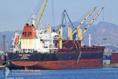
PAN IMPERIAL
Cargo
Current Trip
| Time Travelled | 48 days |
|---|---|
| Remaining Time | --- |
| Distance Travelled | 6096.87 nm |
| Remaining Distance | --- |
| AVG Speed | 10.4 Knots |
| MAX Speed | 14.5 Knots |
| AVG Wind | 11 knots |
| MAX Wind | 27 knots |
| MIN Temp | 22.9°C / 73.22°F |
| MAX Temp | 30.8°C / 87.44°F |
| Draught | 12.4 m |
| Position Received | 1 d ago |
Current Position
| Longitude | 54.54770° |
|---|---|
| Latitude | -21.06348° |
| Status | Under way using engine |
| Speed | 10.7 Knots |
| Course | 235.6° |
| Area | Indian Ocean |
| Station | T-AIS |
| Position Received | 1 d ago |
Info
Information
The current position of PAN IMPERIAL is in Indian Ocean with coordinates -21.06348° / 54.54770° as reported on 2024-05-31 03:05 by AIS to our vessel tracker app. The vessel's current speed is 10.7 Knots and is heading at the port of LAKE CHARLES. The estimated time of arrival as calculated by vessel tracking app is 2024-07-06 08:00 LT
The vessel PAN IMPERIAL (IMO: 9699361, MMSI: 352001187) is a Cargo It's sailing under the flag of [PA] Panama.
In this page you can find informations about the vessels current position, last detected port calls, and current voyage information. If the vessels is not in coverage by AIS you will find the latest position.
The current position of PAN IMPERIAL is detected by our AIS receivers and we are not responsible for the reliability of the data. The last position was recorded while the vessel was in Coverage by the Ais receivers of our vessel tracking app.
The current draught of PAN IMPERIAL as reported by AIS is 12.4 meters
Weather
| Temperature | 24.1°C / 75.38°F |
|---|---|
| Wind Speed | 8 knots |
| Direction | 49° NE |
| Pressure | 1022.4 hPa |
| Humidity | 60.8 % |
| Cloud Coverage | --- |
Featured Company
Most Visited Ports (Last year)
| Port | Arrivals | |
|---|---|---|
| 2 | ||
| 1 | ||
| 1 | ||
| 1 | ||
| 1 | ||
| 1 |
Last Trips
| Origin | Departure | Destination | Arrival | Distance | |
|---|---|---|---|---|---|
| 2024-02-01 18:20 | 2024-04-11 06:43 | 9560.88 nm |
Events
| Time | Event | Details | Position / Dest | Info |
|---|---|---|---|---|
| 2024-05-31 03:14 | Status Changed | Default Under way using engine |
-21.07818 / 54.52612
USLCH
|
Speed: 10.7 kn Course: 235.6° |
| 2024-05-31 03:05 | OUT of Coverage |
-21.06348 / 54.54770
Indian Ocean
|
Speed: 10.7 kn Course: 235.6° |
|
| 2024-05-31 03:00 | Status Changed | Under way using engine Default |
-21.05523 / 54.56074
USLCH
|
Speed: 10.4 kn Course: 233° |
| 2024-05-31 02:52 | Status Changed | Default Under way using engine |
-21.04222 / 54.57973
USLCH
|
Speed: 10.5 kn Course: 234.1° |
| 2024-05-31 02:46 | Status Changed | Under way using engine Default |
-21.03241 / 54.59480
USLCH
|
Speed: 10.6 kn Course: 236° |
| 2024-05-31 02:43 | Status Changed | Default Under way using engine |
-21.02581 / 54.60530
USLCH
|
Speed: 10.9 kn Course: 237.1° |
| 2024-05-31 02:37 | Status Changed | Under way using engine Default |
-21.01795 / 54.61895
USLCH
|
Speed: 10.7 kn Course: 236° |
| 2024-05-31 02:36 | Status Changed | Default Under way using engine |
-21.01526 / 54.62348
USLCH
|
Speed: 10.7 kn Course: 239.7° |
| 2024-05-31 02:06 | Status Changed | Under way using engine Default |
-20.96685 / 54.70304
USLCH
|
Speed: 10.8 kn Course: 236° |
| 2024-05-31 02:03 | Status Changed | Default Under way using engine |
-20.96287 / 54.70961
USLCH
|
Speed: 10.8 kn Course: 235.6° |