
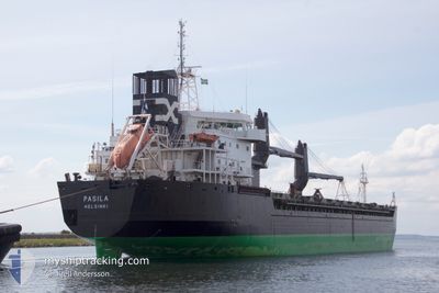
PASILA
General Cargo
Current Trip
| Trip Time | 15 h, 56 mins |
|---|---|
| Trip Distance | 79.22 nm |
| AVG Speed | 9 Knots |
| MAX Speed | 10.7 Knots |
| Draught | 5.9 m |
| AVG Wind | 17.9 knots |
| MAX Wind | 23 knots |
| MIN Temp | 3.6°C / 38.48°F |
| MAX Temp | 8.2°C / 46.76°F |
| Position Received | 16 d ago |
Current Position
| Longitude | 21.05048° |
|---|---|
| Latitude | 63.58094° |
| Status | Under way using engine |
| Speed | 10.2 Knots |
| Course | 67° |
| Area | Gulf of Bothnia |
| Station | T-AIS |
| Position Received | 16 d ago |
Info
Information
The current position of PASILA is in Gulf of Bothnia with coordinates 63.58094° / 21.05048° as reported on 2024-05-03 16:02 by AIS to our vessel tracker app. The vessel's current speed is 10.2 Knots and is currently inside the port of VIRPIPERA.
The vessel PASILA (IMO: 9113018, MMSI: 230336000) is a General Cargo that was built in 1995 ( 29 years old ). It's sailing under the flag of [FI] Finland.
In this page you can find informations about the vessels current position, last detected port calls, and current voyage information. If the vessels is not in coverage by AIS you will find the latest position.
The current position of PASILA is detected by our AIS receivers and we are not responsible for the reliability of the data. The last position was recorded while the vessel was in Coverage by the Ais receivers of our vessel tracking app.
The current draught of PASILA as reported by AIS is 5.9 meters
Weather
| Temperature | 1.8°C / 35.24°F |
|---|---|
| Wind Speed | 9 knots |
| Direction | 303° WNW |
| Pressure | 1015.1 hPa |
| Humidity | 84.1 % |
| Cloud Coverage | --- |
Featured Company
Last Port Calls
| Port | Arrival | Departure | Time In Port |
|---|---|---|---|
| 2024-05-18 11:20 | |||
| 2024-05-17 03:48 | 2024-05-17 19:24 | 15 h | |
| 2024-05-16 10:12 | |||
| 2024-05-14 19:16 | 2024-05-15 11:24 | 16 h | |
| 2024-05-13 23:11 | 2024-05-14 12:15 | 13 h | |
| 2024-05-13 06:20 | 2024-05-13 15:16 | 8 h | |
| 2024-05-12 08:45 | 2024-05-12 21:48 | 13 h | |
| 2024-05-11 05:36 | 2024-05-11 17:56 | 12 h | |
| 2024-05-08 23:30 | 2024-05-09 17:18 | 17 h | |
| 2024-05-08 03:44 | 2024-05-08 15:24 | 11 h |
Last Trips
| Origin | Departure | Destination | Arrival | Distance | |
|---|---|---|---|---|---|
| 2024-05-17 21:24 | 2024-05-18 14:20 | 79.22 nm | |||
| 2024-05-16 13:12 | 2024-05-17 05:48 | 79.57 nm | |||
| 2024-05-14 15:15 | 2024-05-14 21:16 | 78.16 nm | |||
| 2024-05-13 17:16 | 2024-05-14 02:11 | 79.27 nm | |||
| 2024-05-13 00:48 | 2024-05-13 08:20 | 77.04 nm | |||
| 2024-05-11 19:56 | 2024-05-12 11:45 | 89.39 nm | |||
| 2024-05-09 20:18 | 2024-05-11 07:36 | 95.62 nm | |||
| 2024-05-08 17:24 | 2024-05-09 02:30 | 78.68 nm | |||
| 2024-05-07 20:10 | 2024-05-08 05:44 | 78.11 nm | |||
| 2024-05-06 19:24 | 2024-05-07 04:26 | 79.17 nm |
Events
| Time | Event | Details | Position / Dest | Info |
|---|---|---|---|---|
| 2024-05-18 11:32 | STOP Moving |
64.65621 / 24.40393
[FI] VIRPIPERA
|
Speed: Course: 166° |
|
| 2024-05-18 11:20 | PORT ARRIVAL |
|
64.65893 / 24.39991
[FI] VIRPIPERA
|
Speed: 3.6 kn Course: 103° |
| 2024-05-18 09:56 | START Moving | 10.68 nm, West of VIRPIPERA |
64.68230 / 23.98815
SE LLA
|
Speed: 5.4 kn Course: 124° |
| 2024-05-18 02:45 | STOP Moving | 10.83 nm, West of VIRPIPERA |
64.68540 / 23.98306
SE LLA
|
Speed: 0.2 kn Course: 205° |
| 2024-05-17 19:25 | START Moving | 3.92 nm, South East of LULEA |
65.54074 / 22.29924
SE LLA
|
Speed: 6.8 kn Course: 122° |
| 2024-05-17 19:24 | PORT DEPARTURE |
|
65.54074 / 22.29924
SE LLA
|
Speed: 1.4 kn Course: 123° |
| 2024-05-17 03:56 | STOP Moving |
65.54456 / 22.28793
[SE] LULEA
|
Speed: Course: 284° |
|
| 2024-05-17 03:48 | PORT ARRIVAL |
|
65.54433 / 22.28922
[SE] LULEA
|
Speed: 1.5 kn Course: 311° |
| 2024-05-17 02:52 | START Moving | 10.38 nm, South East of LULEA |
65.46482 / 22.48741
SE LLA
|
Speed: 6.7 kn Course: 312° |
| 2024-05-16 16:37 | STOP Moving | 10.71 nm, South East of LULEA |
65.46305 / 22.50116
SE LLA
|
Speed: 0.1 kn Course: 212° |