
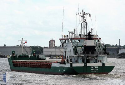
PATRIA
General Cargo
Current Trip
| Time Travelled | 3 days |
|---|---|
| Remaining Time | 16 h, 5 mins |
| Distance Travelled | 706.70 nm |
| Remaining Distance | 108.77 nm |
| AVG Speed | 8.3 Knots |
| MAX Speed | 10.4 Knots |
| AVG Wind | 12.3 knots |
| MAX Wind | 20.5 knots |
| MIN Temp | 9.3°C / 48.74°F |
| MAX Temp | 16.7°C / 62.06°F |
| Draught | 5.4 m |
| Position Received | 1 m ago |
Current Position
| Longitude | 9.72991° |
|---|---|
| Latitude | 54.33174° |
| Status | Under way using engine |
| Speed | 6.4 Knots |
| Course | 230.8° |
| Area | Baltic Sea |
| Station | T-AIS |
| Position Received | 1 m ago |
Info
Information
The current position of PATRIA is in Baltic Sea with coordinates 54.33174° / 9.72991° as reported on 2024-06-08 19:42 by AIS to our vessel tracker app. The vessel's current speed is 6.4 Knots and is heading at the port of BREMERHAVEN. The estimated time of arrival as calculated by vessel tracking app is 2024-06-09 11:48 LT
The vessel PATRIA (IMO: 9123312, MMSI: 209734000) is a General Cargo that was built in 1995 ( 29 years old ). It's sailing under the flag of [CY] Cyprus.
In this page you can find informations about the vessels current position, last detected port calls, and current voyage information. If the vessels is not in coverage by AIS you will find the latest position.
The current position of PATRIA is detected by our AIS receivers and we are not responsible for the reliability of the data. The last position was recorded while the vessel was in Coverage by the Ais receivers of our vessel tracking app.
The current draught of PATRIA as reported by AIS is 5.4 meters
Weather
| Temperature | 10.1°C / 50.18°F |
|---|---|
| Wind Speed | 9 knots |
| Direction | 262° W |
| Pressure | 1007.2 hPa |
| Humidity | 88.3 % |
| Cloud Coverage | 100 % |
Featured Company
Last Port Calls
| Port | Arrival | Departure | Time In Port |
|---|---|---|---|
| 2024-06-04 14:12 | 2024-06-05 14:37 | 1 d | |
| 2024-06-02 11:09 | 2024-06-03 18:19 | 1 d | |
| 2024-05-27 05:41 | 2024-05-28 18:13 | 1 d | |
| 2024-05-24 06:17 | 2024-05-25 19:28 | 1 d | |
| 2024-05-17 21:13 | 2024-05-18 18:26 | 21 h | |
| 2024-05-15 14:23 | 2024-05-15 14:40 | 17 m | |
| 2024-05-11 07:38 | 2024-05-13 22:12 | 2 d | |
| 2024-05-02 16:01 | 2024-05-06 14:55 | 3 d | |
| 2024-04-28 08:54 | 2024-04-29 13:13 | 1 d | |
| 2024-04-25 18:30 | 2024-04-26 19:37 | 1 d |
Most Visited Ports (Last year)
| Port | Arrivals | |
|---|---|---|
| 5 | ||
| 5 | ||
| 4 | ||
| 4 | ||
| 3 | ||
| 2 |
Last Trips
| Origin | Departure | Destination | Arrival | Distance | |
|---|---|---|---|---|---|
| 2024-06-03 20:19 | 2024-06-04 16:12 | 168.34 nm | |||
| 2024-05-28 19:13 | 2024-06-02 13:09 | 1097.41 nm | |||
| 2024-05-25 20:28 | 2024-05-27 06:41 | 245.91 nm | |||
| 2024-05-18 20:26 | 2024-05-24 07:17 | 955.01 nm | |||
| 2024-05-15 16:40 | 2024-05-17 23:13 | 515.96 nm | |||
| 2024-05-13 23:12 | 2024-05-15 16:23 | 360.35 nm | |||
| 2024-05-06 16:55 | 2024-05-11 08:38 | 875.96 nm | |||
| 2024-04-29 15:13 | 2024-05-02 18:01 | 653.11 nm | |||
| 2024-04-26 20:37 | 2024-04-28 10:54 | 305.63 nm | |||
| 2024-04-18 17:45 | 2024-04-25 19:30 | 1038.80 nm |
Events
| Time | Event | Details | Position / Dest | Info |
|---|---|---|---|---|
| 2024-06-08 17:09 | START Moving | 1.43 nm, South West of STICKENHΟRN SPORT |
54.36667 / 10.13814
BREMERHAVEN VIA NOK
|
Speed: 4.1 kn Course: 285° |
| 2024-06-08 16:44 | STOP Moving | 1.38 nm, South West of STICKENHΟRN SPORT |
54.36608 / 10.14126
BREMERHAVEN VIA NOK
|
Speed: 0.3 kn Course: 285° |
| 2024-06-08 13:47 | Change Sea Area | German part of the Baltic Sea Danish part of the Baltic Sea |
54.56465 / 10.55861
Baltic Sea
BREMERHAVEN VIA NOK
|
Speed: 7.9 kn Course: 248.6° |
| 2024-06-08 12:44 | Detected in Sea | Danish part of the Baltic Sea |
54.58811 / 10.80050
Baltic Sea
BREMERHAVEN VIA NOK
|
Speed: 8.4 kn Course: 264.1° |
| 2024-06-08 11:01 | Change Sea Area | German part of the Baltic Sea Danish part of the Baltic Sea |
54.61037 / 11.20250
Baltic Sea
BREMERHAVEN VIA NOK
|
Speed: 7.9 kn Course: 275.5° |
| 2024-06-08 02:26 | Detected in Sea | Danish part of the Baltic Sea |
54.84651 / 12.94578
Baltic Sea
BREMERHAVEN VIA NOK
|
Speed: 8.9 kn Course: 249.9° |
| 2024-06-07 23:05 | Detected in Sea | German part of the Baltic Sea |
55.01811 / 13.78498
Baltic Sea
BREMERHAVEN VIA NOK
|
Speed: 9 kn Course: 250.5° |
| 2024-06-07 17:29 | Change Sea Area | Swedish part of the Baltic Sea Danish part of the Kattegat |
55.57185 / 14.85522
Baltic Sea
BREMERHAVEN VIA NOK
|
Speed: 9.8 kn Course: 242.6° |
| 2024-06-07 16:17 | Detected in Sea | Danish part of the Kattegat |
55.66139 / 15.16033
Kattegat
BREMERHAVEN VIA NOK
|
Speed: 9.9 kn Course: 239.9° |
| 2024-06-07 10:39 | Status Changed | Under way using engine Default |
56.08640 / 16.57494
BREMERHAVEN VIA NOK
|
Speed: 9.6 kn Course: 234° |