
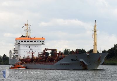
PAUL E
Oil/Chemical Tanker
Current Trip
| Time Travelled | 11 h, 52 mins |
|---|---|
| Remaining Time | 6 h, 35 mins |
| Distance Travelled | 158.09 nm |
| Remaining Distance | 99.68 nm |
| AVG Speed | 13.4 Knots |
| MAX Speed | 16.1 Knots |
| AVG Wind | 21.2 knots |
| MAX Wind | 24.8 knots |
| MIN Temp | 13.3°C / 55.94°F |
| MAX Temp | 14.2°C / 57.56°F |
| Draught | 5.2 m |
| Position Received | Now |
Current Position
| Longitude | 1.99310° |
|---|---|
| Latitude | 51.18203° |
| Status | Under way using engine |
| Speed | 13.6 Knots |
| Course | 62° |
| Area | North Sea |
| Station | T-AIS |
| Position Received | Now |
Info
Information
The current position of PAUL E is in North Sea with coordinates 51.18203° / 1.99310° as reported on 2024-05-29 05:27 by AIS to our vessel tracker app. The vessel's current speed is 13.6 Knots and is heading at the port of ANTWERP. The estimated time of arrival as calculated by vessel tracking app is 2024-05-29 12:03 LT
The vessel PAUL E (IMO: 9268277, MMSI: 236283000) is a Oil/Chemical Tanker that was built in 2005 ( 19 years old ). It's sailing under the flag of [GI] Gibraltar.
In this page you can find informations about the vessels current position, last detected port calls, and current voyage information. If the vessels is not in coverage by AIS you will find the latest position.
The current position of PAUL E is detected by our AIS receivers and we are not responsible for the reliability of the data. The last position was recorded while the vessel was in Coverage by the Ais receivers of our vessel tracking app.
The current draught of PAUL E as reported by AIS is 5.2 meters
Weather
| Temperature | 13.7°C / 56.66°F |
|---|---|
| Wind Speed | 20 knots |
| Direction | 253° WSW |
| Pressure | 1008.8 hPa |
| Humidity | 89.3 % |
| Cloud Coverage | 100 % |
Featured Company
Last Port Calls
| Port | Arrival | Departure | Time In Port |
|---|---|---|---|
| 2024-05-27 10:57 | 2024-05-28 17:36 | 1 d | |
| 2024-05-22 11:29 | 2024-05-24 07:15 | 1 d | |
| 2024-05-17 16:39 | 2024-05-18 15:21 | 22 h | |
| 2024-05-13 01:31 | 2024-05-14 01:29 | 23 h | |
| 2024-05-02 22:03 | 2024-05-03 22:07 | 1 d | |
| 2024-04-29 04:03 | 2024-04-30 05:58 | 1 d | |
| 2024-04-25 03:52 | 2024-04-26 17:36 | 1 d | |
| 2024-04-18 11:23 | 2024-04-18 23:07 | 11 h | |
| 2024-04-09 14:04 | 2024-04-10 23:35 | 1 d | |
| 2024-04-06 20:55 | 2024-04-08 13:58 | 1 d |
Most Visited Ports (Last year)
| Port | Arrivals | |
|---|---|---|
| 15 | ||
| 13 | ||
| 8 | ||
| 8 | ||
| 7 | ||
| 7 |
Last Trips
| Origin | Departure | Destination | Arrival | Distance | |
|---|---|---|---|---|---|
| 2024-05-24 09:15 | 2024-05-27 11:57 | 253.25 nm | |||
| 2024-05-18 17:21 | 2024-05-22 13:29 | 268.04 nm | |||
| 2024-05-14 03:29 | 2024-05-17 18:39 | 292.77 nm | |||
| 2024-05-04 00:07 | 2024-05-13 03:31 | 359.27 nm | |||
| 2024-04-30 07:58 | 2024-05-03 00:03 | 280.50 nm | |||
| 2024-04-26 18:36 | 2024-04-29 06:03 | 267.91 nm | |||
| 2024-04-19 00:07 | 2024-04-25 04:52 | 33.91 nm | |||
| 2024-04-11 01:35 | 2024-04-18 12:23 | 265.78 nm | |||
| 2024-04-08 15:58 | 2024-04-09 16:04 | 113.09 nm | |||
| 2024-04-03 15:33 | 2024-04-06 22:55 | 267.65 nm |
Events
| Time | Event | Details | Position / Dest | Info |
|---|---|---|---|---|
| 2024-05-29 04:14 | Change Sea Area | French part of the North Sea French part of the English Channel |
50.99405 / 1.62583
North Sea
BEANT
|
Speed: 15.4 kn Course: 43° |
| 2024-05-29 02:26 | Status Changed | Under way using engine Default |
50.62943 / 1.25433
BEANT
|
Speed: 14.3 kn Course: 46° |
| 2024-05-29 02:14 | Status Changed | Default Under way using engine |
50.59654 / 1.19948
BEANT
|
Speed: 14.1 kn Course: 47° |
| 2024-05-29 02:04 | Change Sea Area | French part of the English Channel United Kingdom part of the English Channel |
50.56968 / 1.15347
English Channel
BEANT
|
Speed: 14.1 kn Course: 47° |
| 2024-05-29 02:04 | Status Changed | Under way using engine Default |
50.56968 / 1.15347
BEANT
|
Speed: 13.8 kn Course: 47° |
| 2024-05-29 01:50 | IN Coverage |
50.56968 / 1.15347
English Channel
BEANT
|
Speed: 14.1 kn Course: 47° |
|
| 2024-05-29 00:38 | Status Changed | Default Under way using engine |
50.42567 / .69507
BEANT
|
Speed: 14.2 kn Course: 74° |
| 2024-05-29 00:35 | OUT of Coverage |
50.42268 / .67782
English Channel
BEANT
|
Speed: 14.2 kn Course: 74° |
|
| 2024-05-28 19:06 | ETA Changed | 2024/05/29 09:30 2024/05/29 08:00 |
50.67468 / -.91460
BEANT
|
Speed: 11.5 kn Course: 150° |
| 2024-05-28 17:36 | PORT DEPARTURE |
|
50.83292 / -1.31633
BEANT
|
Speed: 8.7 kn Course: 141° |