
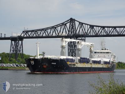
PEACE
General Cargo
Current Trip
| Time Travelled | 9 h, 52 mins |
|---|---|
| Remaining Time | 1 day |
| Distance Travelled | 98.52 nm |
| Remaining Distance | 427.73 nm |
| AVG Speed | 10.3 Knots |
| MAX Speed | 10.9 Knots |
| AVG Wind | 8.4 knots |
| MAX Wind | 12.3 knots |
| MIN Temp | 7.7°C / 45.86°F |
| MAX Temp | 10.4°C / 50.72°F |
| Draught | 6.5 m |
| Position Received | Now |
Current Position
| Longitude | 20.07287° |
|---|---|
| Latitude | 62.83620° |
| Status | Under way using engine |
| Speed | 10.5 Knots |
| Course | 192° |
| Area | Gulf of Bothnia |
| Station | T-AIS |
| Position Received | Now |
Info
Information
The current position of PEACE is in Gulf of Bothnia with coordinates 62.83620° / 20.07287° as reported on 2024-05-29 04:40 by AIS to our vessel tracker app. The vessel's current speed is 10.5 Knots and is heading at the port of HAMINA. The estimated time of arrival as calculated by vessel tracking app is 2024-05-30 22:08 LT
The vessel PEACE (IMO: 9553983, MMSI: 207138000) is a General Cargo that was built in 2012 ( 12 years old ). It's sailing under the flag of [BG] Bulgaria.
In this page you can find informations about the vessels current position, last detected port calls, and current voyage information. If the vessels is not in coverage by AIS you will find the latest position.
The current position of PEACE is detected by our AIS receivers and we are not responsible for the reliability of the data. The last position was recorded while the vessel was in Coverage by the Ais receivers of our vessel tracking app.
The current draught of PEACE as reported by AIS is 6.5 meters
Weather
| Temperature | 9°C / 48.2°F |
|---|---|
| Wind Speed | 9 knots |
| Direction | 174° S |
| Pressure | 1014.4 hPa |
| Humidity | 84.7 % |
| Cloud Coverage | 20 % |
Featured Company
Last Port Calls
| Port | Arrival | Departure | Time In Port |
|---|---|---|---|
| 2024-05-24 11:50 | 2024-05-28 18:49 | 4 d | |
| 2024-05-20 20:17 | 2024-05-22 20:33 | 2 d | |
| 2024-05-15 13:22 | 2024-05-18 00:38 | 2 d | |
| 2024-04-26 21:34 | 2024-04-29 17:40 | 2 d | |
| 2024-04-01 13:12 | 2024-04-26 09:22 | 24 d | |
| 2024-03-30 12:52 | 2024-03-31 02:37 | 13 h | |
| 2024-03-24 23:39 | 2024-03-28 05:59 | 3 d | |
| 2024-03-01 19:37 |
Last Trips
| Origin | Departure | Destination | Arrival | Distance | |
|---|---|---|---|---|---|
| 2024-05-22 22:33 | 2024-05-24 14:50 | 430.16 nm | |||
| 2024-05-18 02:38 | 2024-05-20 22:17 | 246.94 nm | |||
| 2024-04-29 20:40 | 2024-05-15 15:22 | 3795.72 nm | |||
| 2024-04-26 12:22 | 2024-04-27 00:34 | 106.54 nm | |||
| 2024-03-31 05:37 | 2024-04-01 16:12 | 295.34 nm | |||
| 2024-03-28 07:59 | 2024-03-30 15:52 | 567.27 nm | |||
| 2024-03-01 20:37 | 2024-03-25 01:39 | 4133.72 nm |
Events
| Time | Event | Details | Position / Dest | Info |
|---|---|---|---|---|
| 2024-05-29 03:29 | Status Changed | Under way using engine Default |
63.03514 / 20.17366
HAMINA FINLAND
|
Speed: 10.5 kn Course: 194° |
| 2024-05-29 03:26 | Status Changed | Default Under way using engine |
63.04368 / 20.17827
HAMINA FINLAND
|
Speed: 10.4 kn Course: 194.6° |
| 2024-05-29 02:50 | Status Changed | Under way using engine Default |
63.14427 / 20.23361
HAMINA FINLAND
|
Speed: 10.3 kn Course: 192° |
| 2024-05-29 02:46 | Status Changed | Default Under way using engine |
63.15456 / 20.23832
HAMINA FINLAND
|
Speed: 10.4 kn Course: 191.9° |
| 2024-05-29 02:14 | Change Sea Area | Finnish part of the Gulf of Bothnia Swedish part of the Gulf of Bothnia |
63.24483 / 20.27942
Gulf of Bothnia
HAMINA FINLAND
|
Speed: 10.2 kn Course: 191.8° |
| 2024-05-29 02:05 | Change Sea Area | Swedish part of the Gulf of Bothnia Finnish part of the Gulf of Bothnia |
63.26651 / 20.30598
Gulf of Bothnia
HAMINA FINLAND
|
Speed: 10 kn Course: 217.3° |
| 2024-05-29 00:59 | Change Sea Area | Finnish part of the Gulf of Bothnia Swedish part of the Gulf of Bothnia |
63.41267 / 20.55551
Gulf of Bothnia
HAMINA FINLAND
|
Speed: 10.1 kn Course: 218.2° |
| 2024-05-28 23:41 | Draught Changed | 6.5 5.5 |
63.55828 / 20.88522
HAMINA FINLAND
|
Speed: 10.4 kn Course: 248.5° |
| 2024-05-28 23:41 | Destination Changed | HAMINA FINLAND JAKOBSTAD FINLAND |
63.55828 / 20.88522
HAMINA FINLAND
|
Speed: 10.4 kn Course: 248.5° |
| 2024-05-28 23:41 | ETA Changed | 2024/05/30 21:30 2024/05/24 15:00 |
63.55828 / 20.88522
HAMINA FINLAND
|
Speed: 10.4 kn Course: 248.5° |