
PEACEFUL SEAS
Cargo
Current Trip
| Trip Time | --- |
|---|---|
| Trip Distance | --- |
| AVG Speed | --- |
| MAX Speed | --- |
| Draught | --- |
| AVG Wind | --- |
| MAX Wind | --- |
| MIN Temp | --- |
| MAX Temp | --- |
| Position Received | 9 d ago |
Current Position
| Longitude | -15.03430° |
|---|---|
| Latitude | 28.82073° |
| Status | Under way using engine |
| Speed | 11.5 Knots |
| Course | 6.5° |
| Area | North Atlantic Ocean |
| Station | T-AIS |
| Position Received | 9 d ago |
Info
Information
The current position of PEACEFUL SEAS is in North Atlantic Ocean with coordinates 28.82073° / -15.03430° as reported on 2024-06-06 15:58 by AIS to our vessel tracker app. The vessel's current speed is 11.5 Knots and is currently inside the port of AUGHINISH.
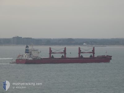
The vessel PEACEFUL SEAS (IMO: 9707584, MMSI: 636016197) is a Cargo It's sailing under the flag of [LR] Liberia.
In this page you can find informations about the vessels current position, last detected port calls, and current voyage information. If the vessels is not in coverage by AIS you will find the latest position.
The current position of PEACEFUL SEAS is detected by our AIS receivers and we are not responsible for the reliability of the data. The last position was recorded while the vessel was in Coverage by the Ais receivers of our vessel tracking app.
The current draught of PEACEFUL SEAS as reported by AIS is 11.3 meters
Weather
| Temperature | 13.1°C / 55.58°F |
|---|---|
| Wind Speed | 11 knots |
| Direction | 294° WNW |
| Pressure | 997.5 hPa |
| Humidity | 73.6 % |
| Cloud Coverage | 59 % |
Featured Company
Last Port Calls
| Port | Arrival | Departure | Time In Port |
|---|---|---|---|
| 2024-05-23 08:13 | 2024-05-24 16:13 | 1 d | |
| 2024-05-08 12:05 | 2024-05-12 00:16 | 3 d | |
| 2024-04-01 19:14 | 2024-04-03 02:37 | 1 d |
Most Visited Ports (Last year)
| Port | Arrivals | |
|---|---|---|
| 3 | ||
| 2 | ||
| 1 | ||
| 1 | ||
| 1 | ||
| 1 |
Events
| Time | Event | Details | Position / Dest | Info |
|---|---|---|---|---|
| 2024-06-06 15:58 | OUT of Coverage |
28.82073 / -15.03430
North Atlantic Ocean
AUGHINISH
|
Speed: 11.5 kn Course: 6.5° |
|
| 2024-06-06 13:43 | ETA Changed | 2024/06/12 00:00 2024/06/11 11:00 |
28.38751 / -15.10388
AUGHINISH
|
Speed: 11.5 kn Course: 9° |
| 2024-06-06 11:43 | ETA Changed | 2024/06/11 11:00 2024/06/11 18:00 |
28.10893 / -15.37045
AUGHINISH
|
Speed: 9 kn Course: 51.3° |
| 2024-06-06 11:32 | START Moving | 2.33 nm, South East of LAS PALMAS |
28.09792 / -15.38631
AUGHINISH
|
Speed: 3.1 kn Course: 50° |
| 2024-06-06 11:26 | Status Changed | Under way using engine At anchor |
28.09646 / -15.38874
AUGHINISH
|
Speed: 0.1 kn Course: 46° |
| 2024-06-06 11:20 | Status Changed | At anchor Default |
28.09595 / -15.38917
AUGHINISH
|
Speed: 0.4 kn Course: 23° |
| 2024-06-06 11:14 | Status Changed | Default At anchor |
28.09539 / -15.38921
AUGHINISH
|
Speed: 0.5 kn Course: 17° |
| 2024-06-06 11:05 | Status Changed | At anchor Default |
28.09425 / -15.38959
AUGHINISH
|
Speed: 0.1 kn Course: 35° |
| 2024-06-06 11:02 | Status Changed | Default At anchor |
28.09420 / -15.38969
AUGHINISH
|
Speed: 0.1 kn Course: 41° |
| 2024-06-06 10:50 | Status Changed | At anchor Default |
28.09433 / -15.38984
AUGHINISH
|
Speed: Course: 46° |