
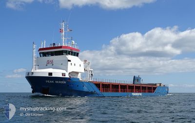
PEAK BERGEN
General Cargo
Current Trip
| Trip Time | 2 days |
|---|---|
| Trip Distance | 580.06 nm |
| AVG Speed | 9.1 Knots |
| MAX Speed | 11.8 Knots |
| Draught | 3.9 m |
| AVG Wind | 10.1 knots |
| MAX Wind | 21 knots |
| MIN Temp | 8.6°C / 47.48°F |
| MAX Temp | 15.6°C / 60.08°F |
| Position Received | 6 m ago |
Current Position
| Longitude | -7.02977° |
|---|---|
| Latitude | 52.26745° |
| Status | Moored |
| Speed | |
| Course | 39° |
| Area | Celtic Sea |
| Station | T-AIS |
| Position Received | 6 m ago |
Info
Information
The current position of PEAK BERGEN is in Celtic Sea with coordinates 52.26745° / -7.02977° as reported on 2024-06-19 19:06 by AIS to our vessel tracker app. The vessel's current speed is 0 Knots and is currently inside the port of WATERFORD.
The vessel PEAK BERGEN (IMO: 9544932, MMSI: 246399000) is a General Cargo that was built in 2010 ( 14 years old ). It's sailing under the flag of [NL] Netherlands.
In this page you can find informations about the vessels current position, last detected port calls, and current voyage information. If the vessels is not in coverage by AIS you will find the latest position.
The current position of PEAK BERGEN is detected by our AIS receivers and we are not responsible for the reliability of the data. The last position was recorded while the vessel was in Coverage by the Ais receivers of our vessel tracking app.
The current draught of PEAK BERGEN as reported by AIS is 3.9 meters
Weather
| Temperature | 13.6°C / 56.48°F |
|---|---|
| Wind Speed | 5 knots |
| Direction | 212° SSW |
| Pressure | 1023.4 hPa |
| Humidity | 82.7 % |
| Cloud Coverage | 100 % |
Featured Company
Last Port Calls
| Port | Arrival | Departure | Time In Port |
|---|---|---|---|
| 2024-06-18 23:09 | |||
| 2024-06-15 18:32 | 2024-06-16 11:37 | 17 h | |
| 2024-06-13 06:15 | 2024-06-14 18:10 | 1 d | |
| 2024-06-01 10:14 | 2024-06-04 10:29 | 3 d | |
| 2024-05-27 10:03 | 2024-05-29 21:15 | 2 d | |
| 2024-05-15 06:02 | 2024-05-17 19:30 | 2 d | |
| 2024-05-04 17:14 | 2024-05-08 17:40 | 4 d | |
| 2024-04-30 19:37 | 2024-05-01 11:30 | 15 h | |
| 2024-04-25 18:34 | 2024-04-26 09:44 | 15 h | |
| 2024-04-19 09:54 | 2024-04-19 20:34 | 10 h |
Last Trips
| Origin | Departure | Destination | Arrival | Distance | |
|---|---|---|---|---|---|
| 2024-06-16 13:37 | 2024-06-19 00:09 | 580.06 nm | |||
| 2024-06-14 20:10 | 2024-06-15 20:32 | 214.51 nm | |||
| 2024-06-04 12:29 | 2024-06-13 08:15 | 1838.26 nm | |||
| 2024-05-29 22:15 | 2024-06-01 12:14 | 620.53 nm | |||
| 2024-05-17 20:30 | 2024-05-27 11:03 | 1085.47 nm | |||
| 2024-05-08 19:40 | 2024-05-15 07:02 | 839.50 nm | |||
| 2024-05-01 13:30 | 2024-05-04 19:14 | 567.82 nm | |||
| 2024-04-26 11:44 | 2024-04-30 21:37 | 570.04 nm | |||
| 2024-04-19 22:34 | 2024-04-25 20:34 | 709.67 nm | |||
| 2024-04-18 18:02 | 2024-04-19 11:54 | 167.56 nm |
Events
| Time | Event | Details | Position / Dest | Info |
|---|---|---|---|---|
| 2024-06-18 23:15 | Status Changed | Moored Under way using engine |
52.26745 / -7.02977
[IE] WATERFORD
|
Speed: Course: 39° |
| 2024-06-18 23:09 | PORT ARRIVAL |
|
52.26683 / -7.02988
[IE] WATERFORD
|
Speed: 0.8 kn Course: 46° |
| 2024-06-18 22:58 | STOP Moving | 0.07 nm, South East of WATERFORD |
52.26523 / -7.03080
IEWAT
|
Speed: 0.3 kn Course: 63° |
| 2024-06-18 19:18 | ETA Changed | 2024/06/18 23:00 2024/06/18 20:00 |
51.78927 / -6.77775
IEWAT
|
Speed: 10.5 kn Course: 339° |
| 2024-06-18 18:56 | Detected in Sea | Irish part of the Celtic Sea |
51.72810 / -6.74045
Celtic Sea
IEWAT
|
Speed: 10.7 kn Course: 339° |
| 2024-06-18 18:55 | IN Coverage |
51.72810 / -6.74045
Celtic Sea
IEWAT
|
Speed: 10.7 kn Course: 339° |
|
| 2024-06-18 14:55 | Status Changed | Default Under way using engine |
51.07170 / -6.33277
IEWAT
|
Speed: 9.7 kn Course: 0° |
| 2024-06-18 14:49 | OUT of Coverage |
51.05520 / -6.32587
Celtic Sea
IEWAT
|
Speed: 9.7 kn Course: 0° |
|
| 2024-06-18 14:45 | Change Sea Area | United Kingdom part of the Celtic Sea United Kingdom part of the English Channel |
51.04580 / -6.32598
Celtic Sea
IEWAT
|
Speed: 9.7 kn Course: 359° |
| 2024-06-18 14:45 | Status Changed | Under way using engine Default |
51.04580 / -6.32598
IEWAT
|
Speed: 9.8 kn Course: 0° |