
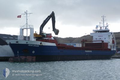
PEAK SAUDA
General Cargo
Current Trip
| Time Travelled | 1 day |
|---|---|
| Remaining Time | --- |
| Distance Travelled | 293.40 nm |
| Remaining Distance | --- |
| AVG Speed | 9.2 Knots |
| MAX Speed | 12.1 Knots |
| AVG Wind | 8.6 knots |
| MAX Wind | 19 knots |
| MIN Temp | 10.9°C / 51.62°F |
| MAX Temp | 13.9°C / 57.02°F |
| Draught | 6.2 m |
| Position Received | 3 m ago |
Current Position
| Longitude | -3.46947° |
|---|---|
| Latitude | 58.70621° |
| Status | Under way using engine |
| Speed | 6.9 Knots |
| Course | 88.8° |
| Area | North Atlantic Ocean |
| Station | T-AIS |
| Position Received | 3 m ago |
Info
Information
The current position of PEAK SAUDA is in North Atlantic Ocean with coordinates 58.70621° / -3.46947° as reported on 2024-05-28 23:44 by AIS to our vessel tracker app. The vessel's current speed is 6.9 Knots and is heading at the port of ODDA. The estimated time of arrival as calculated by vessel tracking app is 2024-05-31 01:00 LT
The vessel PEAK SAUDA (IMO: 9187136, MMSI: 245871000) is a General Cargo that was built in 1999 ( 25 years old ). It's sailing under the flag of [NL] Netherlands.
In this page you can find informations about the vessels current position, last detected port calls, and current voyage information. If the vessels is not in coverage by AIS you will find the latest position.
The current position of PEAK SAUDA is detected by our AIS receivers and we are not responsible for the reliability of the data. The last position was recorded while the vessel was in Coverage by the Ais receivers of our vessel tracking app.
The current draught of PEAK SAUDA as reported by AIS is 6.2 meters
Weather
| Temperature | 11.1°C / 51.98°F |
|---|---|
| Wind Speed | 13 knots |
| Direction | 131° SE |
| Pressure | 1003.7 hPa |
| Humidity | 94.5 % |
| Cloud Coverage | 82 % |
Featured Company
Last Port Calls
| Port | Arrival | Departure | Time In Port |
|---|---|---|---|
| 2024-05-27 05:23 | 2024-05-27 16:07 | 10 h | |
| 2024-05-24 09:34 | 2024-05-24 11:44 | 2 h | |
| 2024-05-22 05:00 | 2024-05-22 12:12 | 7 h | |
| 2024-05-20 18:27 | 2024-05-22 02:06 | 1 d | |
| 2024-05-18 05:13 | 2024-05-19 14:51 | 1 d | |
| 2024-05-09 19:06 | 2024-05-10 16:22 | 21 h | |
| 2024-05-06 14:27 | 2024-05-07 05:33 | 15 h | |
| 2024-05-04 19:44 | 2024-05-04 22:21 | 2 h | |
| 2024-05-04 06:49 | 2024-05-04 15:30 | 8 h | |
| 2024-05-02 10:54 | 2024-05-03 17:06 | 1 d |
Last Trips
| Origin | Departure | Destination | Arrival | Distance | |
|---|---|---|---|---|---|
| 2024-05-24 13:44 | 2024-05-27 06:23 | 573.79 nm | |||
| 2024-05-22 14:12 | 2024-05-24 11:34 | 259.00 nm | |||
| 2024-05-22 04:06 | 2024-05-22 07:00 | 27.08 nm | |||
| 2024-05-19 16:51 | 2024-05-20 20:27 | 291.47 nm | |||
| 2024-05-10 17:22 | 2024-05-18 07:13 | 1060.06 nm | |||
| 2024-05-07 06:33 | 2024-05-09 20:06 | 443.57 nm | |||
| 2024-05-05 00:21 | 2024-05-06 15:27 | 390.67 nm | |||
| 2024-05-04 17:30 | 2024-05-04 21:44 | 40.80 nm | |||
| 2024-05-03 19:06 | 2024-05-04 08:49 | 165.63 nm | |||
| 2024-05-01 16:51 | 2024-05-02 12:54 | 159.21 nm |
Events
| Time | Event | Details | Position / Dest | Info |
|---|---|---|---|---|
| 2024-05-28 23:43 | Status Changed | Under way using engine Default |
58.70616 / -3.47324
TYSSEDAL
|
Speed: 9.7 kn Course: 88° |
| 2024-05-28 23:28 | Status Changed | Default Under way using engine |
58.70478 / -3.55652
TYSSEDAL
|
Speed: 10.3 kn Course: 86.4° |
| 2024-05-28 22:26 | Destination Changed | TYSSEDAL LONDONDERRY |
58.69320 / -3.88886
TYSSEDAL
|
Speed: 9.7 kn Course: 88° |
| 2024-05-28 22:08 | Status Changed | Under way using engine Default |
58.69061 / -3.98436
LONDONDERRY
|
Speed: 10 kn Course: 86° |
| 2024-05-28 21:59 | Status Changed | Default Under way using engine |
58.68936 / -4.02912
LONDONDERRY
|
Speed: 9.8 kn Course: 85.4° |
| 2024-05-28 21:46 | Status Changed | Under way using engine Default |
58.68688 / -4.09754
LONDONDERRY
|
Speed: 9.7 kn Course: 85° |
| 2024-05-28 21:40 | Status Changed | Default Under way using engine |
58.68552 / -4.13264
LONDONDERRY
|
Speed: 9.6 kn Course: 87° |
| 2024-05-28 21:35 | Change Sea Area | United Kingdom part of the North Atlantic Ocean United Kingdom part of the Inner Seas off the West Coast of Scotland |
58.68474 / -4.15804
North Atlantic Ocean
LONDONDERRY
|
Speed: 9.6 kn Course: 87° |
| 2024-05-28 21:33 | Status Changed | Under way using engine Default |
58.68451 / -4.16832
LONDONDERRY
|
Speed: 9.5 kn Course: 88° |
| 2024-05-28 21:17 | IN Coverage |
58.68474 / -4.15804
North Atlantic Ocean
LONDONDERRY
|
Speed: 9.6 kn Course: 87° |