
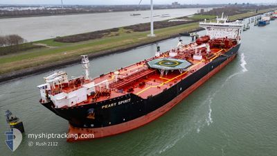
PEARY SPIRIT
Shuttle Tanker
Aktuelle Reise
| Trip Time | 8 Tage |
|---|---|
| Trip Distanz | 859.24 nm |
| Durchschnittliche Geschwindigkeit | 10.2 Knoten |
| Maximale Geschwindigkeit | 14.7 Knoten |
| Tiefgang | 11.8 m |
| Durchschnittliche Windgeschwindigkeit | 6.8 Knoten |
| Maximale Windgeschwindigkeit | 21 Knoten |
| Minimale Temperatur | 13.1°C / 55.58°F |
| Maximale Temperatur | 19.3°C / 66.74°F |
| Position erhalten | 3 m alt |
Aktuelle Position
| Länge | --- |
|---|---|
| Breite | --- |
| Zustand | Moored |
| Geschwindigkeit | |
| Kurs | 323° |
| Gebiet | Baltic Sea |
| Station | T-AIS |
| Position erhalten | 3 m alt |
Schiffsdetails
Information
Die PEARY SPIRIT befindet sich derzeit in Baltic Sea mit den Koordinaten 54.15650° / 12.13083°, Diese Position wurde am 2024-09-28 07:08 von unserer Schiffsverfolgungs-App über AIS erfasst. Das Schiff fährt momentan mit einer Geschwindigkeit von 0 Knoten und liegt im Hafen von ROSTOCK .
Das Schiff PEARY SPIRIT (IMO: 9466130, MMSI: 311027600) ist Shuttle Tanker das wurde im Jahr 2011 ( 13 Jahre alt ) gebaut. und fährt unter der Flagge von [BS] Bahamas.
Auf dieser Seite erhalten Sie Informationen zur aktuellen Position des Schiffes, zu den letzten bekannten Hafenanläufen und zu den aktuellen Reiseinformationen. Sollte das Schiff nicht durch AIS abgedeckt sein, wird die zuletzt erfasste Position angezeigt.
Die PEARY SPIRIT wird durch unsere AIS-Empfänger ermittelt. Wir übernehmen keine Gewähr für die Richtigkeit der Daten. Die letzte Position wurde von unseren AIS-Empfängern aufgezeichnet, während das Schiff in Reichweite war.
Der aktuelle Entwurf von PEARY SPIRIT, wie von AIS gemeldet, betragt 9.2 meter
Wetter
| Temperatur | 12.7°C / 54.86°F |
|---|---|
| Windgeschwindigkeit | 18 Knoten |
| Windrichtung | 287° WNW |
| Luftdruck | 1007 hPa |
| Luftfeuchtigkeit | 64.2 % |
| Wolken | 61 % |
Featured Company
Letzte Hafenanläufe
| Hafen | Ankunft | Abfahrt | Time In Port |
|---|---|---|---|
| 2024-09-26 11:16 | |||
| 2024-09-08 06:09 | 2024-09-17 13:33 | 9 d | |
| 2024-09-04 09:32 | 2024-09-05 15:52 | 1 d | |
| 2024-08-22 11:52 | 2024-08-23 18:17 | 1 d | |
| 2024-08-05 08:26 | 2024-08-06 12:49 | 1 d | |
| 2024-07-27 08:04 | 2024-07-28 20:51 | 1 d | |
| 2024-07-10 00:49 | 2024-07-11 05:29 | 1 d |
Meistbesuchte Häfen (Letztes Jahr)
| Hafen | Ankünfte | |
|---|---|---|
| 7 | ||
| 5 | ||
| 5 | ||
| 4 | ||
| 2 | ||
| 1 |
Letzte Reisen
| Herkunft | Abfahrt | Ziel | Ankunft | Distanz | |
|---|---|---|---|---|---|
| 2024-09-17 15:33 | 2024-09-26 13:16 | 859.24 nm | |||
| 2024-09-05 17:52 | 2024-09-08 08:09 | 679.13 nm | |||
| 2024-08-23 20:17 | 2024-09-04 11:32 | 1905.91 nm | |||
| 2024-08-06 14:49 | 2024-08-22 13:52 | 1408.01 nm | |||
| 2024-07-28 22:51 | 2024-08-05 10:26 | 1881.13 nm | |||
| 2024-07-11 07:29 | 2024-07-27 10:04 | 2063.09 nm | |||
| 2024-06-28 17:22 | 2024-07-10 02:49 | 2001.40 nm |
Events
| Zeit | Ereignis | Details | Position / Ziel | Information |
|---|---|---|---|---|
| 2024-09-28 03:25 | geänderter Tiefgang | 9.2 9 |
54.15650 / 12.13083
[DE] ROSTOCK
|
Geschwindigkeit: Kurs: 323° |
| 2024-09-28 03:25 | geänderte voraussichtliche Ankunftszeit | 2024/09/22 13:00 |
54.15650 / 12.13083
[DE] ROSTOCK
|
Geschwindigkeit: Kurs: 323° |
| 2024-09-28 03:13 | geänderter Tiefgang | 9 11.8 |
54.15650 / 12.13083
[DE] ROSTOCK
|
Geschwindigkeit: Kurs: 323° |
| 2024-09-27 20:54 | geänderter Tiefgang | 11.8 11 |
54.15650 / 12.13083
[DE] ROSTOCK
|
Geschwindigkeit: Kurs: 323° |
| 2024-09-27 20:54 | geänderte voraussichtliche Ankunftszeit | 2024/09/22 13:00 |
54.15650 / 12.13083
[DE] ROSTOCK
|
Geschwindigkeit: Kurs: 323° |
| 2024-09-27 20:48 | geänderter Tiefgang | 11 11.8 |
54.15650 / 12.13083
[DE] ROSTOCK
|
Geschwindigkeit: Kurs: 323° |
| 2024-09-27 19:48 | geänderter Tiefgang | 11.8 11 |
54.15650 / 12.13083
[DE] ROSTOCK
|
Geschwindigkeit: Kurs: 323° |
| 2024-09-27 19:48 | geänderte voraussichtliche Ankunftszeit | 2024/09/22 13:00 |
54.15650 / 12.13083
[DE] ROSTOCK
|
Geschwindigkeit: Kurs: 323° |
| 2024-09-27 19:42 | geänderter Tiefgang | 11 11.8 |
54.15650 / 12.13083
[DE] ROSTOCK
|
Geschwindigkeit: Kurs: 323° |
| 2024-09-27 19:00 | geänderter Tiefgang | 11.8 11 |
54.15650 / 12.13083
[DE] ROSTOCK
|
Geschwindigkeit: Kurs: 323° |