
PEPIN EXPRESS
General Cargo
Current Trip
| Time Travelled | 1 day |
|---|---|
| Remaining Time | 21 h, 16 mins |
| Distance Travelled | 433.21 nm |
| Remaining Distance | 419.85 nm |
| AVG Speed | 9.4 Knots |
| MAX Speed | 11.8 Knots |
| AVG Wind | 7 knots |
| MAX Wind | 12.4 knots |
| MIN Temp | 27.2°C / 80.96°F |
| MAX Temp | 29.5°C / 85.1°F |
| Draught | 4.3 m |
| Position Received | 1 d ago |
Current Position
| Longitude | -79.95578° |
|---|---|
| Latitude | 25.48391° |
| Status | Under way using engine |
| Speed | 8.5 Knots |
| Course | 157.7° |
| Area | North Atlantic Ocean |
| Station | T-AIS |
| Position Received | 1 d ago |
Info
Information
The current position of PEPIN EXPRESS is in North Atlantic Ocean with coordinates 25.48391° / -79.95578° as reported on 2024-06-24 06:05 by AIS to our vessel tracker app. The vessel's current speed is 8.5 Knots and is heading at the port of PUERTO PLATA. The estimated time of arrival as calculated by vessel tracking app is 2024-06-26 22:06 LT
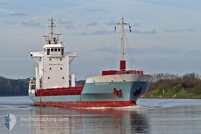
The vessel PEPIN EXPRESS (IMO: 9196228, MMSI: 677062300) is a General Cargo that was built in 1999 ( 25 years old ). It's sailing under the flag of [TZ] Tanzania.
In this page you can find informations about the vessels current position, last detected port calls, and current voyage information. If the vessels is not in coverage by AIS you will find the latest position.
The current position of PEPIN EXPRESS is detected by our AIS receivers and we are not responsible for the reliability of the data. The last position was recorded while the vessel was in Coverage by the Ais receivers of our vessel tracking app.
The current draught of PEPIN EXPRESS as reported by AIS is 4.3 meters
Weather
| Temperature | 28.8°C / 83.84°F |
|---|---|
| Wind Speed | 2 knots |
| Direction | 102° ESE |
| Pressure | 1015.4 hPa |
| Humidity | 76.8 % |
| Cloud Coverage | 83 % |
Featured Company
Last Port Calls
| Port | Arrival | Departure | Time In Port |
|---|---|---|---|
| 2024-06-24 03:17 | 2024-06-24 03:42 | 24 m | |
| 2024-06-21 10:18 | 2024-06-21 11:18 | 1 h | |
| 2024-06-15 07:23 | 2024-06-16 09:50 | 1 d | |
| 2024-06-11 08:46 | 2024-06-11 09:18 | 31 m | |
| 2024-06-10 15:47 | 2024-06-10 16:45 | 57 m | |
| 2024-06-07 15:21 | 2024-06-08 11:15 | 19 h | |
| 2024-06-04 15:09 | 2024-06-05 00:57 | 9 h | |
| 2024-06-01 12:37 | 2024-06-01 13:00 | 23 m | |
| 2024-05-31 16:04 | 2024-05-31 17:04 | 1 h | |
| 2024-05-28 15:47 | 2024-05-29 03:15 | 11 h |
Most Visited Ports (Last year)
| Port | Arrivals | |
|---|---|---|
| 37 | ||
| 14 | ||
| 8 | ||
| 6 | ||
| 6 | ||
| 1 |
Last Trips
| Origin | Departure | Destination | Arrival | Distance | |
|---|---|---|---|---|---|
| 2024-06-21 07:18 | 2024-06-23 23:17 | 6.82 nm | |||
| 2024-06-16 05:50 | 2024-06-21 06:18 | 949.84 nm | |||
| 2024-06-11 05:18 | 2024-06-15 03:23 | 932.01 nm | |||
| 2024-06-10 12:45 | 2024-06-11 04:46 | 6.58 nm | |||
| 2024-06-08 07:15 | 2024-06-10 11:47 | 606.38 nm | |||
| 2024-06-04 20:57 | 2024-06-07 11:21 | 249.87 nm | |||
| 2024-06-01 09:00 | 2024-06-04 11:09 | 655.11 nm | |||
| 2024-05-31 13:04 | 2024-06-01 08:37 | 6.88 nm | |||
| 2024-05-28 23:15 | 2024-05-31 12:04 | 688.17 nm | |||
| 2024-05-27 08:38 | 2024-05-28 11:47 | 298.11 nm |
Events
| Time | Event | Details | Position / Dest | Info |
|---|---|---|---|---|
| 2024-06-24 06:15 | Status Changed | Default Under way using engine |
25.46213 / -79.94662
DOPOP_
|
Speed: 8.5 kn Course: 157.7° |
| 2024-06-24 06:05 | Status Changed | Under way using engine Default |
25.48391 / -79.95578
DOPOP_
|
Speed: 8.5 kn Course: 156° |
| 2024-06-24 06:05 | OUT of Coverage |
25.48391 / -79.95578
North Atlantic Ocean
DOPOP_
|
Speed: 8.5 kn Course: 157.7° |
|
| 2024-06-24 06:00 | Status Changed | Default Under way using engine |
25.49544 / -79.96101
DOPOP_
|
Speed: 8.6 kn Course: 156.7° |
| 2024-06-24 03:42 | PORT DEPARTURE |
|
25.76160 / -80.12822
DOPOP_
|
Speed: 8.9 kn Course: 114° |
| 2024-06-24 03:17 | PORT ARRIVAL |
|
25.77335 / -80.17865
[US] MIAMI
|
Speed: 0.7 kn Course: 254° |
| 2024-06-24 02:08 | START Moving | 4.32 nm, West of MIAMI |
25.79350 / -80.24112
DOPOP_
|
Speed: 3.1 kn Course: 304° |
| 2024-06-24 02:01 | Status Changed | Under way using engine Moored |
25.79569 / -80.24467
DOPOP_
|
Speed: 1.4 kn Course: 310° |
| 2024-06-24 00:33 | Draught Changed | 4.3 4 |
25.79709 / -80.24633
DOPOP_
|
Speed: Course: 310° |
| 2024-06-24 00:33 | Destination Changed | DOPOP_ USMIA_ |
25.79709 / -80.24633
DOPOP_
|
Speed: Course: 310° |