
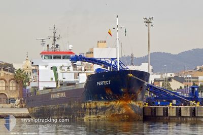
PERFECT
General Cargo
Current Trip
| Time Travelled | 7 days |
|---|---|
| Remaining Time | --- |
| Distance Travelled | 1467.98 nm |
| Remaining Distance | --- |
| AVG Speed | 7.7 Knots |
| MAX Speed | 9.3 Knots |
| AVG Wind | 15.5 knots |
| MAX Wind | 24.9 knots |
| MIN Temp | 8.8°C / 47.84°F |
| MAX Temp | 17.9°C / 64.22°F |
| Draught | 6.4 m |
| Position Received | 6 m ago |
Current Position
| Longitude | -5.72303° |
|---|---|
| Latitude | 48.57446° |
| Status | Under way using engine |
| Speed | 7.9 Knots |
| Course | 29.7° |
| Area | North Atlantic Ocean |
| Station | T-AIS |
| Position Received | 6 m ago |
Info
Information
The current position of PERFECT is in North Atlantic Ocean with coordinates 48.57446° / -5.72303° as reported on 2024-05-02 02:23 by AIS to our vessel tracker app. The vessel's current speed is 7.9 Knots and is heading at the port of LUBECK. The estimated time of arrival as calculated by vessel tracking app is 2024-05-05 14:00 LT
The vessel PERFECT (IMO: 9371854, MMSI: 244058000) is a General Cargo that was built in 2009 ( 15 years old ). It's sailing under the flag of [NL] Netherlands.
In this page you can find informations about the vessels current position, last detected port calls, and current voyage information. If the vessels is not in coverage by AIS you will find the latest position.
The current position of PERFECT is detected by our AIS receivers and we are not responsible for the reliability of the data. The last position was recorded while the vessel was in Coverage by the Ais receivers of our vessel tracking app.
The current draught of PERFECT as reported by AIS is 6.4 meters
Weather
| Temperature | 11.1°C / 51.98°F |
|---|---|
| Wind Speed | 10 knots |
| Direction | 275° W |
| Pressure | 1008.1 hPa |
| Humidity | 76.9 % |
| Cloud Coverage | 59 % |
Featured Company
Last Port Calls
| Port | Arrival | Departure | Time In Port |
|---|---|---|---|
| 2024-04-23 13:09 | 2024-04-24 14:52 | 1 d | |
| 2024-04-22 08:01 | 2024-04-22 19:39 | 11 h | |
| 2024-04-09 10:46 | 2024-04-10 21:38 | 1 d | |
| 2024-04-07 17:52 | 2024-04-09 10:14 | 1 d | |
| 2024-03-17 07:36 | 2024-03-18 12:26 | 1 d | |
| 2024-03-11 14:59 | 2024-03-15 15:43 | 4 d | |
| 2024-03-03 05:36 | |||
| 2024-03-01 19:35 |
Last Trips
| Origin | Departure | Destination | Arrival | Distance | |
|---|---|---|---|---|---|
| 2024-04-22 21:39 | 2024-04-23 15:09 | 152.29 nm | |||
| 2024-04-10 23:38 | 2024-04-22 10:01 | 1889.26 nm | |||
| 2024-04-09 12:14 | 2024-04-09 12:46 | 1.09 nm | |||
| 2024-03-18 13:26 | 2024-04-07 19:52 | 1522.49 nm | |||
| 2024-03-15 16:43 | 2024-03-17 08:36 | 373.73 nm | |||
| 2024-03-01 20:35 | 2024-03-03 06:36 | 211.29 nm |
Events
| Time | Event | Details | Position / Dest | Info |
|---|---|---|---|---|
| 2024-05-02 02:23 | Change Sea Area | French part of the Celtic Sea Spanish part of the North Atlantic Ocean |
48.57446 / -5.72303
Celtic Sea
LUBECK
|
Speed: 7.9 kn Course: 29.7° |
| 2024-05-02 02:23 | Status Changed | Under way using engine Default |
48.57446 / -5.72303
LUBECK
|
Speed: 7 kn Course: 27° |
| 2024-05-02 02:17 | IN Coverage |
48.57446 / -5.72303
Celtic Sea
LUBECK
|
Speed: 7.9 kn Course: 29.7° |
|
| 2024-04-30 12:14 | Status Changed | Default Under way using engine |
43.88500 / -9.25500
LUBECK
|
Speed: 7.4 kn Course: 26.8° |
| 2024-04-30 12:03 | Status Changed | Under way using engine Default |
43.86715 / -9.27080
LUBECK
|
Speed: 7 kn Course: 31° |
| 2024-04-30 12:03 | OUT of Coverage |
43.86715 / -9.27080
North Atlantic Ocean
LUBECK
|
Speed: 7.4 kn Course: 26.8° |
|
| 2024-04-30 11:53 | Status Changed | Default Under way using engine |
43.84667 / -9.28500
LUBECK
|
Speed: 7.3 kn Course: 31.2° |
| 2024-04-30 11:47 | Status Changed | Under way using engine Default |
43.83851 / -9.29269
LUBECK
|
Speed: 7 kn Course: 28° |
| 2024-04-30 11:29 | IN Coverage |
43.83851 / -9.29269
North Atlantic Ocean
LUBECK
|
Speed: 7.3 kn Course: 31.2° |
|
| 2024-04-30 10:40 | OUT of Coverage |
43.71423 / -9.38040
North Atlantic Ocean
LUBECK
|
Speed: 7.6 kn Course: 22.2° |