
PERI-PERI
Sailing
Current Trip
Unknown
Destination Port
ETA*
---
| Time Travelled | 3 days |
|---|---|
| Remaining Time | --- |
| Distance Travelled | 61.72 nm |
| Remaining Distance | --- |
| AVG Speed | 5.5 Knots |
| MAX Speed | 8.4 Knots |
| AVG Wind | 7.4 knots |
| MAX Wind | 9.1 knots |
| MIN Temp | 17.8°C / 64.04°F |
| MAX Temp | 27.1°C / 80.78°F |
| Draught | --- |
| Position Received | 11 h, 11 m ago |
Current Position
| Longitude | 13.66013° |
|---|---|
| Latitude | 54.46718° |
| Status | Default |
| Speed | 8.4 Knots |
| Course | 336.5° |
| Area | Baltic Sea |
| Station | T-AIS |
| Position Received | 11 h, 11 m ago |
Info
info
Information
The current position of PERI-PERI is in Baltic Sea with coordinates 54.46718° / 13.66013° as reported on 2024-06-29 12:57 by AIS to our vessel tracker app. The vessel's current speed is 8.4 Knots
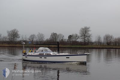
The vessel PERI-PERI (MMSI: 265033040) is a Sailing It's sailing under the flag of [SE] Sweden.
In this page you can find informations about the vessels current position, last detected port calls, and current voyage information. If the vessels is not in coverage by AIS you will find the latest position.
The current position of PERI-PERI is detected by our AIS receivers and we are not responsible for the reliability of the data. The last position was recorded while the vessel was in Coverage by the Ais receivers of our vessel tracking app.
Weather
| Temperature | 17.9°C / 64.22°F |
|---|---|
| Wind Speed | 6 knots |
| Direction | 45° NE |
| Pressure | 1017.7 hPa |
| Humidity | 71 % |
| Cloud Coverage | 22 % |
Featured Company
Limited time offer - Install a base station receiver to your area and list your company on Free forever!
Last Port Calls
| Port | Arrival | Departure | Time In Port |
|---|---|---|---|
| 2024-06-24 08:38 | 2024-06-26 06:29 | 1 d | |
| 2024-06-23 12:18 | 2024-06-24 07:23 | 19 h | |
| 2024-06-12 10:13 | 2024-06-21 08:09 | 8 d | |
| 2024-05-19 15:14 | 2024-06-11 13:02 | 22 d | |
| 2024-05-17 21:01 | 2024-05-18 04:38 | 7 h |
Most Visited Ports (Last year)
| Port | Arrivals | |
|---|---|---|
| 3 | ||
| 1 | ||
| 1 | ||
| 1 | ||
| 1 | ||
| 1 |
Last Trips
| Origin | Departure | Destination | Arrival | Distance | |
|---|---|---|---|---|---|
| 2024-06-24 09:23 | 2024-06-24 10:38 | 7.67 nm | |||
| 2024-06-21 10:09 | 2024-06-23 14:18 | 116.14 nm | |||
| 2024-06-11 15:02 | 2024-06-12 12:13 | 25.91 nm | |||
| 2024-05-18 06:38 | 2024-05-19 17:14 | 123.68 nm |
Events
| Time | Event | Details | Position / Dest | Info |
|---|---|---|---|---|
| 2024-06-29 12:57 | OUT of Coverage |
54.46718 / 13.66013
Baltic Sea
|
Speed: 8.4 kn Course: 336.5° |
|
| 2024-06-29 10:56 | IN Coverage |
54.29722 / 13.75882
Baltic Sea
|
Speed: 2.9 kn Course: 14.7° |
|
| 2024-06-29 09:35 | OUT of Coverage |
54.29496 / 13.62019
Baltic Sea
|
Speed: 2 kn Course: 121.1° |
|
| 2024-06-29 09:35 | IN Coverage |
54.29496 / 13.62019
Baltic Sea
|
Speed: 2 kn Course: 121.1° |
|
| 2024-06-27 11:36 | OUT of Coverage |
54.33984 / 13.50484
Baltic Sea
|
Speed: 5.2 kn Course: 310.9° |
|
| 2024-06-27 11:08 | IN Coverage |
54.29755 / 13.47780
Baltic Sea
|
Speed: 6.8 kn Course: 357.4° |
|
| 2024-06-27 09:59 | OUT of Coverage |
54.15477 / 13.48062
Baltic Sea
|
Speed: 6.4 kn Course: 2.8° |
|
| 2024-06-27 07:56 | START Moving | 1.94 nm, West of LADEBOW |
54.09952 / 13.39380
|
Speed: 4.5 kn Course: 91.9° |
| 2024-06-27 07:44 | IN Coverage |
54.09977 / 13.38988
Baltic Sea
|
Speed: Course: 511° |
|
| 2024-06-26 19:58 | OUT of Coverage |
54.09976 / 13.38990
Baltic Sea
|
Speed: Course: 511° |