
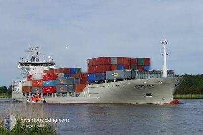
PERSEUS
Container Ship
Current Trip
| Time Travelled | 19 h, 38 mins |
|---|---|
| Remaining Time | 3 days |
| Distance Travelled | 282.65 nm |
| Remaining Distance | 1177.62 nm |
| AVG Speed | 14.8 Knots |
| MAX Speed | 15.7 Knots |
| AVG Wind | 6.8 knots |
| MAX Wind | 11.2 knots |
| MIN Temp | 10.8°C / 51.44°F |
| MAX Temp | 26.3°C / 79.34°F |
| Draught | 6.8 m |
| Position Received | Now |
Current Position
| Longitude | 21.41499° |
|---|---|
| Latitude | 59.01224° |
| Status | Under way using engine |
| Speed | 14.3 Knots |
| Course | 217.5° |
| Area | Baltic Sea |
| Station | T-AIS |
| Position Received | Now |
Info
Information
The current position of PERSEUS is in Baltic Sea with coordinates 59.01224° / 21.41499° as reported on 2024-05-29 06:46 by AIS to our vessel tracker app. The vessel's current speed is 14.3 Knots and is heading at the port of ROTTERDAM. The estimated time of arrival as calculated by vessel tracking app is 2024-06-01 12:49 LT
The vessel PERSEUS (IMO: 9129469, MMSI: 275524000) is a Container Ship that was built in 1995 ( 29 years old ). It's sailing under the flag of [LV] Latvia.
In this page you can find informations about the vessels current position, last detected port calls, and current voyage information. If the vessels is not in coverage by AIS you will find the latest position.
The current position of PERSEUS is detected by our AIS receivers and we are not responsible for the reliability of the data. The last position was recorded while the vessel was in Coverage by the Ais receivers of our vessel tracking app.
The current draught of PERSEUS as reported by AIS is 6.8 meters
Weather
| Temperature | 11.6°C / 52.88°F |
|---|---|
| Wind Speed | 8 knots |
| Direction | 150° SSE |
| Pressure | 1014.1 hPa |
| Humidity | 92.6 % |
| Cloud Coverage | 52 % |
Featured Company
Last Port Calls
| Port | Arrival | Departure | Time In Port |
|---|---|---|---|
| 2024-05-27 02:29 | 2024-05-28 11:09 | 1 d | |
| 2024-05-21 05:21 | 2024-05-22 12:14 | 1 d | |
| 2024-05-15 14:48 | 2024-05-16 21:31 | 1 d | |
| 2024-05-09 14:32 | 2024-05-10 10:26 | 19 h | |
| 2024-05-05 03:32 | 2024-05-05 21:41 | 18 h | |
| 2024-05-02 10:53 | 2024-05-02 10:55 | 2 m | |
| 2024-04-30 03:30 | 2024-04-30 22:49 | 19 h | |
| 2024-04-28 15:32 | 2024-04-29 16:26 | 1 d | |
| 2024-04-27 06:41 | 2024-04-27 07:51 | 1 h | |
| 2024-04-23 15:00 | 2024-04-24 18:36 | 1 d |
Most Visited Ports (Last year)
| Port | Arrivals | |
|---|---|---|
| 26 | ||
| 19 | ||
| 13 | ||
| 13 | ||
| 12 | ||
| 11 |
Last Trips
| Origin | Departure | Destination | Arrival | Distance | |
|---|---|---|---|---|---|
| 2024-05-22 14:14 | 2024-05-27 05:29 | 1310.40 nm | |||
| 2024-05-17 00:31 | 2024-05-21 07:21 | 1324.73 nm | |||
| 2024-05-10 12:26 | 2024-05-15 17:48 | 1312.45 nm | |||
| 2024-05-06 00:41 | 2024-05-09 16:32 | 1322.93 nm | |||
| 2024-05-02 12:55 | 2024-05-05 06:32 | 788.37 nm | |||
| 2024-05-01 00:49 | 2024-05-02 12:53 | 392.32 nm | |||
| 2024-04-29 18:26 | 2024-04-30 05:30 | 122.68 nm | |||
| 2024-04-27 09:51 | 2024-04-28 17:32 | 341.97 nm | |||
| 2024-04-24 21:36 | 2024-04-27 08:41 | 788.81 nm | |||
| 2024-04-21 05:48 | 2024-04-23 18:00 | 795.29 nm |
Events
| Time | Event | Details | Position / Dest | Info |
|---|---|---|---|---|
| 2024-05-29 05:57 | Status Changed | Under way using engine Default |
59.17191 / 21.65212
NLRTM
|
Speed: 15.1 kn Course: 236° |
| 2024-05-29 05:50 | Status Changed | Default Under way using engine |
59.18763 / 21.69745
NLRTM
|
Speed: 15.1 kn Course: 236° |
| 2024-05-29 04:32 | Change Sea Area | Estonian part of the Baltic Sea Finnish part of the Baltic Sea |
59.37619 / 22.21303
Baltic Sea
NLRTM
|
Speed: 15 kn Course: 231.8° |
| 2024-05-29 02:32 | Change Sea Area | Finnish part of the Baltic Sea Finnish part of the Gulf of Finland |
59.59222 / 23.09181
Baltic Sea
NLRTM
|
Speed: 15 kn Course: 252° |
| 2024-05-28 23:14 | Change Sea Area | Finnish part of the Gulf of Finland Estonian part of the Gulf of Finland |
59.80994 / 24.69045
Gulf of Finland
NLRTM
|
Speed: 15.1 kn Course: 256.6° |
| 2024-05-28 21:56 | Change Sea Area | Estonian part of the Gulf of Finland Finnish part of the Gulf of Finland |
59.87970 / 25.32782
Gulf of Finland
NLRTM
|
Speed: 14.9 kn Course: 261.7° |
| 2024-05-28 20:20 | Change Sea Area | Finnish part of the Gulf of Finland Estonian part of the Gulf of Finland |
59.96098 / 26.11696
Gulf of Finland
NLRTM
|
Speed: 15.3 kn Course: 254.3° |
| 2024-05-28 19:53 | Change Sea Area | Estonian part of the Gulf of Finland Russian part of the Gulf of Finland |
59.99202 / 26.33503
Gulf of Finland
NLRTM
|
Speed: 15.3 kn Course: 254° |
| 2024-05-28 13:32 | Status Changed | Under way using engine Default |
60.02933 / 29.39974
NLRTM
|
Speed: 11.7 kn Course: 278° |
| 2024-05-28 13:25 | IN Coverage |
60.02933 / 29.39974
Gulf of Finland
NLRTM
|
Speed: 13.8 kn Course: 271.5° |