
PIA
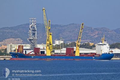
General Cargo
Current Trip
| Time Travelled | 11 days |
|---|---|
| Remaining Time | --- |
| Distance Travelled | 1104.55 nm |
| Remaining Distance | --- |
| AVG Speed | 12.9 Knots |
| MAX Speed | 16.4 Knots |
| AVG Wind | 13.3 knots |
| MAX Wind | 25.8 knots |
| MIN Temp | 9.4°C / 48.92°F |
| MAX Temp | 21.2°C / 70.16°F |
| Draught | 5.9 m |
| Position Received | 9 m ago |
Current Position
| Longitude | 144.80412° |
|---|---|
| Latitude | -38.04028° |
| Status | At anchor |
| Speed | |
| Course | 168° |
| Area | Bass Strait |
| Station | T-AIS |
| Position Received | 9 m ago |
Info
Information
The current position of PIA is in Bass Strait with coordinates -38.04028° / 144.80412° as reported on 2024-06-02 07:04 by AIS to our vessel tracker app. The vessel's current speed is 0 Knots
The vessel PIA (IMO: 9384318, MMSI: 305066000) is a General Cargo that was built in 2007 ( 17 years old ). It's sailing under the flag of [AG] Antigua Barbuda.
In this page you can find informations about the vessels current position, last detected port calls, and current voyage information. If the vessels is not in coverage by AIS you will find the latest position.
The current position of PIA is detected by our AIS receivers and we are not responsible for the reliability of the data. The last position was recorded while the vessel was in Coverage by the Ais receivers of our vessel tracking app.
The current draught of PIA as reported by AIS is 5.9 meters
Weather
| Temperature | 12.3°C / 54.14°F |
|---|---|
| Wind Speed | 13 knots |
| Direction | 159° SSE |
| Pressure | 1022.8 hPa |
| Humidity | 62.3 % |
| Cloud Coverage | 6 % |
Featured Company
Last Port Calls
| Port | Arrival | Departure | Time In Port |
|---|---|---|---|
| 2024-05-20 12:33 | 2024-05-21 15:17 | 1 d | |
| 2024-05-09 23:35 | 2024-05-10 19:39 | 20 h | |
| 2024-05-04 20:09 | 2024-05-05 12:51 | 16 h | |
| 2024-04-27 13:08 | 2024-04-29 15:40 | 2 d | |
| 2024-04-16 08:25 | |||
| 2024-04-12 08:18 | 2024-04-13 06:18 | 22 h | |
| 2024-04-02 03:37 | 2024-04-02 11:46 | 8 h |
Last Trips
| Origin | Departure | Destination | Arrival | Distance | |
|---|---|---|---|---|---|
| 2024-05-11 05:09 | 2024-05-20 22:33 | 2411.88 nm | |||
| 2024-05-05 19:51 | 2024-05-10 09:05 | 1242.71 nm | |||
| 2024-04-29 22:40 | 2024-05-05 03:09 | 1462.89 nm | |||
| 2024-04-13 12:18 | 2024-04-16 13:55 | 945.93 nm | |||
| 2024-04-02 16:46 | 2024-04-12 14:18 | 2710.24 nm | |||
| 2024-03-31 10:19 | 2024-04-02 08:37 | 556.10 nm |
Events
| Time | Event | Details | Position / Dest | Info |
|---|---|---|---|---|
| 2024-06-02 07:07 | Status Changed | Default At anchor |
-38.04030 / 144.80420
AU GEX
|
Speed: Course: 168° |
| 2024-06-02 06:46 | Status Changed | At anchor Default |
-38.04037 / 144.80455
AU GEX
|
Speed: 0.2 kn Course: 185° |
| 2024-06-02 06:43 | Status Changed | Default At anchor |
-38.04030 / 144.80446
AU GEX
|
Speed: 0.1 kn Course: 160° |
| 2024-06-02 04:46 | Status Changed | At anchor Default |
-38.04034 / 144.80394
AU GEX
|
Speed: Course: 176° |
| 2024-06-02 04:43 | Status Changed | Default At anchor |
-38.04035 / 144.80400
AU GEX
|
Speed: 0.2 kn Course: 161° |
| 2024-06-02 04:34 | Status Changed | At anchor Default |
-38.04045 / 144.80341
AU GEX
|
Speed: 0.4 kn Course: 170° |
| 2024-06-02 04:31 | Status Changed | Default At anchor |
-38.04039 / 144.80376
AU GEX
|
Speed: 0.4 kn Course: 192° |
| 2024-06-02 03:46 | Status Changed | At anchor Default |
-38.04034 / 144.80415
AU GEX
|
Speed: 0.1 kn Course: 192° |
| 2024-06-02 03:43 | Status Changed | Default At anchor |
-38.04034 / 144.80444
AU GEX
|
Speed: Course: 185° |
| 2024-06-02 02:01 | Status Changed | At anchor Default |
-38.04029 / 144.80424
AU GEX
|
Speed: 0.1 kn Course: 170° |