
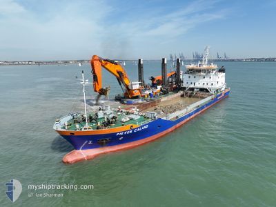
PIETER CALAND
Motor Hopper
Current Trip
| Time Travelled | --- |
|---|---|
| Remaining Time | --- |
| Distance Travelled | 3761.92 nm |
| Remaining Distance | --- |
| AVG Speed | 9.1 Knots |
| MAX Speed | 15.1 Knots |
| AVG Wind | 13.5 knots |
| MAX Wind | 30.4 knots |
| MIN Temp | -9.5°C / 14.9°F |
| MAX Temp | 10.1°C / 50.18°F |
| Draught | 3.2 m |
| Position Received | 8 h, 46 m ago |
Current Position
| Longitude | -7.74560° |
|---|---|
| Latitude | 45.96308° |
| Status | Under way using engine |
| Speed | 10 Knots |
| Course | 28.2° |
| Area | North Atlantic Ocean |
| Station | T-AIS |
| Position Received | 8 h, 46 m ago |
Info
Information
The current position of PIETER CALAND is in North Atlantic Ocean with coordinates 45.96308° / -7.74560° as reported on 2024-06-26 06:48 by AIS to our vessel tracker app. The vessel's current speed is 10 Knots
The vessel PIETER CALAND (IMO: 9516662, MMSI: 244992000) is a Motor Hopper that was built in 2010 ( 14 years old ). It's sailing under the flag of [NL] Netherlands.
In this page you can find informations about the vessels current position, last detected port calls, and current voyage information. If the vessels is not in coverage by AIS you will find the latest position.
The current position of PIETER CALAND is detected by our AIS receivers and we are not responsible for the reliability of the data. The last position was recorded while the vessel was in Coverage by the Ais receivers of our vessel tracking app.
The current draught of PIETER CALAND as reported by AIS is 3.2 meters
Weather
| Temperature | 16.2°C / 61.16°F |
|---|---|
| Wind Speed | 16 knots |
| Direction | 19° NNE |
| Pressure | 1012.8 hPa |
| Humidity | 90.8 % |
| Cloud Coverage | 84 % |
Featured Company
Last Port Calls
Most Visited Ports (Last year)
| Port | Arrivals | |
|---|---|---|
| 3 | ||
| 1 |
Last Trips
| Origin | Departure | Destination | Arrival | Distance |
|---|
Events
| Time | Event | Details | Position / Dest | Info |
|---|---|---|---|---|
| 2024-06-26 06:48 | OUT of Coverage |
45.96308 / -7.74560
North Atlantic Ocean
AMSTERDAM
|
Speed: 10 kn Course: 28.2° |
|
| 2024-06-26 06:46 | IN Coverage |
45.95894 / -7.74878
North Atlantic Ocean
AMSTERDAM
|
Speed: 9.9 kn Course: 27.6° |
|
| 2024-06-26 05:44 | OUT of Coverage |
45.80916 / -7.86564
North Atlantic Ocean
AMSTERDAM
|
Speed: 10.2 kn Course: 27.7° |
|
| 2024-06-26 05:37 | Change Sea Area | French part of the North Atlantic Ocean Spanish part of the North Atlantic Ocean |
45.79124 / -7.87860
North Atlantic Ocean
AMSTERDAM
|
Speed: 9.9 kn Course: 27.1° |
| 2024-06-26 05:37 | IN Coverage |
45.79124 / -7.87860
North Atlantic Ocean
AMSTERDAM
|
Speed: 9.9 kn Course: 27.1° |
|
| 2024-06-25 06:02 | OUT of Coverage |
42.49714 / -9.77035
North Atlantic Ocean
AMSTERDAM
|
Speed: 9 kn Course: 1.3° |
|
| 2024-06-25 05:18 | IN Coverage |
42.38747 / -9.77087
North Atlantic Ocean
AMSTERDAM
|
Speed: 8.9 kn Course: 358.6° |
|
| 2024-06-25 03:49 | OUT of Coverage |
42.15642 / -9.76967
North Atlantic Ocean
AMSTERDAM
|
Speed: 9.3 kn Course: 359.6° |
|
| 2024-06-25 01:23 | Detected in Sea | Spanish part of the North Atlantic Ocean |
41.78861 / -9.76542
North Atlantic Ocean
AMSTERDAM
|
Speed: 8.9 kn Course: 2.2° |
| 2024-06-23 10:26 | ETA Changed | 2024/06/29 06:00 2024/06/28 18:00 |
36.91385 / -9.33250
AMSTERDAM
|
Speed: 5.7 kn Course: 327.2° |