
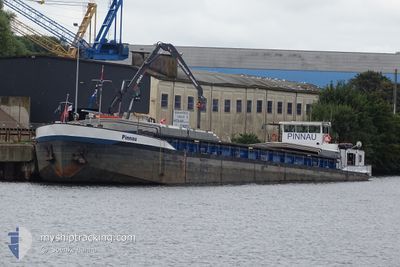
PINNAU
Other Type
Current Trip
| Trip Time | 6 h, 38 mins |
|---|---|
| Trip Distance | 49.80 nm |
| AVG Speed | 9.6 Knots |
| MAX Speed | 11.3 Knots |
| Draught | 0.1 m |
| AVG Wind | 9.6 knots |
| MAX Wind | 11 knots |
| MIN Temp | 10.8°C / 51.44°F |
| MAX Temp | 13.9°C / 57.02°F |
| Position Received | 1 m ago |
Current Position
| Longitude | 9.94857° |
|---|---|
| Latitude | 53.51804° |
| Status | Under way using engine |
| Speed | |
| Course | --- |
| Area | North Sea |
| Station | T-AIS |
| Position Received | 1 m ago |
Info
Information
The current position of PINNAU is in North Sea with coordinates 53.51804° / 9.94857° as reported on 2024-05-29 11:55 by AIS to our vessel tracker app. The vessel's current speed is 0 Knots and is currently inside the port of HAMBURG.
The vessel PINNAU (MMSI: 211511440) is a Other Type It's sailing under the flag of [DE] Germany.
In this page you can find informations about the vessels current position, last detected port calls, and current voyage information. If the vessels is not in coverage by AIS you will find the latest position.
The current position of PINNAU is detected by our AIS receivers and we are not responsible for the reliability of the data. The last position was recorded while the vessel was in Coverage by the Ais receivers of our vessel tracking app.
The current draught of PINNAU as reported by AIS is 0.1 meters
Weather
| Temperature | 14.3°C / 57.74°F |
|---|---|
| Wind Speed | 8 knots |
| Direction | 180° S |
| Pressure | 1008.6 hPa |
| Humidity | 96.1 % |
| Cloud Coverage | 100 % |
Featured Company
Last Port Calls
| Port | Arrival | Departure | Time In Port |
|---|---|---|---|
| 2024-05-29 07:44 | |||
| 2024-05-28 11:23 | 2024-05-29 01:06 | 13 h | |
| 2024-05-27 15:25 | 2024-05-28 05:00 | 13 h | |
| 2024-05-26 21:16 | 2024-05-27 06:22 | 9 h | |
| 2024-05-25 12:16 | 2024-05-26 15:55 | 1 d | |
| 2024-05-21 08:03 | 2024-05-21 13:45 | 5 h | |
| 2024-05-15 09:50 | 2024-05-17 15:21 | 2 d | |
| 2024-05-14 19:26 | 2024-05-15 08:07 | 12 h | |
| 2024-05-05 21:19 | 2024-05-06 09:58 | 12 h | |
| 2024-05-03 15:21 | 2024-05-05 15:46 | 2 d |
Last Trips
| Origin | Departure | Destination | Arrival | Distance | |
|---|---|---|---|---|---|
| 2024-05-29 03:06 | 2024-05-29 09:44 | 49.80 nm | |||
| 2024-05-28 07:00 | 2024-05-28 13:23 | 42.35 nm | |||
| 2024-05-27 08:22 | 2024-05-27 17:25 | 50.24 nm | |||
| 2024-05-26 17:55 | 2024-05-26 23:16 | 35.74 nm | |||
| 2024-05-21 15:45 | 2024-05-25 14:16 | 278.96 nm | |||
| 2024-05-17 17:21 | 2024-05-21 10:03 | 158.59 nm | |||
| 2024-05-15 10:07 | 2024-05-15 11:50 | 11.84 nm | |||
| 2024-05-06 11:58 | 2024-05-14 21:26 | 323.99 nm | |||
| 2024-05-05 17:46 | 2024-05-05 23:19 | 44.63 nm | |||
| 2024-05-03 11:01 | 2024-05-03 17:21 | 46.93 nm |
Events
| Time | Event | Details | Position / Dest | Info |
|---|---|---|---|---|
| 2024-05-29 07:44 | STOP Moving |
53.51797 / 9.94860
[DE] HAMBURG
|
Speed: 0.3 kn Course: 511° |
|
| 2024-05-29 07:44 | PORT ARRIVAL |
|
53.51795 / 9.94859
[DE] HAMBURG
|
Speed: 0.6 kn Course: 511° |
| 2024-05-29 03:39 | START Moving | 0.99 nm, South West of BRUNSBUETTEL |
53.89157 / 9.13987
BRB HH BRB
|
Speed: 7.5 kn Course: 226° |
| 2024-05-29 03:37 | Status Changed | Under way using engine Default |
53.89330 / 9.14344
BRB HH BRB
|
Speed: Course: -1° |
| 2024-05-29 03:37 | IN Coverage |
53.89330 / 9.14344
North Sea
|
Speed: 3 kn Course: 232.4° |
|
| 2024-05-29 02:33 | Status Changed | Default Under way using engine |
53.89343 / 9.14397
BRB HH BRB
|
Speed: 3.2 kn Course: 223.5° |
| 2024-05-29 02:33 | STOP Moving | 0.81 nm, South West of BRUNSBUETTEL |
53.89343 / 9.14397
BRB HH BRB
|
Speed: Course: -1° |
| 2024-05-29 02:25 | OUT of Coverage |
53.89451 / 9.14584
North Sea
|
Speed: 3.2 kn Course: 223.5° |
|
| 2024-05-29 01:21 | Status Changed | Under way using engine Default |
53.98432 / 9.28063
BRB HH BRB
|
Speed: 6.9 kn Course: -1° |
| 2024-05-29 01:06 | Status Changed | Default Under way using engine |
54.01251 / 9.29616
BRB HH BRB
|
Speed: 5.4 kn Course: 181.4° |