
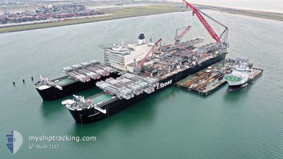
PIONEERING SPIRIT
Not available
Current Trip
NORTH SEA ELDFISK
| Time Travelled | 12 days |
|---|---|
| Remaining Time | --- |
| Distance Travelled | 1484.40 nm |
| Remaining Distance | --- |
| AVG Speed | 8.2 Knots |
| MAX Speed | 13.2 Knots |
| AVG Wind | 16.2 knots |
| MAX Wind | 33.8 knots |
| MIN Temp | 8.3°C / 46.94°F |
| MAX Temp | 17.4°C / 63.32°F |
| Draught | 13.3 m |
| Position Received | 3 m ago |
Current Position
| Longitude | 4.34150° |
|---|---|
| Latitude | 55.19117° |
| Status | Under way using engine |
| Speed | 8 Knots |
| Course | --- |
| Area | North Sea |
| Station | T-AIS |
| Position Received | 3 m ago |
Info
Information
The current position of PIONEERING SPIRIT is in North Sea with coordinates 55.19117° / 4.34150° as reported on 2024-06-17 19:09 by AIS to our vessel tracker app. The vessel's current speed is 8 Knots
The vessel PIONEERING SPIRIT (IMO: 9593505, MMSI: 249110000) is a Not available It's sailing under the flag of [MT] Malta.
In this page you can find informations about the vessels current position, last detected port calls, and current voyage information. If the vessels is not in coverage by AIS you will find the latest position.
The current position of PIONEERING SPIRIT is detected by our AIS receivers and we are not responsible for the reliability of the data. The last position was recorded while the vessel was in Coverage by the Ais receivers of our vessel tracking app.
The current draught of PIONEERING SPIRIT as reported by AIS is 13.3 meters
Weather
| Temperature | 12.8°C / 55.04°F |
|---|---|
| Wind Speed | 16 knots |
| Direction | 244° WSW |
| Pressure | 1010 hPa |
| Humidity | 85 % |
| Cloud Coverage | 12 % |
Featured Company
Last Port Calls
| Port | Arrival | Departure | Time In Port |
|---|---|---|---|
| 2024-04-09 21:54 | 2024-06-05 10:13 |
Most Visited Ports (Last year)
| Port | Arrivals | |
|---|---|---|
| 3 |
Last Trips
| Origin | Departure | Destination | Arrival | Distance | |
|---|---|---|---|---|---|
| 2024-03-21 11:51 | 2024-04-09 23:54 | 1205.19 nm |
Events
| Time | Event | Details | Position / Dest | Info |
|---|---|---|---|---|
| 2024-06-17 18:56 | Status Changed | Under way using engine Default |
55.16117 / 4.33600
NORTH SEA ELDFISK
|
Speed: 8.1 kn Course: 336° |
| 2024-06-17 18:23 | Status Changed | Default Under way using engine |
55.09383 / 4.37933
NORTH SEA ELDFISK
|
Speed: 8.1 kn Course: 337° |
| 2024-06-17 18:19 | Status Changed | Under way using engine Default |
55.08550 / 4.38533
NORTH SEA ELDFISK
|
Speed: 8 kn Course: 336° |
| 2024-06-17 17:33 | Status Changed | Default Under way using engine |
54.99250 / 4.46317
NORTH SEA ELDFISK
|
Speed: 8 kn Course: 334° |
| 2024-06-17 17:24 | Status Changed | Under way using engine Default |
54.97333 / 4.47933
NORTH SEA ELDFISK
|
Speed: 7.9 kn Course: 335° |
| 2024-06-17 17:24 | IN Coverage |
54.97467 / 4.47833
North Sea
NORTH SEA ELDFISK
|
Speed: 8 kn Course: 334° |
|
| 2024-06-17 11:28 | Status Changed | Default Under way using engine |
54.21983 / 5.04883
NORTH SEA ELDFISK
|
Speed: 8.7 kn Course: 338° |
| 2024-06-17 11:23 | OUT of Coverage |
54.21017 / 5.05533
North Sea
NORTH SEA ELDFISK
|
Speed: 8.7 kn Course: 338° |
|
| 2024-06-17 11:20 | Status Changed | Under way using engine Default |
54.20267 / 5.06067
NORTH SEA ELDFISK
|
Speed: 8.7 kn Course: 338° |
| 2024-06-17 11:13 | Status Changed | Default Under way using engine |
54.18767 / 5.07150
NORTH SEA ELDFISK
|
Speed: 8.8 kn Course: 338° |