
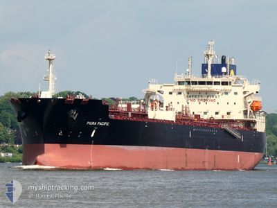
PIURA PACIFIC
Tanker
Current Trip
| Trip Time | 15 days |
|---|---|
| Trip Distance | 4322.82 nm |
| AVG Speed | 12.9 Knots |
| MAX Speed | 17.7 Knots |
| Draught | 11.2 m |
| AVG Wind | 13.6 knots |
| MAX Wind | 27 knots |
| MIN Temp | 12.1°C / 53.78°F |
| MAX Temp | 22.4°C / 72.32°F |
| Position Received | 2 m ago |
Current Position
| Longitude | 4.21433° |
|---|---|
| Latitude | 51.91716° |
| Status | Moored |
| Speed | |
| Course | 359° |
| Area | North Sea |
| Station | T-AIS |
| Position Received | 2 m ago |
Info
Information
The current position of PIURA PACIFIC is in North Sea with coordinates 51.91716° / 4.21433° as reported on 2024-06-10 04:06 by AIS to our vessel tracker app. The vessel's current speed is 0 Knots and is currently inside the port of ROTTERDAM.
The vessel PIURA PACIFIC (IMO: 9983889, MMSI: 563221100) is a Tanker It's sailing under the flag of [SG] Singapore.
In this page you can find informations about the vessels current position, last detected port calls, and current voyage information. If the vessels is not in coverage by AIS you will find the latest position.
The current position of PIURA PACIFIC is detected by our AIS receivers and we are not responsible for the reliability of the data. The last position was recorded while the vessel was in Coverage by the Ais receivers of our vessel tracking app.
The current draught of PIURA PACIFIC as reported by AIS is 11.2 meters
Weather
| Temperature | 12.1°C / 53.78°F |
|---|---|
| Wind Speed | 7 knots |
| Direction | 220° SW |
| Pressure | 1005.7 hPa |
| Humidity | 84.6 % |
| Cloud Coverage | 100 % |
Featured Company
Last Port Calls
| Port | Arrival | Departure | Time In Port |
|---|---|---|---|
| 2024-06-08 01:05 | |||
| 2024-05-19 11:13 | 2024-05-23 13:29 | 4 d | |
| 2024-05-11 17:34 | 2024-05-17 23:35 | 6 d | |
| 2024-04-03 10:54 | 2024-04-04 13:39 | 1 d |
Most Visited Ports (Last year)
| Port | Arrivals | |
|---|---|---|
| 1 | ||
| 1 | ||
| 1 | ||
| 1 |
Last Trips
| Origin | Departure | Destination | Arrival | Distance | |
|---|---|---|---|---|---|
| 2024-05-23 15:29 | 2024-06-08 03:05 | 4322.82 nm | |||
| 2024-05-18 01:35 | 2024-05-19 13:13 | 367.67 nm | |||
| 2024-04-04 21:39 | 2024-05-11 19:34 | 11388.34 nm |
Events
| Time | Event | Details | Position / Dest | Info |
|---|---|---|---|---|
| 2024-06-08 02:18 | Status Changed | Moored Under way using engine |
51.91714 / 4.21428
[NL] ROTTERDAM
|
Speed: Course: 359° |
| 2024-06-08 02:09 | STOP Moving |
51.91741 / 4.21373
[NL] ROTTERDAM
|
Speed: 0.3 kn Course: 5° |
|
| 2024-06-08 01:05 | PORT ARRIVAL |
|
51.96617 / 4.12004
[NL] ROTTERDAM
|
Speed: 7.5 kn Course: 121.8° |
| 2024-06-07 19:56 | Change Sea Area | Dutch part of the North Sea Belgian part of the North Sea |
51.77738 / 2.69983
North Sea
NLRTM
|
Speed: 11.8 kn Course: 58.6° |
| 2024-06-07 18:05 | Change Sea Area | Belgian part of the North Sea French part of the North Sea |
51.50947 / 2.26481
North Sea
NLRTM
|
Speed: 13.1 kn Course: 41.4° |
| 2024-06-07 15:05 | Change Sea Area | French part of the North Sea French part of the English Channel |
51.01475 / 1.60274
North Sea
NLRTM
|
Speed: 14.3 kn Course: 39.9° |
| 2024-06-07 13:30 | ETA Changed | 2024/06/08 00:00 2024/06/08 01:00 |
50.68143 / 1.33343
NLRTM
|
Speed: 13.9 kn Course: 44.1° |
| 2024-06-07 12:44 | Detected in Sea | French part of the English Channel |
50.56316 / 1.13431
English Channel
NLRTM
|
Speed: 13.9 kn Course: 51.4° |
| 2024-06-07 12:44 | IN Coverage |
50.56316 / 1.13431
English Channel
NLRTM
|
Speed: 13.9 kn Course: 51.4° |
|
| 2024-06-07 11:26 | OUT of Coverage |
50.43449 / .72588
English Channel
NLRTM
|
Speed: 13.6 kn Course: 72.6° |