
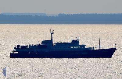
PLANCIUS
Passengers Ship
Current Trip
LONGYEARBYEN
| Time Travelled | 15 days |
|---|---|
| Remaining Time | --- |
| Distance Travelled | 2770.56 nm |
| Remaining Distance | --- |
| AVG Speed | 9.9 Knots |
| MAX Speed | 13.4 Knots |
| AVG Wind | 10.9 knots |
| MAX Wind | 26 knots |
| MIN Temp | -3.1°C / 26.42°F |
| MAX Temp | 12.6°C / 54.68°F |
| Draught | 5.2 m |
| Position Received | 1 m ago |
Current Position
| Longitude | 15.39559° |
|---|---|
| Latitude | 78.26851° |
| Status | Under way using engine |
| Speed | 4.4 Knots |
| Course | 105° |
| Area | Greenland Sea |
| Station | T-AIS |
| Position Received | 1 m ago |
Info
Information
The current position of PLANCIUS is in Greenland Sea with coordinates 78.26851° / 15.39559° as reported on 2024-06-13 04:21 by AIS to our vessel tracker app. The vessel's current speed is 4.4 Knots
The vessel PLANCIUS (IMO: 7432044, MMSI: 246573000) is a Passengers Ship that was built in 1976 ( 48 years old ). It's sailing under the flag of [NL] Netherlands.
In this page you can find informations about the vessels current position, last detected port calls, and current voyage information. If the vessels is not in coverage by AIS you will find the latest position.
The current position of PLANCIUS is detected by our AIS receivers and we are not responsible for the reliability of the data. The last position was recorded while the vessel was in Coverage by the Ais receivers of our vessel tracking app.
The current draught of PLANCIUS as reported by AIS is 5.2 meters
Weather
| Temperature | 0.6°C / 33.08°F |
|---|---|
| Wind Speed | 8 knots |
| Direction | 235° SW |
| Pressure | 1009.7 hPa |
| Humidity | 82.6 % |
| Cloud Coverage | 100 % |
Featured Company
Last Port Calls
| Port | Arrival | Departure | Time In Port |
|---|---|---|---|
| 2024-05-28 06:37 | 2024-05-28 17:19 | 10 h | |
| 2024-05-01 04:59 | 2024-05-26 16:59 | 25 d | |
| 2024-04-01 00:39 | 2024-04-01 21:12 | 20 h |
Most Visited Ports (Last year)
| Port | Arrivals | |
|---|---|---|
| 12 | ||
| 2 | ||
| 2 | ||
| 1 | ||
| 1 |
Last Trips
| Origin | Departure | Destination | Arrival | Distance | |
|---|---|---|---|---|---|
| 2024-05-26 18:59 | 2024-05-28 07:37 | 417.16 nm | |||
| 2024-04-01 18:12 | 2024-05-01 06:59 | 7457.83 nm | |||
| 2024-03-21 18:30 | 2024-03-31 21:39 | 1893.75 nm |
Events
| Time | Event | Details | Position / Dest | Info |
|---|---|---|---|---|
| 2024-06-12 22:13 | Destination Changed | LONGYEARBYEN LYR |
78.27107 / 14.40826
LONGYEARBYEN
|
Speed: 4.6 kn Course: 54° |
| 2024-06-12 17:24 | Destination Changed | LYR POOLEPYNTEN |
78.37968 / 12.44407
LYR
|
Speed: 11.1 kn Course: 154.4° |
| 2024-06-12 17:24 | ETA Changed | 2024/06/13 06:00 2024/06/12 06:00 |
78.37968 / 12.44407
LYR
|
Speed: 11.1 kn Course: 154.4° |
| 2024-06-12 17:10 | Status Changed | Under way using engine Default |
78.41515 / 12.35840
POOLEPYNTEN
|
Speed: 10.4 kn Course: 153° |
| 2024-06-12 16:46 | Status Changed | Default Under way using engine |
78.47833 / 12.23500
POOLEPYNTEN
|
Speed: 10.6 kn Course: 219.3° |
| 2024-06-12 16:39 | Status Changed | Under way using engine Default |
78.49670 / 12.28363
POOLEPYNTEN
|
Speed: 10.6 kn Course: 244° |
| 2024-06-12 16:10 | Status Changed | Default Under way using engine |
78.52021 / 12.67314
POOLEPYNTEN
|
Speed: 10 kn Course: 274.9° |
| 2024-06-12 16:02 | START Moving |
78.51807 / 12.79093
POOLEPYNTEN
|
Speed: 10 kn Course: 274.9° |
|
| 2024-06-12 15:56 | IN Coverage |
78.51835 / 12.85070
Greenland Sea
|
Speed: 2.9 kn Course: 259.6° |
|
| 2024-06-12 15:54 | Status Changed | Under way using engine Default |
78.51831 / 12.85499
POOLEPYNTEN
|
Speed: Course: -1° |