
PLANET NINE
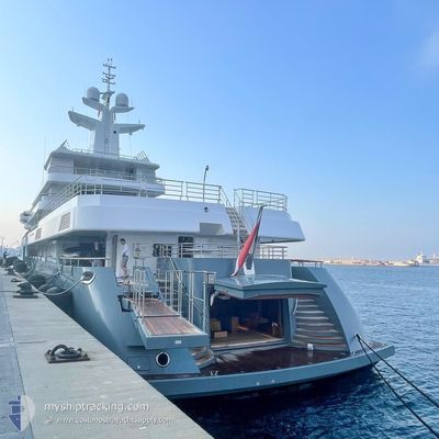
Pleasure Craft
Current Trip
| Time Travelled | 12 days |
|---|---|
| Remaining Time | --- |
| Distance Travelled | 769.68 nm |
| Remaining Distance | --- |
| AVG Speed | 10.5 Knots |
| MAX Speed | 14.4 Knots |
| AVG Wind | 5.4 knots |
| MAX Wind | 24 knots |
| MIN Temp | 17.9°C / 64.22°F |
| MAX Temp | 28.2°C / 82.76°F |
| Draught | 3.8 m |
| Position Received | 1 h, 31 m ago |
Current Position
| Longitude | 15.85369° |
|---|---|
| Latitude | 37.88320° |
| Status | Under way using engine |
| Speed | 11 Knots |
| Course | 90.1° |
| Area | Ionian Sea |
| Station | T-AIS |
| Position Received | 1 h, 31 m ago |
Info
Information
The current position of PLANET NINE is in Ionian Sea with coordinates 37.88320° / 15.85369° as reported on 2024-06-18 10:46 by AIS to our vessel tracker app. The vessel's current speed is 11 Knots and is heading at the port of VLORE. The estimated time of arrival as calculated by vessel tracking app is 2024-06-19 10:00 LT
The vessel PLANET NINE (IMO: 1009716, MMSI: 248739000) is a Pleasure Craft It's sailing under the flag of [MT] Malta.
In this page you can find informations about the vessels current position, last detected port calls, and current voyage information. If the vessels is not in coverage by AIS you will find the latest position.
The current position of PLANET NINE is detected by our AIS receivers and we are not responsible for the reliability of the data. The last position was recorded while the vessel was in Coverage by the Ais receivers of our vessel tracking app.
The current draught of PLANET NINE as reported by AIS is 3.8 meters
Weather
| Temperature | 27.3°C / 81.14°F |
|---|---|
| Wind Speed | 5 knots |
| Direction | 206° SSW |
| Pressure | 1019 hPa |
| Humidity | 40.5 % |
| Cloud Coverage | --- |
Featured Company
Events
| Time | Event | Details | Position / Dest | Info |
|---|---|---|---|---|
| 2024-06-18 10:46 | OUT of Coverage |
37.88320 / 15.85369
Ionian Sea
ALVOA
|
Speed: 11 kn Course: 90.1° |
|
| 2024-06-18 10:44 | IN Coverage |
37.88320 / 15.85369
Ionian Sea
ALVOA
|
Speed: 11 kn Course: 90.1° |
|
| 2024-06-18 09:38 | OUT of Coverage |
37.95623 / 15.62298
Ionian Sea
ALVOA
|
Speed: 10.7 kn Course: 149.5° |
|
| 2024-06-18 07:58 | Change Sea Area | Italian part of the Ionian Sea Italian part of the Tyrrhenian Sea |
38.25738 / 15.65148
Ionian Sea
ALVOA
|
Speed: 12.4 kn Course: 244.7° |
| 2024-06-18 03:30 | IN Coverage |
39.03875 / 15.30305
Tyrrhenian Sea
ALVOA
|
Speed: 10.9 kn Course: 154.2° |
|
| 2024-06-18 01:31 | OUT of Coverage |
39.35755 / 15.09924
Tyrrhenian Sea
ALVOA
|
Speed: 10.9 kn Course: 146.7° |
|
| 2024-06-17 22:55 | IN Coverage |
39.75405 / 14.83276
Tyrrhenian Sea
ALVOA
|
Speed: 10.5 kn Course: 153.7° |
|
| 2024-06-17 21:04 | OUT of Coverage |
40.05229 / 14.63672
Tyrrhenian Sea
ALVOA
|
Speed: 10.8 kn Course: 151.3° |
|
| 2024-06-17 16:27 | START Moving | 0.74 nm, South East of MERGELLINA |
40.82187 / 14.24057
ALVOA
|
Speed: 3.7 kn Course: 186° |
| 2024-06-17 16:01 | Status Changed | Under way using engine At anchor |
40.82385 / 14.24012
ALVOA
|
Speed: 0.1 kn Course: 177° |